 |
|
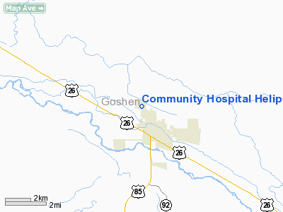
Community Hospital Heliport |
Location & QuickFacts
| FAA Information Effective: | 2008-09-25 |
| Airport Identifier: | WY26 |
| Airport Status: | Operational |
| Longitude/Latitude: | 104-11-32.8200W/42-05-00.8700N
-104.192450/42.083575 (Estimated) |
| Elevation: | 4210 ft / 1283.21 m (Estimated) |
| Land: | 0 acres |
| From nearest city: | 1 nautical miles NW of Torrington, WY |
| Location: | Goshen County, WY |
| Magnetic Variation: | 11E (1985) |
Owner & Manager
| Ownership: | Privately owned |
| Owner: | Banner Health Community Hospital |
| Address: | 2000 Campbell Dr
Torrington, WY 82240 |
| Phone number: | 307-532-4181 |
| Manager: | Clay Bowyer |
| Address: | 2000 Campbell Dr
Torrington, WY 82240 |
| Phone number: | 307-534-7194 |
Airport Operations and Facilities
| Airport Use: | Private
MEDICAL USE. |
| Wind indicator: | Yes |
| Segmented Circle: | No |
| Control Tower: | No |
| Lighting Schedule: | DUSK-DAWN |
| Landing fee charge: | No |
| Sectional chart: | Cheyenne |
| Region: | ANM - Northwest Mountain |
| Boundary ARTCC: | ZDV - Denver |
| Tie-in FSS: | CPR - Casper |
| FSS on Airport: | No |
| FSS Toll Free: | 1-800-WX-BRIEF |
Runway Information
Helipad H1
| Dimension: | 35 x 35 ft / 10.7 x 10.7 m |
| Surface: | CONC, |
| |
Runway H1 |
Runway |
| Traffic Pattern: | Left | Left |
|
Radio Navigation Aids
| ID |
Type |
Name |
Ch |
Freq |
Var |
Dist |
| TOR | NDB | Torrington | | 293.00 | 11E | 2.0 nm |
| GIG | NDB | Gering | | 341.00 | 11E | 24.2 nm |
| GYZ | NDB | Camp Guernsey | | 280.00 | 11E | 25.1 nm |
| CDR | VOR/DME | Chadron | 081X | 113.40 | 13E | 48.4 nm |
| BFF | VORTAC | Scottsbluff | 073X | 112.60 | 13E | 33.7 nm |
Images and information placed above are from
http://www.airport-data.com/airport/WY26/
We thank them for the data!
| General Info
|
| Country |
United States
|
| State |
WYOMING
|
| FAA ID |
WY26
|
| Latitude |
42-05-00.870N
|
| Longitude |
104-11-32.820W
|
| Elevation |
4210 feet
|
| Near City |
TORRINGTON
|
We don't guarantee the information is fresh and accurate. The data may
be wrong or outdated.
For more up-to-date information please refer to other sources.
|
|


