 |
|
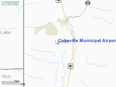
Location & QuickFacts
| FAA Information Effective: | 2008-09-25 |
| Airport Identifier: | U06 |
| Airport Status: | Operational |
| Longitude/Latitude: | 110-57-57.6740W/42-02-44.7750N
-110.966021/42.045771 (Estimated) |
| Elevation: | 6270 ft / 1911.10 m (Estimated) |
| Land: | 320 acres |
| From nearest city: | 3 nautical miles S of Cokeville, WY |
| Location: | Lincoln County, WY |
| Magnetic Variation: | 15E (1985) |
Owner & Manager
| Ownership: | Publicly owned |
| Owner: | Town Of Cokeville |
| Address: | P.o. Box 99
Cokeville, WY 83114 |
| Phone number: | 307-279-3227 |
| Manager: | Kevin Walker |
| Address: | City Hall, P.o. Box 99
Cokeville, WY 83114 |
| Phone number: | 307-279-3229 |
Airport Operations and Facilities
| Airport Use: | Open to public |
| Wind indicator: | Yes |
| Segmented Circle: | Yes |
| Control Tower: | No |
| Lighting Schedule: | DUSK-DAWN
ACTVT MIRL RY 15/33 - CTAF. |
| Beacon Color: | Clear-Green (lighted land airport) |
| Landing fee charge: | No |
| Sectional chart: | Salt Lake City |
| Region: | ANM - Northwest Mountain |
| Boundary ARTCC: | ZLC - Salt Lake City |
| Tie-in FSS: | CPR - Casper |
| FSS on Airport: | No |
| FSS Toll Free: | 1-800-WX-BRIEF |
| NOTAMs Facility: | CPR (NOTAM-d service avaliable) |
| Federal Agreements: | SY |
Airport Communications
| CTAF: | 122.800 |
| Unicom: | 122.800 |
Airport Services
| Bottled Oxygen: | NONE |
| Bulk Oxygen: | NONE |
Runway Information
Runway 15/33
| Dimension: | 3400 x 60 ft / 1036.3 x 18.3 m |
| Surface: | ASPH, Poor Condition
EXTENSIVE CRACKING AND UNEVEN PAVEMENT SURFACE. |
| Weight Limit: | Single wheel: 10000 lbs. |
| Edge Lights: | Non-standard lighting system
RWY 15/33 NSTD MIRL HAS IRREGULAR SPACING DUE TO MISSING AND BROKEN LIGHTS. SOME THSHLD LENSES CLEAR. |
| |
Runway 15 |
Runway 33 |
| Elevation: | 6260.00 ft | 0.00 ft |
| Traffic Pattern: | Left | Left |
| Markings: | Basic, Poor Condition
RYS 15 & 33 MOST MARKINGS COMPLETELY FADED AWAY. | Basic, Poor Condition |
| Obstruction: | , 50:1 slope to clear | 7 ft fence, 235.0 ft from runway, 5:1 slope to clear |
|
Radio Navigation Aids
| ID |
Type |
Name |
Ch |
Freq |
Var |
Dist |
| LGU | VOR/DME | Logan | 035X | 109.80 | 16E | 42.0 nm |
| EVW | VOR/DME | Evanston | 33X | 109.60 | 13E | 46.6 nm |
| FBR | VOR/DME | Fort Bridger | 023X | 108.60 | 14E | 46.9 nm |
| LHO | VOR/DME | Brigham City | 076X | 112.90 | 14E | 49.1 nm |
| BPI | VOR/DME | Big Piney | 112X | 116.50 | 16E | 49.8 nm |
Remarks
- VARIABLE RY CONDITIONS AND BRAKING ACTION DURING WINTER MONTHS DUE TO THAWING AND FREEZING PRECIP.
- +2 FT GROUND 70 FT W OF CNTRLN FULL LENGTH.
- 120 FT HIGH ELECTRICAL TRANSMISSION LINES RUNNING EAST-WEST 2 MILES NORTH ARPT.
- RWY 15/33 ELEVATION HIGHEST NEAR MIDFIELD. NO LINE OF SITE BETWEEN RWY ENDS.
- UNCONTROLLED VEHICLE ACCESS TO AIRPORT.
Images and information placed above are from
http://www.airport-data.com/airport/U06/
We thank them for the data!
| General Info
|
| Country |
United States
|
| State |
WYOMING
|
| FAA ID |
U06
|
| Latitude |
42-02-44.775N
|
| Longitude |
110-57-57.674W
|
| Elevation |
6270 feet
|
| Near City |
COKEVILLE
|
We don't guarantee the information is fresh and accurate. The data may
be wrong or outdated.
For more up-to-date information please refer to other sources.
|
|


