|
 |
|
||||
|
Coordinates: 41°09′20″N 104°48′38″W / 41.15556°N 104.81056°W
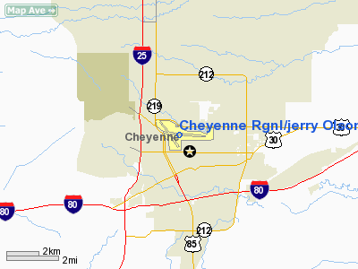
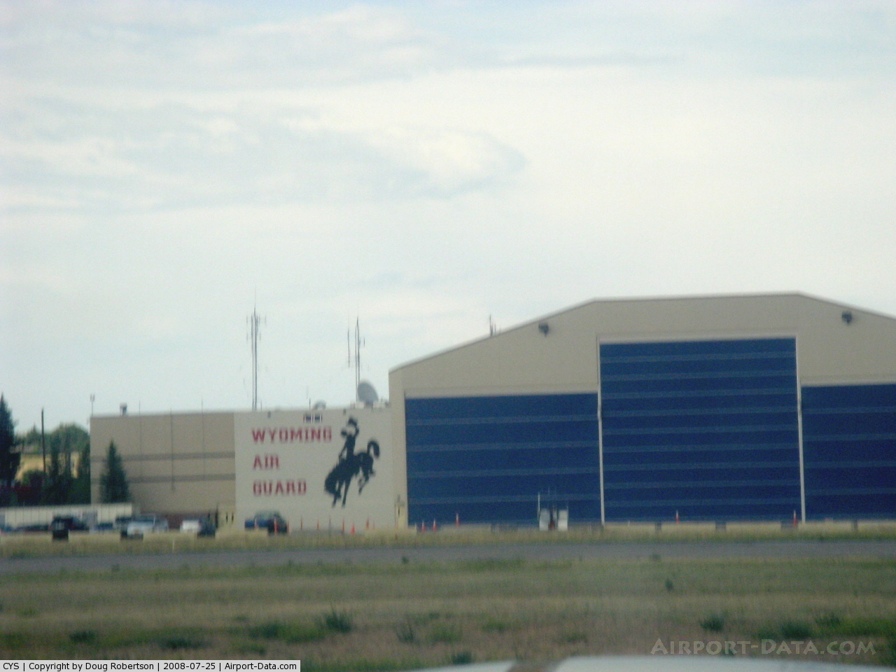
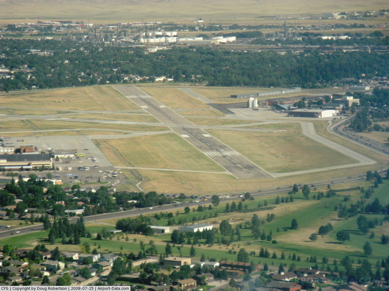
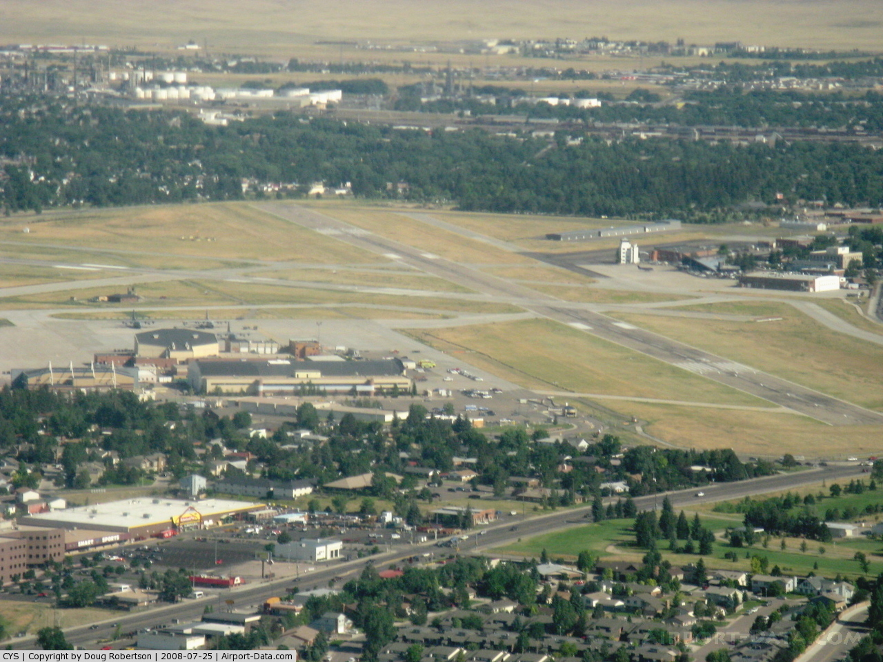
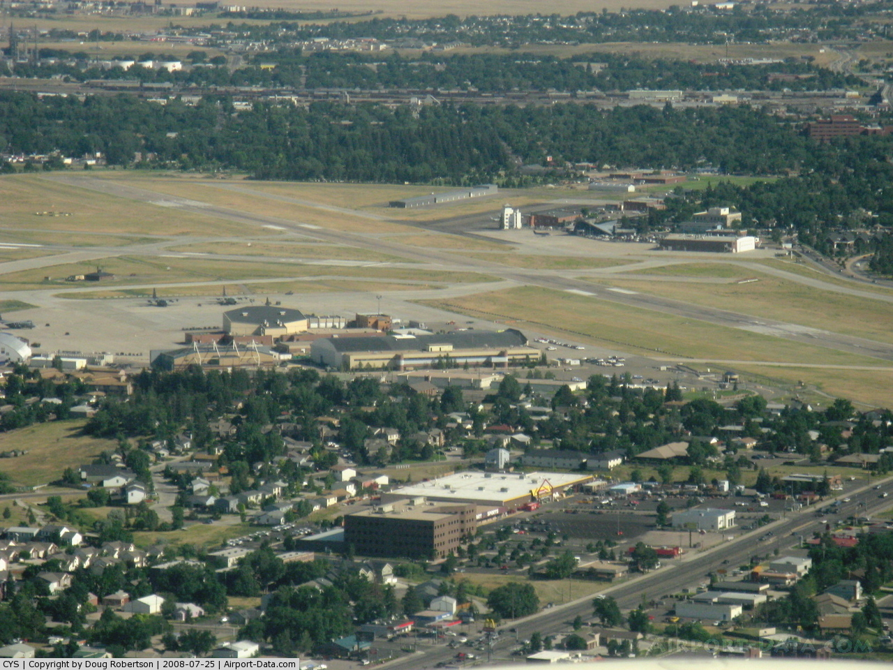
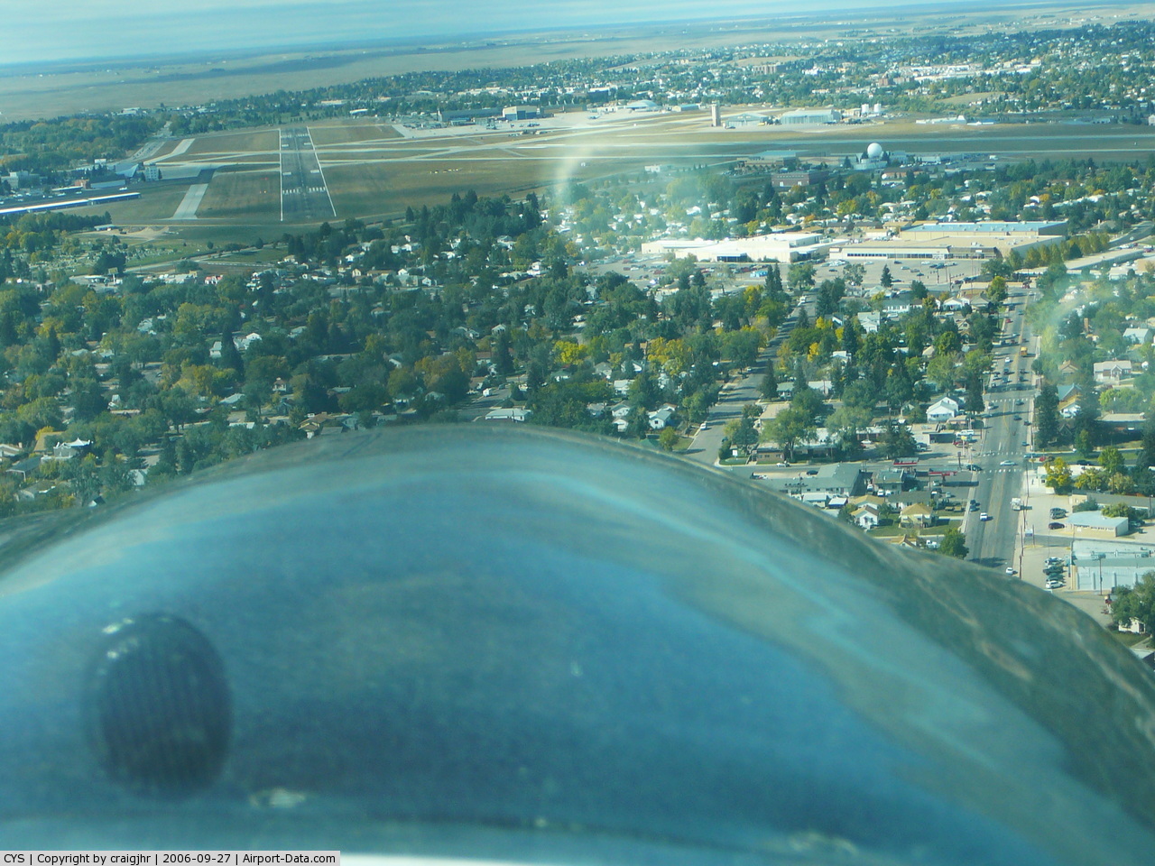
Cheyenne Regional Airport (IATA: CYS, ICAO: KCYS, FAA LID: CYS), also known as Jerry Olson Field, is a joint civil-military public airport located one mile (1.6 km) north of the central business district of Cheyenne, a city in Laramie County, Wyoming, United States. It is owned by the Cheyenne Regional Airport Board. Cheyenne Regional Airport is a focus city for Great Lakes Airlines. Cheyenne Regional Airport is also the main base for the Wyoming Air National Guard (WyANG) and the Wyoming Army National Guard (WARNG). The WyANG operates C-130H Hercules aircraft under the 153rd Airlift Wing (153 AW), an Air Mobility Command (AMC)-gained unit of the Air National Guard. The U.S. Air Force's 30th Airlift Squadron is colocated with the 153rd and flies missions alongside them. This is the first Active Associate unit between the Air National Guard and the Regular Air Force. The WARNG is also located at the airport and operates UH-60 Black Hawk helicopters. HistoryIn 1911 Cheyenne entered the world of aviation. While the air demonstration at the fairgrounds that year was less than impressive, it marked the beginning of what would become a rich aviation history. Throughout the years, the Cheyenne Airport would not only impact the city's economy, but its cultural history, and the whole nation, as well. It was the U.S. Post Office that gave Cheyenne's fledgling aviation efforts its first real boost. With the introduction of airmail routes following WWI, the Cheyenne civic leaders successfully lobbied to establish Cheyenne as a cross country site. Buck Heffron piloted the first air mail flight destined for Salt Lake City on September 9, 1920 . Heffron flew in a DH-4, an aircraft that could barely reach an altitude high enough to clear the mountains and had a maximum speed of 100 mph (160 km/h). The pilot was one of the brave aviators who took off on daring flights guided only by limited instruments, landmarks and a few maps. Cheyenne's airport saw its first commercial passengers take to the skies in the 1920s. This first passenger was Elizabeth Brown, a female barber. She enjoyed a ride with WWI pilot, C.A. McKenzie, in a Curtis Oriole biplane. With the step up to the impressive DC-3 in 1935, passengers enjoyed greater comfort and safety. Soon, the famous DC-3s were flying Cheyenne passengers to both coasts and south to Denver via three major airlines. The Boeing/United Airlines Terminal Building, Hangar and Fountain, built for what would become United Airlines between 1929 and 1934, are listed on the National Register of Historic Places. During World War II, the airport served as a completion and modification center for B-17 aircraft. Captain Ralph S. Johnson was a key test pilot for the then United States Army Air Corps, forerunner to the Air Force. The tail turret on the B-17 is also known as the "Cheyenne" turret because it was invented at the Cheyenne airport. And up until 1961, the airport also housed the training center where United Airlines stewardesses came from across the country to train. The airport was not without its share of celebrated visitors. Among those illustrious aviators to touch down on its runways were Charles Lindbergh, aboard the famous "Spirit of St. Louis," and Amelia Earhart. Many of the airport's rich historic events are chronicled in fascinating display on the walls inside the airport restaurant. The airport now, because of its high altitude also serves as an airport where major aircraft manufactuers test their planes. The latest test planes were Embraer of Brazil's ERJ-170 and 190 aircraft and Boeing's 737-900. Facilities and aircraftCheyenne Regional/Jerry Olson Field covers an area of 1,060 acres (429 ha) which contains two runways: 9/27 with a 9,270 x 150 ft (2,825 x 46 m) concrete surface and 13/31 with a 6,690 x 150 ft (2,039 x 46 m) asphalt surface. For the 12-month period ending December 31, 2006, the airport had 65,163 aircraft operations, an average of 178 per day: 54% general aviation, 36% military, 10% air taxi and <1% scheduled commercial. There are 99 aircraft based at this airport: 35% single-engine, 38% multi-engine, 4% jet and 22% military. Airlines and destinationsCheyenne regional airport is currently served by Great Lakes Airlines who under flies under its own identity, as well as a codeshare partner for United Airlines and Frontier Airlines. Beginning on July 15th, American Eagle started nonstop service to Dallas/Fort Worth, Texas. In additiion to the above listed scheduled service, occasional charter flights (known as "casino or gamblers flights") to Laughlin or Wendover, Nevada are offered. United airlines heavliy uses this airport for diversions with a final destination of Denver International airport.
Cargo
Incidents and AccidentsOn April 11, 1996, 7 year old Jessica Dubroff, along with her father and flight instructor, died when her general aviation aircraft crashed after takeoff from Cheyenne Regional in a storm. Dubroff was attempting to be the youngest person to fly across the United States. The above content comes from Wikipedia and is published under free licenses – click here to read more.
Location & QuickFacts
Owner & Manager
Airport Operations and Facilities
Airport Communications
Airport Services
Runway InformationRunway 09/27
Runway 13/31
Radio Navigation Aids
Remarks
Images and information placed above are from We thank them for the data!
We don't guarantee the information is fresh and accurate. The data may
be wrong or outdated.
|
||||||||||||||||||||||||||||||||||||||||||||||||||||||||||||||||||||||||||||||||||||||||||||||||||||||||||||||||||||||||||||||||||||||||||||||||||||||||||||||||||||||||||||||||||||||||||||||||||||||||||||||||||||||||||||||||||||||||||||||||||||||||||||||||||||||||||||||||||||||||||||||||||||||||||||||||||||||||||||||||||||||||||||||||||||||||||||||||||||

 |
|
Copyright 2004-2026 © by Airports-Worldwide.com, Vyshenskoho st. 36, Lviv 79010, Ukraine Legal Disclaimer |