 |
|
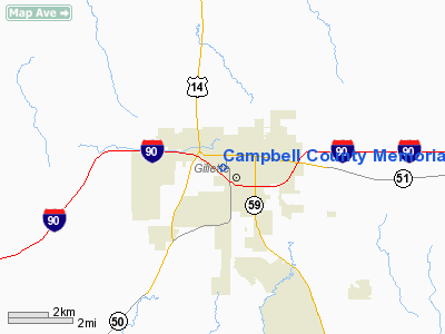
Campbell County Memorial Hospital Heliport |
Location & QuickFacts
| FAA Information Effective: | 2008-09-25 |
| Airport Identifier: | WY21 |
| Airport Status: | Operational |
| Longitude/Latitude: | 105-30-50.9900W/44-17-15.9300N
-105.514164/44.287758 (Estimated) |
| Elevation: | 4875 ft / 1485.90 m (Estimated) |
| Land: | 0 acres |
| From nearest city: | 0 nautical miles N of Gillette, WY |
| Location: | Campbell County, WY |
| Magnetic Variation: | 12E (1995) |
Owner & Manager
| Ownership: | Privately owned |
| Owner: | Campbell County Memorial Hospital |
| Address: | 501 South Burma Avenue, P.o. Box 3011
Gillette, WY 82717-3011 |
| Phone number: | 307-688-1441 |
| Manager: | Bob Morasko |
| Address: | 501 South Burma Avenue, P.o. Box 3011
Gillette, WY 82717-3011 |
| Phone number: | 307-688-1555 |
Airport Operations and Facilities
| Airport Use: | Private |
| Wind indicator: | Yes |
| Segmented Circle: | No |
| Control Tower: | No |
| Lighting Schedule: | DUSK-DAWN |
| Sectional chart: | Cheyenne |
| Region: | ANM - Northwest Mountain |
| Boundary ARTCC: | ZDV - Denver |
| Tie-in FSS: | CPR - Casper |
| FSS Toll Free: | 1-800-WX-BRIEF |
Runway Information
Helipad H1
| Dimension: | 100 x 80 ft / 30.5 x 24.4 m |
| Surface: | CONC, |
| |
Runway H1 |
Runway |
| Traffic Pattern: | Left | Left |
| Markings: | Basic, Good Condition | , |
|
Radio Navigation Aids
| ID |
Type |
Name |
Ch |
Freq |
Var |
Dist |
| GC | NDB | Deryk | | 380.00 | 12E | 1.1 nm |
| GCC | VOR/DME | Gillette | 093X | 114.60 | 12E | 3.8 nm |
| CZI | VOR/DME | Crazy Woman | 120X | 117.30 | 13E | 43.4 nm |
Remarks
- 131 FT LGTD TOWER 100 FT NORTH, 115 FT LGTD TOWER 200 FT WEST, 222 FT LGTD WATER TOWER 1250 FT SOUTHWEST & 161 FT LGTD WATER TANK 1500 FT SOUTH OF HELIPAD.
Images and information placed above are from
http://www.airport-data.com/airport/WY21/
We thank them for the data!
| General Info
|
| Country |
United States
|
| State |
WYOMING
|
| FAA ID |
WY21
|
| Latitude |
44-17-15.930N
|
| Longitude |
105-30-50.990W
|
| Elevation |
4875 feet
|
| Near City |
GILLETTE
|
We don't guarantee the information is fresh and accurate. The data may
be wrong or outdated.
For more up-to-date information please refer to other sources.
|
|


