 |
|
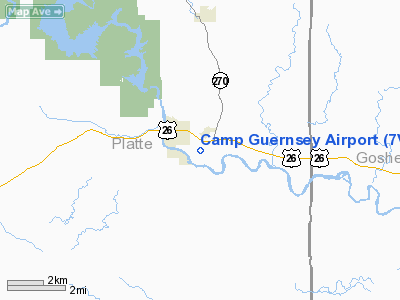
Location & QuickFacts
| FAA Information Effective: | 2008-09-25 |
| Airport Identifier: | 7V6 |
| Airport Status: | Operational |
| Longitude/Latitude: | 104-43-41.8400W/42-15-34.6000N
-104.728289/42.259611 (Estimated) |
| Elevation: | 4400 ft / 1341.12 m (Surveyed) |
| Land: | 155 acres |
| From nearest city: | 1 nautical miles SE of Guernsey, WY |
| Location: | Platte County, WY |
| Magnetic Variation: | 11E (1995) |
Owner & Manager
| Ownership: | Publicly owned |
| Owner: | State Of Wyo Mil Dept |
| Address: | 5500 Bishop Blvd.
Cheyenne, WY 82009-3320 |
| Phone number: | 307-772-5235 |
| Manager: | Capt. Terry Jenkins |
| Address: | Po Box 399, Bldg 107
Guernsey, WY 82214 |
| Phone number: | 307-836-7832 |
Airport Operations and Facilities
| Airport Use: | Private
CITY HAS LEASE AGREEMENT WITH MILITARY FOR PUBLIC USE. |
| Wind indicator: | Yes |
| Segmented Circle: | Yes |
| Control Tower: | No |
| Lighting Schedule: | DUSK-DAWN
ACTVT MIRL RY 14/32 - CTAF. |
| Beacon Color: | Split-Clear-Green (lighted military airport) |
| Landing fee charge: | No |
| Sectional chart: | Cheyenne |
| Region: | ANM - Northwest Mountain |
| Boundary ARTCC: | ZDV - Denver |
| Tie-in FSS: | CPR - Casper |
| FSS on Airport: | No |
| FSS Toll Free: | 1-800-WX-BRIEF |
| NOTAMs Facility: | CPR (NOTAM-d service avaliable) |
Airport Communications
| CTAF: | 122.700 |
| Unicom: | 122.700 |
Airport Services
| Fuel available: | 100LL
AVAILABLE 24 HR. CREDIT CARD SERVICE |
| Airframe Repair: | MINOR |
| Power Plant Repair: | MINOR |
| Bottled Oxygen: | NONE |
| Bulk Oxygen: | NONE |
Runway Information
Runway 14/32
| Dimension: | 5491 x 75 ft / 1673.7 x 22.9 m
W/25' NON-WEIGHT BEARING SHOULDER.(ASPH) |
| Surface: | ASPH, Good Condition |
| Surface Treatment: | Porous Friction Course |
| Pavement Class: | 49 /R/B/W/T |
| Weight Limit: | Dual wheel: 175000 lbs.
SINGLE TANDEM WHEEL RATING. |
| Edge Lights: | Non-standard lighting system
RY 32 NSTD MIRL; THLD LGTS ONLY, 3 LGTS EACH SIDE. |
| |
Runway 14 |
Runway 32 |
| Longitude: | 104-43-58.9000W | 104-43-24.9000W |
| Latitude: | 42-15-58.9000N | 42-15-10.9000N |
| Elevation: | 4400.00 ft | 4331.00 ft |
| Alignment: | 127 | 127 |
| Traffic Pattern: | Left | Right |
| Markings: | Basic, Fair Condition
RY 14/32 CNTRLN FADED. | Nonstandard, Fair Condition
RUNWAY 32 HAS NPI APPROACH, MARKINGS ARE BASIC. |
| Crossing Height: | 53.00 ft | 53.00 ft |
| VASI: | 4-light PAPI on left side | 4-light PAPI on left side |
| Visual Glide Angle: | 3.30° | 3.30° |
|
Radio Navigation Aids
| ID |
Type |
Name |
Ch |
Freq |
Var |
Dist |
| GYZ | NDB | Camp Guernsey | | 280.00 | 11E | 1.3 nm |
| TOR | NDB | Torrington | | 293.00 | 11E | 28.1 nm |
| IIP | VOR/DME | Hipsher | 023X | 108.60 | 12E | 33.4 nm |
Remarks
- CFR AVBL ONLY ON APVD PPR AT ETA/ETD.
- R-7001 A,B,C 6 NM NORTHWEST. SMALL ARMS RANGE 1 NM SOUTH.
- ARNG: NO TRANSIENT MAINTENANCE.
- 40 FT DROP OFF ON BOTH APCH ENDS OF RY.
- EXTSV MIL ROT WING & C130 F/WING OPERS YEAR ROUND. F/WING ACFT OVER 12,500LBS MUST USE CONC TURNAROUNDS AT EACH THR & CNTR OF RY 14/32.
- PARALLEL TWY FOR CIVILIAN & MILITARY USE.
- DEER AND ANTELOPE ON & INVOF RY.
- RMK: ALL TRANSIENT ACT PPR DSN 344-7832/7810.
- RMK: C130 MUST USE CONCRETE TURN AROUND AT EACH THLD OR CENTER INTERSECTION. EXTENSIVE COPTER AND C130 OPERATIONS YEAR ROUND.
- TFC PAT: FIXED WING TURBO 5900'. ROTARY WING 5100'.
- ESTAB PRIOR TO 1959.
Images and information placed above are from
http://www.airport-data.com/airport/7V6/
We thank them for the data!
| General Info
|
| Country |
United States
|
| State |
WYOMING
|
| FAA ID |
7V6
|
| Latitude |
42-15-34.600N
|
| Longitude |
104-43-41.840W
|
| Elevation |
4400 feet
|
| Near City |
GUERNSEY
|
We don't guarantee the information is fresh and accurate. The data may
be wrong or outdated.
For more up-to-date information please refer to other sources.
|
|


