 |
|
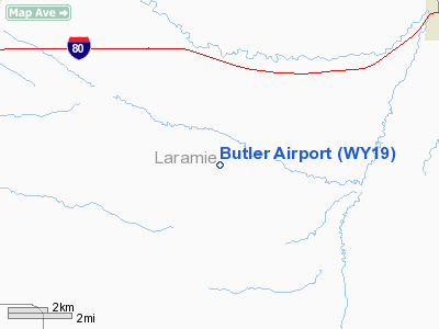
Location & QuickFacts
| FAA Information Effective: | 2008-09-25 |
| Airport Identifier: | WY19 |
| Airport Status: | Operational |
| Longitude/Latitude: | 104-12-26.8280W/41-06-20.9370N
-104.207452/41.105816 (Estimated) |
| Elevation: | 5295 ft / 1613.92 m (Estimated) |
| Land: | 0 acres |
| From nearest city: | 8 nautical miles SW of Pine Bluffs, WY |
| Location: | Laramie County, WY |
| Magnetic Variation: | 11E (1985) |
Owner & Manager
| Ownership: | Privately owned |
| Owner: | George Butler |
| Address: | Box 567
Pine Bluffs, WY 82082 |
| Phone number: | 307-245-3293 |
| Manager: | George Butler |
| Address: | Box 567
Pine Bluffs, WY 82082 |
| Phone number: | 307-245-3293 |
Airport Operations and Facilities
| Airport Use: | Private |
| Wind indicator: | Yes |
| Segmented Circle: | No |
| Control Tower: | No |
| Landing fee charge: | No |
| Sectional chart: | Cheyenne |
| Region: | ANM - Northwest Mountain |
| Boundary ARTCC: | ZDV - Denver |
| Tie-in FSS: | CPR - Casper |
| FSS on Airport: | No |
| FSS Toll Free: | 1-800-WX-BRIEF |
Airport Services
| Airframe Repair: | NONE |
| Power Plant Repair: | NONE |
Runway Information
Runway E/W
| Dimension: | 4100 x 200 ft / 1249.7 x 61.0 m |
| Surface: | TURF, Good Condition |
| |
Runway E |
Runway W |
| Traffic Pattern: | Left | Left |
|
Runway N/S
| Dimension: | 1700 x 150 ft / 518.2 x 45.7 m |
| Surface: | TURF, Fair Condition |
| |
Runway N |
Runway S |
| Traffic Pattern: | Left | Left |
|
Radio Navigation Aids
| ID |
Type |
Name |
Ch |
Freq |
Var |
Dist |
| IBM | NDB | Kimball | | 317.00 | 10E | 24.9 nm |
| CYS | VORTAC | Cheyenne | 078X | 113.10 | 13E | 26.4 nm |
| GLL | VORTAC | Gill | 089X | 114.20 | 13E | 39.5 nm |
Remarks
- NO SNOW REMOVAL IN WINTER.
- LANDING STRIP FOR PRIVATE USE ONLY - NOT TO BE LISTED.
- EXISTED PRIOR TO 1959.
Images and information placed above are from
http://www.airport-data.com/airport/WY19/
We thank them for the data!
| General Info
|
| Country |
United States
|
| State |
WYOMING
|
| FAA ID |
WY19
|
| Latitude |
41-06-20.937N
|
| Longitude |
104-12-26.828W
|
| Elevation |
5295 feet
|
| Near City |
PINE BLUFFS
|
We don't guarantee the information is fresh and accurate. The data may
be wrong or outdated.
For more up-to-date information please refer to other sources.
|
|


