 |
|
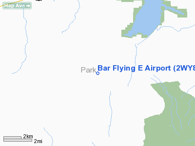
Location & QuickFacts
| FAA Information Effective: | 2008-09-25 |
| Airport Identifier: | 2WY8 |
| Airport Status: | Operational |
| Longitude/Latitude: | 109-16-55.0000W/44-24-16.0000N
-109.281944/44.404444 (Estimated) |
| Elevation: | 5550 ft / 1691.64 m () |
| Land: | 5 acres |
| From nearest city: | 12 nautical miles SW of Cody, WY |
| Location: | Park County, WY |
| Magnetic Variation: | 13E (2000) |
Owner & Manager
| Ownership: | Privately owned |
| Owner: | Michael J Mc Cue |
| Address: | 262 Road 6 Ns
Cody, WY 82414 |
| Phone number: | 307-587-8228 |
| Manager: | Michael J Mc Cue |
| Address: | 262 Road 6 Ns
Cody, WY 82414 |
| Phone number: | 307-587-8228 |
Airport Operations and Facilities
| Airport Use: | Private |
| Wind indicator: | Yes |
| Segmented Circle: | No |
| Control Tower: | No |
| Sectional chart: | Great Falls |
| Region: | ANM - Northwest Mountain |
| Boundary ARTCC: | ZLC - Salt Lake City |
| Tie-in FSS: | CPR - Casper |
| FSS Toll Free: | 1-800-WX-BRIEF |
Runway Information
Runway 04/22
| Dimension: | 1240 x 50 ft / 378.0 x 15.2 m |
| Surface: | TURF-GRVL, Fair Condition |
| |
Runway 04 |
Runway 22 |
| Traffic Pattern: | Left | Left |
|
Radio Navigation Aids
| ID |
Type |
Name |
Ch |
Freq |
Var |
Dist |
| POY | NDB | Powell | | 344.00 | 15E | 35.0 nm |
| HCY | NDB | Cowley | | 257.00 | 14E | 47.2 nm |
| COD | VOR/DME | Cody | 055X | 111.80 | 14E | 18.8 nm |
Images and information placed above are from
http://www.airport-data.com/airport/2WY8/
We thank them for the data!
| General Info
|
| Country |
United States
|
| State |
WYOMING
|
| FAA ID |
2WY8
|
| Latitude |
44-24-16.000N
|
| Longitude |
109-16-55.000W
|
| Elevation |
5550 feet
|
| Near City |
CODY
|
We don't guarantee the information is fresh and accurate. The data may
be wrong or outdated.
For more up-to-date information please refer to other sources.
|
|


