 |
|
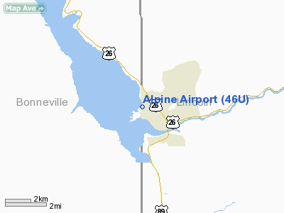
Location & QuickFacts
| FAA Information Effective: | 2008-09-25 |
| Airport Identifier: | 46U |
| Airport Status: | Operational |
| Longitude/Latitude: | 111-02-32.7640W/43-11-04.7170N
-111.042434/43.184644 (Estimated) |
| Elevation: | 5634 ft / 1717.24 m (Estimated) |
| Land: | 20 acres |
| From nearest city: | 1 nautical miles NW of Alpine, WY |
| Location: | Lincoln County, WY |
| Magnetic Variation: | 15E (1985) |
Owner & Manager
| Ownership: | Privately owned |
| Owner: | Alpine Airpark, Llc
NW 1500' OF RWY 13/31 ON U.S. FOREST SERVICE PROPERTY. |
| Address: | 270 Alpine Village Circle
Alpine, WY 83128 |
| Phone number: | 307-654-4646 |
| Manager: | Bill Wiemann |
| Address: | 270 Alpine Village Circle
Alpine, WY 83128 |
| Phone number: | 307-654-4646 |
Airport Operations and Facilities
| Airport Use: | Open to public |
| Wind indicator: | Yes |
| Segmented Circle: | No |
| Control Tower: | No |
| Landing fee charge: | No |
| Sectional chart: | Salt Lake City |
| Region: | ANM - Northwest Mountain |
| Traffic Pattern Alt: | 1000 ft |
| Boundary ARTCC: | ZLC - Salt Lake City |
| Tie-in FSS: | CPR - Casper |
| FSS on Airport: | No |
| FSS Toll Free: | 1-800-WX-BRIEF |
| NOTAMs Facility: | CPR (NOTAM-d service avaliable) |
Airport Communications
Airport Services
| Fuel available: | 100LL
FUEL AVAILABLE BY 24 HOUR CREDIT CARD SERVICE. |
| Airframe Repair: | NONE |
| Power Plant Repair: | NONE |
| Bottled Oxygen: | NONE |
| Bulk Oxygen: | NONE |
Runway Information
Runway 13/31
| Dimension: | 5850 x 50 ft / 1783.1 x 15.2 m
RY 13/31 EXTDD 225 FEET NW END. |
| Surface: | ASPH, Good Condition |
| Weight Limit: | Single wheel: 5000 lbs. |
| |
Runway 13 |
Runway 31 |
| Traffic Pattern: | Left | Left |
| Markings: | Non-precision instrument, Good Condition | Non-precision instrument, Good Condition |
| Displaced threshold: | 0.00 ft | 400.00 ft |
| Obstruction: | , 50:1 slope to clear | 19 ft road, 220.0 ft from runway, 1:1 slope to clear
RWY 31 FM DSPLCD THLD 16:1 TO +55 FT TREE 480 FT EOR 135 FT L.
RWY 31 +15 FT PAVED ROAD 106 FT FM THR CROSSES RY END. |
|
Radio Navigation Aids
| ID |
Type |
Name |
Ch |
Freq |
Var |
Dist |
| JAC | FAN MARKER | Teton | | | 17E | 25.2 nm |
| JAC | VOR/DME | Jackson | 101X | 115.40 | 13E | 29.5 nm |
| IDA | VOR/DME | Idaho Falls | 85Y | 113.85 | 15E | 49.0 nm |
| DNW | VOR/DME | Dunoir | 119X | 117.20 | 15E | 49.5 nm |
Remarks
- ARPT CLSD NIGHTS.
- UNRSTRD VEHICLE ACCESS TO RY.
- FENCES; BLDGS & TREES WITHIN 120 FT N & S OF CNTRLN FIRST 4100' RWY 31.
- FENCE 52 FT R OF RY 13 FIRST 1500 FT.
- ARPT CLSD 15 NOV - 1 APR.
- BIRDS ON AND INVOF OF ARPT.
- GLIDER OPNS INVOF ARPT, INCLUDING TFC PAT.
Images and information placed above are from
http://www.airport-data.com/airport/46U/
We thank them for the data!
| General Info
|
| Country |
United States
|
| State |
WYOMING
|
| FAA ID |
46U
|
| Latitude |
43-11-04.717N
|
| Longitude |
111-02-32.764W
|
| Elevation |
5634 feet
|
| Near City |
ALPINE
|
We don't guarantee the information is fresh and accurate. The data may
be wrong or outdated.
For more up-to-date information please refer to other sources.
|
|


