 |
|
Afton Municipal Airport
Afton-Lincoln County Airport |
| IATA: AFO – ICAO: KAFO – FAA LID: AFO |
| Summary |
| Airport type |
Public |
| Owner |
Town of Afton |
| Serves |
Afton, Wyoming |
| Elevation AMSL |
6,221 ft / 1,896 m |
| Coordinates |
42°42′32″N 110°56′32″W / 42.70889°N 110.94222°W / 42.70889; -110.94222 |
| Runways |
| Direction |
Length |
Surface |
| ft |
m |
| 16/34 |
7,023 |
2,141 |
Asphalt |
| Statistics (2007) |
| Aircraft operations |
14,820 |
| Based aircraft |
43 |
| Source: Federal Aviation Administration |
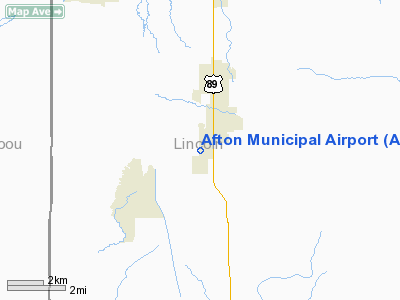
Afton Municipal Airport (IATA: AFO, ICAO: KAFO, FAA LID: AFO) is a town-owned, public-use airport located one nautical mile (1.85 km) southwest of the central business district of Afton, a town in Lincoln County, Wyoming, United States. It is also known as Afton-Lincoln County Airport.
This airport is included in the FAA's National Plan of Integrated Airport Systems (2009–2013), which categorizes it as a general aviation airport.
Facilities and aircraft
The airport covers an area of 282 acres (114 ha) at an elevation of 6,221 feet (1,896 m) above mean sea level. It has one runway designated 16/34 with an asphalt surface measuring 7,023 by 75 feet (2,141 x 23 m).
For the 12-month period ending April 30, 2007, the airport had 14,820 aircraft operations, an average of 40 per day: 98% general aviation, 2% air taxi and <1% military. At that time there were 43 aircraft based at this airport: 81% single-engine, 9% multi-engine and 9% ultralight.
The above content comes from Wikipedia and is published under free licenses – click here to read more.
Location & QuickFacts
| FAA Information Effective: | 2008-09-25 |
| Airport Identifier: | AFO |
| Airport Status: | Operational |
| Longitude/Latitude: | 110-56-31.7900W/42-42-40.4850N
-110.942164/42.711246 (Estimated) |
| Elevation: | 6201 ft / 1890.06 m (Surveyed) |
| Land: | 282 acres |
| From nearest city: | 1 nautical miles SW of Afton, WY |
| Location: | Lincoln County, WY |
| Magnetic Variation: | 14E (2000) |
Owner & Manager
| Ownership: | Publicly owned |
| Owner: | Town Of Afton
ALSO LINCOLN COUNTY-800-422-9001. |
| Address: | Box 1181
Afton, WY 83110 |
| Phone number: | 307-885-8696 |
| Manager: | Rick Sessions |
| Address: | Box 1181
Afton, WY 83110 |
| Phone number: | 307-885-3245 |
Airport Operations and Facilities
| Airport Use: | Open to public |
| Wind indicator: | Yes |
| Segmented Circle: | Yes |
| Control Tower: | No |
| Lighting Schedule: | DUSK-DAWN
ACTVT MIRL RY 16/34, REIL & PAPI RYS 16 & 34 - CTAF. |
| Beacon Color: | Clear-Green (lighted land airport) |
| Landing fee charge: | No |
| Sectional chart: | Salt Lake City |
| Region: | ANM - Northwest Mountain |
| Boundary ARTCC: | ZLC - Salt Lake City |
| Tie-in FSS: | CPR - Casper |
| FSS on Airport: | No |
| FSS Toll Free: | 1-800-WX-BRIEF |
| NOTAMs Facility: | CPR (NOTAM-d service avaliable) |
| Federal Agreements: | NGY |
Airport Communications
| CTAF: | 122.800 |
| Unicom: | 122.800 |
Airport Services
| Fuel available: | 100LLA
FUEL AVAILABLE 24 HRS BY SELF SERVICE WITH CREDIT CARD. |
| Airframe Repair: | MAJOR |
| Power Plant Repair: | MAJOR |
| Bottled Oxygen: | NONE |
| Bulk Oxygen: | HIGH/LOW |
Runway Information
Runway 16/34
| Dimension: | 7023 x 75 ft / 2140.6 x 22.9 m |
| Surface: | ASPH, Good Condition |
| Surface Treatment: | Porous Friction Course |
| Weight Limit: | Single wheel: 24000 lbs. |
| Edge Lights: | Medium |
| |
Runway 16 |
Runway 34 |
| Longitude: | 110-56-31.7000W | 110-56-31.9400W |
| Latitude: | 42-43-06.2600N | 42-41-56.8900N |
| Elevation: | 6188.00 ft | 6221.00 ft |
| Alignment: | 127 | 0 |
| Traffic Pattern: | Right | Left |
| Markings: | Non-precision instrument, Good Condition | Non-precision instrument, Good Condition |
| Crossing Height: | 40.00 ft | 30.00 ft |
| VASI: | 2-light PAPI on left side | 2-light PAPI on left side |
| Visual Glide Angle: | 3.00° | 3.00° |
| Runway End Identifier: | Yes | Yes |
| Obstruction: | 51 ft pole, 1290.0 ft from runway, 278 ft left of centerline, 21:1 slope to clear | 90 ft tree, 2014.0 ft from runway, 185 ft right of centerline, 19:1 slope to clear |
|
Radio Navigation Aids
| ID |
Type |
Name |
Ch |
Freq |
Var |
Dist |
| BPI | VOR/DME | Big Piney | 112X | 116.50 | 16E | 37.7 nm |
Remarks
- SNBNKS 4' TO 7' ALONG RWYS & TXYS EDGES FROM OCT-MAY WITH SLICK SPOTS ALL SFCS.
- ULTRA-LIGHT ACTIVITY IN VICINITY OF AIRPORT
Images and information placed above are from
http://www.airport-data.com/airport/AFO/
We thank them for the data!
| General Info
|
| Country |
United States
|
| State |
WYOMING
|
| FAA ID |
AFO
|
| Latitude |
42-42-40.485N
|
| Longitude |
110-56-31.790W
|
| Elevation |
6201 feet
|
| Near City |
AFTON
|
We don't guarantee the information is fresh and accurate. The data may
be wrong or outdated.
For more up-to-date information please refer to other sources.
|
|


