 |
|
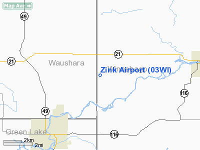
Location & QuickFacts
| FAA Information Effective: | 2008-09-25 |
| Airport Identifier: | 03WI |
| Airport Status: | Operational |
| Longitude/Latitude: | 088-52-51.4070W/44-01-38.9310N
-88.880946/44.027481 (Estimated) |
| Elevation: | 880 ft / 268.22 m (Estimated) |
| Land: | 0 acres |
| From nearest city: | 4 nautical miles NE of Berlin, WI |
| Location: | Winnebago County, WI |
| Magnetic Variation: | 01W (1985) |
Owner & Manager
| Ownership: | Privately owned |
| Owner: | Donald Zink |
| Address: | 3684 Bell Line Road
Berlin, WI 54293 |
| Phone number: | 414-361-2837 |
| Manager: | Donald Zink |
| Address: | 3684 Bell Line Road
Berlin, WI 54293 |
| Phone number: | 414-361-2837 |
Airport Operations and Facilities
| Airport Use: | Private |
| Segmented Circle: | No |
| Control Tower: | No |
| Sectional chart: | Green Bay |
| Region: | AGL - Great Lakes |
| Boundary ARTCC: | ZAU - Chicago |
| Tie-in FSS: | GRB - Green Bay |
| FSS on Airport: | No |
| FSS Toll Free: | 1-800-WX-BRIEF |
Runway Information
Runway N/S
| Dimension: | 1500 x 60 ft / 457.2 x 18.3 m |
| Surface: | TURF, |
| |
Runway N |
Runway S |
| Traffic Pattern: | Left | Left |
| Obstruction: | 30 ft pline, 50.0 ft from runway | |
|
Radio Navigation Aids
| ID |
Type |
Name |
Ch |
Freq |
Var |
Dist |
| PCZ | NDB | Waupaca | | 382.00 | 01W | 19.2 nm |
| AQ | NDB | Kooky | | 407.00 | 02W | 23.7 nm |
| CLI | NDB | Clintonville | | 209.00 | 02W | 36.1 nm |
| UNU | NDB | Juneau | | 344.00 | 01W | 36.8 nm |
| SG | NDB | Depre | | 332.00 | 02W | 39.2 nm |
| HXF | NDB | Hartford | | 200.00 | 00E | 45.9 nm |
| ISW | NDB | Wisconsin Rapids | | 215.00 | 01W | 46.0 nm |
| LLE | NDB | Kettle Moraine | | 329.00 | 01W | 48.8 nm |
| BJB | VOR | West Bend | | 109.80 | 01W | 49.0 nm |
| FAH | VOR/DME | Falls | 37X | 110.00 | 02W | 47.3 nm |
| OSH | VORTAC | Oshkosh | 055X | 111.80 | 02E | 14.2 nm |
| STE | VORTAC | Stevens Point | 043X | 110.60 | 01W | 41.7 nm |
| GRB | VORTAC | Green Bay | 102X | 115.50 | 01E | 43.3 nm |
| DLL | VORTAC | Dells | 117X | 117.00 | 03E | 47.8 nm |
Remarks
- FILED FOR RECORD PURPOSES ONLY.
Images and information placed above are from
http://www.airport-data.com/airport/03WI/
We thank them for the data!
| General Info
|
| Country |
United States
|
| State |
WISCONSIN
|
| FAA ID |
03WI
|
| Latitude |
44-01-38.931N
|
| Longitude |
088-52-51.407W
|
| Elevation |
880 feet
|
| Near City |
BERLIN
|
We don't guarantee the information is fresh and accurate. The data may
be wrong or outdated.
For more up-to-date information please refer to other sources.
|
|


