 |
|
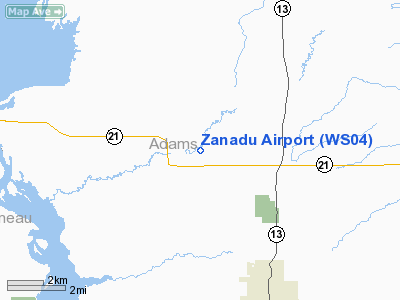
Location & QuickFacts
| FAA Information Effective: | 2008-09-25 |
| Airport Identifier: | WS04 |
| Airport Status: | Operational |
| Longitude/Latitude: | 089-51-54.4560W/44-01-56.8870N
-89.865127/44.032469 (Estimated) |
| Elevation: | 950 ft / 289.56 m (Estimated) |
| Land: | 0 acres |
| From nearest city: | 1 nautical miles NE of Arkdale, WI |
| Location: | Adams County, WI |
| Magnetic Variation: | 00E (1985) |
Owner & Manager
| Ownership: | Privately owned |
| Owner: | Wayne K. Carstens |
| Address: | 2762 N. 82nd St
Milwaukee, WI 53222 |
| Phone number: | 414-774-1004 |
| Manager: | Wayne K. Carstens |
| Address: | 2762 N. 82nd St
Milwaukee, WI 53222 |
| Phone number: | 414-774-1004 |
Airport Operations and Facilities
| Airport Use: | Private |
| Wind indicator: | Yes |
| Segmented Circle: | No |
| Control Tower: | No |
| Sectional chart: | Green Bay |
| Region: | AGL - Great Lakes |
| Boundary ARTCC: | ZAU - Chicago |
| Tie-in FSS: | GRB - Green Bay |
| FSS on Airport: | No |
| FSS Toll Free: | 1-800-WX-BRIEF |
Runway Information
Runway NE/SW
| Dimension: | 2000 x 75 ft / 609.6 x 22.9 m |
| Surface: | TURF, |
| |
Runway NE |
Runway SW |
| Traffic Pattern: | Left | Left |
|
Radio Navigation Aids
| ID |
Type |
Name |
Ch |
Freq |
Var |
Dist |
| ISW | NDB | Wisconsin Rapids | | 215.00 | 01W | 20.0 nm |
| HBW | NDB | Kickapoo | | 251.00 | 03E | 30.4 nm |
| CMY | NDB | Mccoy | | 412.00 | 00E | 34.1 nm |
| MFI | NDB | Marshfield | | 391.00 | 00E | 39.1 nm |
| PCZ | NDB | Waupaca | | 382.00 | 01W | 40.8 nm |
| VIQ | NDB | Neillsville | | 368.00 | 01W | 42.2 nm |
| BCK | NDB | Black River Falls | | 362.00 | 00E | 44.5 nm |
| VOK | TACAN | Volk | 041X | | 00E | 17.9 nm |
| LNR | VOR/DME | Lone Rock | 075X | 112.80 | 00E | 45.9 nm |
| DLL | VORTAC | Dells | 117X | 117.00 | 03E | 29.3 nm |
| STE | VORTAC | Stevens Point | 043X | 110.60 | 01W | 33.9 nm |
Images and information placed above are from
http://www.airport-data.com/airport/WS04/
We thank them for the data!
| General Info
|
| Country |
United States
|
| State |
WISCONSIN
|
| FAA ID |
WS04
|
| Latitude |
44-01-56.887N
|
| Longitude |
089-51-54.456W
|
| Elevation |
950 feet
|
| Near City |
ARKDALE
|
We don't guarantee the information is fresh and accurate. The data may
be wrong or outdated.
For more up-to-date information please refer to other sources.
|
|


