 |
|
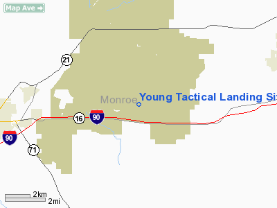
Young Tactical Landing Site Airport |
Location & QuickFacts
| FAA Information Effective: | 2008-09-25 |
| Airport Identifier: | WS20 |
| Airport Status: | Operational |
| Longitude/Latitude: | 090-39-45.4800W/43-57-10.8770N
-90.662633/43.953021 (Estimated) |
| Elevation: | 912 ft / 277.98 m (Estimated) |
| Land: | 0 acres |
| From nearest city: | 4 nautical miles W of Fort Mc Coy, WI |
| Location: | Monroe County, WI |
| Magnetic Variation: | 01E (1985) |
Owner & Manager
| Ownership: | Army owned |
| Owner: | Commander |
| Address: |
Ft Cm Coy, WI 98433 |
| Phone number: | 608-388-2266 |
| Manager: | Military Police |
| Address: |
Ft Cm Coy, WI 98433 |
| Phone number: | 608-388-2266 |
Airport Operations and Facilities
| Airport Use: | Private |
| Segmented Circle: | No |
| Control Tower: | No |
| Sectional chart: | Chicago |
| Region: | AGL - Great Lakes |
| Boundary ARTCC: | ZMP - Minneapolis |
| Tie-in FSS: | GRB - Green Bay |
| FSS on Airport: | No |
| FSS Toll Free: | 1-800-WX-BRIEF |
Runway Information
Runway 11/29
| Dimension: | 4100 x 60 ft / 1249.7 x 18.3 m |
| Surface: | GRVL, |
| |
Runway 11 |
Runway 29 |
| Traffic Pattern: | Left | Left |
|
Radio Navigation Aids
| ID |
Type |
Name |
Ch |
Freq |
Var |
Dist |
| CMY | NDB | Mccoy | | 412.00 | 00E | 1.3 nm |
| BCK | NDB | Black River Falls | | 362.00 | 00E | 19.8 nm |
| HBW | NDB | Kickapoo | | 251.00 | 03E | 22.9 nm |
| VIQ | NDB | Neillsville | | 368.00 | 01W | 36.9 nm |
| CHU | NDB | Caledonia | | 209.00 | 03E | 42.1 nm |
| ISW | NDB | Wisconsin Rapids | | 215.00 | 01W | 43.2 nm |
| MFI | NDB | Marshfield | | 391.00 | 00E | 46.1 nm |
| VOK | TACAN | Volk | 041X | | 00E | 17.5 nm |
| LSE | VOR/DME | La Crosse | 021X | 108.40 | 02E | 26.1 nm |
| ONA | VOR/DME | Winona | 051X | 111.40 | 01E | 45.7 nm |
| LNR | VOR/DME | Lone Rock | 075X | 112.80 | 00E | 45.8 nm |
| ODI | VORTAC | Nodine | 126X | 117.90 | 01E | 34.9 nm |
| DLL | VORTAC | Dells | 117X | 117.00 | 03E | 45.9 nm |
Images and information placed above are from
http://www.airport-data.com/airport/WS20/
We thank them for the data!
| General Info
|
| Country |
United States
|
| State |
WISCONSIN
|
| FAA ID |
WS20
|
| Latitude |
43-57-10.877N
|
| Longitude |
090-39-45.480W
|
| Elevation |
912 feet
|
| Near City |
FORT MC COY
|
We don't guarantee the information is fresh and accurate. The data may
be wrong or outdated.
For more up-to-date information please refer to other sources.
|
|


