 |
|
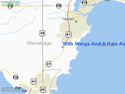
With Wings And A Halo Airport |
Location & QuickFacts
| FAA Information Effective: | 2008-09-25 |
| Airport Identifier: | 0WI7 |
| Airport Status: | Operational |
| Longitude/Latitude: | 088-29-57.4000W/44-08-00.9460N
-88.499278/44.133596 (Estimated) |
| Elevation: | 760 ft / 231.65 m (Estimated) |
| Land: | 40 acres |
| From nearest city: | 3 nautical miles S of Neenah, WI |
| Location: | Winnebago County, WI |
| Magnetic Variation: | 01W (1985) |
Owner & Manager
| Ownership: | Privately owned |
| Owner: | With Wings And A Halo Corp |
| Address: | 407 Augusta Dr
Waunake, WI 53597 |
| Phone number: | 608-849-7071 |
| Manager: | Paul S. Gilbertson |
| Address: | 407 Augusta Dr
Waunake, WI 53597 |
| Phone number: | 608-345-7074 |
Airport Operations and Facilities
| Airport Use: | Private |
| Wind indicator: | Yes |
| Segmented Circle: | No |
| Control Tower: | No |
| Landing fee charge: | No |
| Sectional chart: | Green Bay |
| Region: | AGL - Great Lakes |
| Boundary ARTCC: | ZAU - Chicago |
| Tie-in FSS: | GRB - Green Bay |
| FSS on Airport: | No |
| FSS Toll Free: | 1-800-WX-BRIEF |
Airport Services
| Airframe Repair: | NONE |
| Power Plant Repair: | NONE |
Runway Information
Runway 09/27
| Dimension: | 2100 x 150 ft / 640.1 x 45.7 m |
| Surface: | TURF, |
| |
Runway 09 |
Runway 27 |
| Traffic Pattern: | Left | Left |
| Displaced threshold: | 0.00 ft | 300.00 ft |
|
Runway 18/36
| Dimension: | 1500 x 100 ft / 457.2 x 30.5 m |
| Surface: | TURF, |
| |
Runway 18 |
Runway 36 |
| Traffic Pattern: | Left | Left |
|
Radio Navigation Aids
| ID |
Type |
Name |
Ch |
Freq |
Var |
Dist |
| AQ | NDB | Kooky | | 407.00 | 02W | 6.6 nm |
| SG | NDB | Depre | | 332.00 | 02W | 22.4 nm |
| PCZ | NDB | Waupaca | | 382.00 | 01W | 25.3 nm |
| CLI | NDB | Clintonville | | 209.00 | 02W | 30.8 nm |
| UNU | NDB | Juneau | | 344.00 | 01W | 43.3 nm |
| LLE | NDB | Kettle Moraine | | 329.00 | 01W | 45.5 nm |
| HXF | NDB | Hartford | | 200.00 | 00E | 47.4 nm |
| BJB | VOR | West Bend | | 109.80 | 01W | 45.8 nm |
| MTW | VOR/DME | Manitowoc | 047X | 111.00 | 02W | 35.4 nm |
| FAH | VOR/DME | Falls | 37X | 110.00 | 02W | 35.7 nm |
| OSH | VORTAC | Oshkosh | 055X | 111.80 | 02E | 8.9 nm |
| GRB | VORTAC | Green Bay | 102X | 115.50 | 01E | 28.5 nm |
Images and information placed above are from
http://www.airport-data.com/airport/0WI7/
We thank them for the data!
| General Info
|
| Country |
United States
|
| State |
WISCONSIN
|
| FAA ID |
0WI7
|
| Latitude |
44-08-00.946N
|
| Longitude |
088-29-57.400W
|
| Elevation |
760 feet
|
| Near City |
NEENAH
|
We don't guarantee the information is fresh and accurate. The data may
be wrong or outdated.
For more up-to-date information please refer to other sources.
|
|


