 |
|
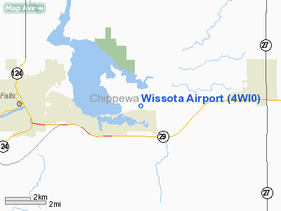
Location & QuickFacts
| FAA Information Effective: | 2008-09-25 |
| Airport Identifier: | 4WI0 |
| Airport Status: | Operational |
| Longitude/Latitude: | 091-16-20.5470W/44-55-59.8620N
-91.272374/44.933295 (Estimated) |
| Elevation: | 936 ft / 285.29 m (Surveyed) |
| Land: | 0 acres |
| From nearest city: | 5 nautical miles E of Chippewa Falls, WI |
| Location: | Chippewa County, WI |
| Magnetic Variation: | 01E (1985) |
Owner & Manager
| Ownership: | Privately owned |
| Owner: | Robert W Stumm/mary M Bauer |
| Address: | Po Box 370
Cadott, WI 54727 |
| Phone number: | 715-289-4440 |
| Manager: | Robert W. Stumm |
| Address: | Po Box 370
Cadott, WI 54727 |
| Phone number: | 715-289-4440 |
Airport Operations and Facilities
| Airport Use: | Private |
| Wind indicator: | Yes |
| Segmented Circle: | No |
| Control Tower: | No |
| Lighting Schedule: | RDO REQ
ACTVT LIRL RY 06/24 - 122.8. |
| Landing fee charge: | No |
| Sectional chart: | Green Bay |
| Region: | AGL - Great Lakes |
| Boundary ARTCC: | ZMP - Minneapolis |
| Tie-in FSS: | GRB - Green Bay |
| FSS on Airport: | No |
| FSS Toll Free: | 1-800-WX-BRIEF |
Airport Services
| Fuel available: | 80 |
| Airframe Repair: | MINOR |
| Power Plant Repair: | MINOR |
Runway Information
Runway 06/24
| Dimension: | 2800 x 100 ft / 853.4 x 30.5 m |
| Surface: | TURF, |
| Edge Lights: | Low |
| |
Runway 06 |
Runway 24 |
| Traffic Pattern: | Left | Left |
| Obstruction: | | 27 ft pline, 253.0 ft from runway |
|
Radio Navigation Aids
| ID |
Type |
Name |
Ch |
Freq |
Var |
Dist |
| RCX | NDB | Rusk County | | 356.00 | 00W | 36.1 nm |
| VIQ | NDB | Neillsville | | 368.00 | 01W | 39.4 nm |
| MDZ | NDB | Medford | | 335.00 | 00E | 42.2 nm |
| BCK | NDB | Black River Falls | | 362.00 | 00E | 44.6 nm |
| UBE | NDB | Cumberland | | 375.00 | 01E | 45.7 nm |
| MFI | NDB | Marshfield | | 391.00 | 00E | 49.5 nm |
| RPD | VOR/DME | Rice Lake | 037X | 110.00 | 01E | 36.0 nm |
| EAU | VORTAC | Eau Claire | 076X | 112.90 | 04E | 9.0 nm |
Remarks
- SKYDIVING ACTIVITIES WED; WKENDS & HOLS.
- PVT USE. ALL PATTERNS NW OF RWY.
Images and information placed above are from
http://www.airport-data.com/airport/4WI0/
We thank them for the data!
| General Info
|
| Country |
United States
|
| State |
WISCONSIN
|
| FAA ID |
4WI0
|
| Latitude |
44-55-59.862N
|
| Longitude |
091-16-20.547W
|
| Elevation |
936 feet
|
| Near City |
CHIPPEWA FALLS
|
We don't guarantee the information is fresh and accurate. The data may
be wrong or outdated.
For more up-to-date information please refer to other sources.
|
|


