 |
|
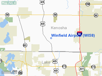
Location & QuickFacts
| FAA Information Effective: | 2008-09-25 |
| Airport Identifier: | WI58 |
| Airport Status: | Operational |
| Longitude/Latitude: | 088-01-40.2950W/42-31-20.0690N
-88.027860/42.522241 (Estimated) |
| Elevation: | 770 ft / 234.70 m (Estimated) |
| Land: | 0 acres |
| From nearest city: | 3 nautical miles SE of Bristol, WI |
| Location: | Kenosha County, WI |
| Magnetic Variation: | 01W (1985) |
Owner & Manager
| Ownership: | Privately owned |
| Owner: | Softwing Flight, Llc |
| Address: | 18120 Winfield Road
Bristol, WI 53104 |
| Phone number: | 847-910-7150 |
| Manager: | Patrcia Sharp-gregg |
| Address: | 332 W Lake Street
Libertyville, IL 60048 |
| Phone number: | 847-680-1750 |
Airport Operations and Facilities
| Airport Use: | Private |
| Wind indicator: | Yes |
| Segmented Circle: | No |
| Control Tower: | No |
| Landing fee charge: | No |
| Sectional chart: | Chicago |
| Region: | AGL - Great Lakes |
| Boundary ARTCC: | ZAU - Chicago |
| Tie-in FSS: | GRB - Green Bay |
| FSS on Airport: | No |
| FSS Toll Free: | 1-800-WX-BRIEF |
Airport Services
| Airframe Repair: | NONE |
| Power Plant Repair: | NONE |
Runway Information
Runway 05/23
| Dimension: | 1500 x 100 ft / 457.2 x 30.5 m |
| Surface: | TURF, |
| |
Runway 05 |
Runway 23 |
| Traffic Pattern: | Left | Left |
|
Runway 09/27
| Dimension: | 1200 x 100 ft / 365.8 x 30.5 m |
| Surface: | TURF, |
| |
Runway 09 |
Runway 27 |
| Traffic Pattern: | Left | Left |
|
Runway 18/36
| Dimension: | 2000 x 100 ft / 609.6 x 30.5 m |
| Surface: | TURF, |
| |
Runway 18 |
Runway 36 |
| Traffic Pattern: | Left | Left |
|
Radio Navigation Aids
| ID |
Type |
Name |
Ch |
Freq |
Var |
Dist |
| RA | NDB | Paser | | 206.00 | 00E | 11.2 nm |
| GM | NDB | Teels | | 242.00 | 02W | 23.3 nm |
| LVV | NDB | Lake Lawn | | 404.00 | 00W | 27.2 nm |
| UES | NDB | Waukesha | | 359.00 | 01W | 32.7 nm |
| BL | NDB | Yanks | | 260.00 | 02W | 33.0 nm |
| ME | NDB | Deana | | 350.00 | 00E | 33.3 nm |
| JVL | NDB | Janesville | | 375.00 | 03E | 45.2 nm |
| DKB | NDB | Dekalb | | 209.00 | 02W | 46.5 nm |
| HK | NDB | Ermin | | 332.00 | 01W | 49.0 nm |
| MX | NDB | Kedzi | | 248.00 | 01W | 49.3 nm |
| RYV | NDB | Rock River | | 371.00 | 01W | 49.8 nm |
| ENW | VOR/DME | Kenosha | 029X | 109.20 | 02W | 6.3 nm |
| BUU | VOR/DME | Burbun | 092X | 114.50 | 01W | 15.7 nm |
| HRK | VOR/DME | Horlick | 124X | 117.70 | 02W | 17.2 nm |
| OBK | VOR/DME | Northbrook | 077X | 113.00 | 02W | 18.4 nm |
| ORD | VOR/DME | Chicago O'hare | 086X | 113.90 | 02E | 32.6 nm |
| LJT | VOR/DME | Timmerman | 072X | 112.50 | 02W | 35.3 nm |
| DPA | VOR/DME | Dupage | 021X | 108.40 | 02E | 40.6 nm |
| JVL | VOR/DME | Janesville | 090X | 114.30 | 03E | 47.8 nm |
| BAE | VORTAC | Badger | 111X | 116.40 | 02E | 37.5 nm |
| MKE | VOT | Milwaukee | | 109.00 | | 26.2 nm |
| ORD | VOT | Chicago O'hare Intl | | 112.00 | | 32.9 nm |
| MDW | VOT | Chicago Midway | | 111.00 | | 45.9 nm |
Images and information placed above are from
http://www.airport-data.com/airport/WI58/
We thank them for the data!
| General Info
|
| Country |
United States
|
| State |
WISCONSIN
|
| FAA ID |
WI58
|
| Latitude |
42-31-20.069N
|
| Longitude |
088-01-40.295W
|
| Elevation |
770 feet
|
| Near City |
BRISTOL
|
We don't guarantee the information is fresh and accurate. The data may
be wrong or outdated.
For more up-to-date information please refer to other sources.
|
|


