 |
|
Location & QuickFacts
| FAA Information Effective: | 2008-09-25 |
| Airport Identifier: | 72WI |
| Airport Status: | Operational |
| Longitude/Latitude: | 087-59-34.3430W/44-02-45.9730N
-87.992873/44.046104 (Estimated) |
| Elevation: | 910 ft / 277.37 m (Estimated) |
| Land: | 0 acres |
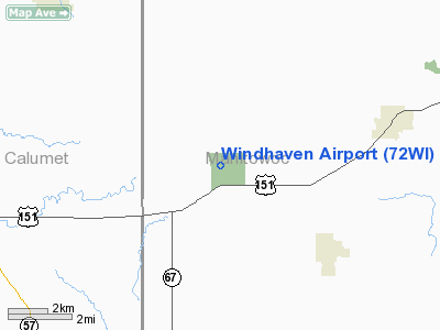
| From nearest city: | 3 nautical miles SW of Collins, WI |
| Location: | Manitowoc County, WI |
| Magnetic Variation: | 02W (1985) |
Owner & Manager
| Ownership: | Privately owned |
| Owner: | Roland Olm, Jr. |
| Address: | 21803 Duchow Rd
Chilton, WI 53014 |
| Phone number: | 414-772-4450 |
| Manager: | Roland Olm, Jr. |
| Address: | 21803 Duchow Rd.
Chilton, WI 53014 |
| Phone number: | 414-772-4450 |
Airport Operations and Facilities
| Airport Use: | Private |
| Wind indicator: | Yes |
| Segmented Circle: | No |
| Control Tower: | No |
| Landing fee charge: | No |
| Sectional chart: | Green Bay |
| Region: | AGL - Great Lakes |
| Boundary ARTCC: | ZAU - Chicago |
| Tie-in FSS: | GRB - Green Bay |
| FSS on Airport: | No |
| FSS Toll Free: | 1-800-WX-BRIEF |
Runway Information
Runway 11/29
| Dimension: | 1500 x 40 ft / 457.2 x 12.2 m |
| Surface: | TURF, |
| |
Runway 11 |
Runway 29 |
| Traffic Pattern: | Left | Left |
|
Radio Navigation Aids
| ID |
Type |
Name |
Ch |
Freq |
Var |
Dist |
| AQ | NDB | Kooky | | 407.00 | 02W | 20.3 nm |
| SG | NDB | Depre | | 332.00 | 02W | 22.0 nm |
| LLE | NDB | Kettle Moraine | | 329.00 | 01W | 37.8 nm |
| HXF | NDB | Hartford | | 200.00 | 00E | 45.5 nm |
| CLI | NDB | Clintonville | | 209.00 | 02W | 46.9 nm |
| PCZ | NDB | Waupaca | | 382.00 | 01W | 47.3 nm |
| UNU | NDB | Juneau | | 344.00 | 01W | 48.2 nm |
| OCQ | NDB | Oconto | | 388.00 | 03W | 50.0 nm |
| BJB | VOR | West Bend | | 109.80 | 01W | 38.0 nm |
| MTW | VOR/DME | Manitowoc | 047X | 111.00 | 02W | 14.4 nm |
| FAH | VOR/DME | Falls | 37X | 110.00 | 02W | 17.8 nm |
| OSH | VORTAC | Oshkosh | 055X | 111.80 | 02E | 24.6 nm |
| GRB | VORTAC | Green Bay | 102X | 115.50 | 01E | 31.8 nm |
Images and information placed above are from
http://www.airport-data.com/airport/72WI/
We thank them for the data!
| General Info
|
| Country |
United States
|
| State |
WISCONSIN
|
| FAA ID |
72WI
|
| Latitude |
44-02-45.973N
|
| Longitude |
087-59-34.343W
|
| Elevation |
910 feet
|
| Near City |
COLLINS
|
We don't guarantee the information is fresh and accurate. The data may
be wrong or outdated.
For more up-to-date information please refer to other sources.
|
|


