 |
|
Location & QuickFacts
| FAA Information Effective: | 2008-09-25 |
| Airport Identifier: | 6WI3 |
| Airport Status: | Operational |
| Longitude/Latitude: | 091-33-45.0930W/45-40-37.8410N
-91.562526/45.677178 (Estimated) |
| Elevation: | 1290 ft / 393.19 m (Estimated) |
| Land: | 80 acres |
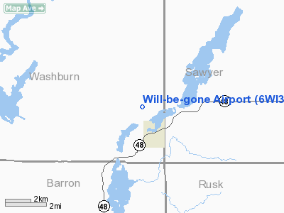
| From nearest city: | 1 nautical miles N of Birchwood, WI |
| Location: | Washburn County, WI |
| Magnetic Variation: | 01E (1995) |
Owner & Manager
| Ownership: | Privately owned |
| Owner: | William F. Cyr |
| Address: | 329 Hinman Drive
Birchwood, WI 54817 |
| Phone number: | 715-354-3360 |
| Manager: | William F. Cyr |
| Address: | 329 Hinman Drive
Birchwood, WI 54817 |
| Phone number: | 715-354-3360 |
Airport Operations and Facilities
| Airport Use: | Private |
| Wind indicator: | Yes |
| Segmented Circle: | No |
| Control Tower: | No |
| Sectional chart: | Green Bay |
| Region: | AGL - Great Lakes |
| Boundary ARTCC: | ZMP - Minneapolis |
| Tie-in FSS: | GRB - Green Bay |
| FSS on Airport: | No |
| FSS Toll Free: | 1-800-WX-BRIEF |
Runway Information
Runway 01/19
| Dimension: | 2000 x 60 ft / 609.6 x 18.3 m |
| Surface: | TURF, |
| |
Runway 01 |
Runway 19 |
| Traffic Pattern: | Left | Left |
| Displaced threshold: | 300.00 ft | 0.00 ft |
| Obstruction: | 50 ft trees, 200.0 ft from runway | 50 ft trees, 200.0 ft from runway |
|
Radio Navigation Aids
| ID |
Type |
Name |
Ch |
Freq |
Var |
Dist |
| SSQ | NDB | Shell Lake | | 212.00 | 01E | 15.3 nm |
| UBE | NDB | Cumberland | | 375.00 | 01E | 20.1 nm |
| RCX | NDB | Rusk County | | 356.00 | 00W | 25.9 nm |
| SLY | NDB | Seeley | | 344.00 | 01E | 27.2 nm |
| BXR | NDB | Big Doctor | | 203.00 | 02E | 34.8 nm |
| OLG | NDB | Solon Springs | | 388.00 | 01E | 39.9 nm |
| AHH | NDB | Ameron | | 278.00 | 01E | 41.6 nm |
| PBH | NDB | Phillips | | 263.00 | 00E | 48.3 nm |
| RPD | VOR/DME | Rice Lake | 037X | 110.00 | 01E | 18.2 nm |
| HYR | VOR/DME | Hayward | 081X | 113.40 | 03E | 21.1 nm |
| RZN | VOR/DME | Siren | 031X | 109.40 | 02E | 35.1 nm |
| EAU | VORTAC | Eau Claire | 076X | 112.90 | 04E | 47.0 nm |
Remarks
- PRVDD OBSTNS ARE LOWERED/REMOVED OR THLD DSPLCD TO PROVIDE A CLEAR 20:1 APCH; AREA 125 FT EITHER SIDE OF CNTRLN & 200 FT OFF RY ENDS ARE CLEAR OF OBSTNS; AREA 60 FT EITHER SIDE OF CNTRLN & 240 FT OFF RY ENDS ARE CLEAR OF RUTS.
Images and information placed above are from
http://www.airport-data.com/airport/6WI3/
We thank them for the data!
| General Info
|
| Country |
United States
|
| State |
WISCONSIN
|
| FAA ID |
6WI3
|
| Latitude |
45-40-37.841N
|
| Longitude |
091-33-45.093W
|
| Elevation |
1290 feet
|
| Near City |
BIRCHWOOD
|
We don't guarantee the information is fresh and accurate. The data may
be wrong or outdated.
For more up-to-date information please refer to other sources.
|
|


