 |
|
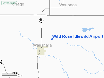
Wild Rose Idlewild Airport |
Location & QuickFacts
| FAA Information Effective: | 2008-09-25 |
| Airport Identifier: | W23 |
| Airport Status: | Operational |
| Longitude/Latitude: | 089-13-04.4210W/44-11-51.9190N
-89.217895/44.197755 (Estimated) |
| Elevation: | 908 ft / 276.76 m (Estimated) |
| Land: | 100 acres |
| From nearest city: | 2 nautical miles NE of Wild Rose, WI |
| Location: | Waushara County, WI |
| Magnetic Variation: | 00W (1985) |
Owner & Manager
| Ownership: | Publicly owned |
| Owner: | Village Of Wild Rose
LEASED TO THE WILD ROSE ARPT ASSOCIATION. |
| Address: | P.o. Box 296
Wild Rose, WI 54984 |
| Phone number: | 920-622-4183 |
| Manager: | Dean Riley |
| Address: | N6041 County Road K
Wild Rose, WI 54984 |
| Phone number: | 920-622-4911 |
Airport Operations and Facilities
| Airport Use: | Open to public |
| Wind indicator: | Yes |
| Segmented Circle: | Yes |
| Control Tower: | No |
| Lighting Schedule: | DUSK-DAWN
ACTVT LIRL RY 09/27 - CTAF. |
| Beacon Color: | Clear-Green (lighted land airport) |
| Sectional chart: | Chicago |
| Region: | AGL - Great Lakes |
| Boundary ARTCC: | ZAU - Chicago |
| Tie-in FSS: | GRB - Green Bay |
| FSS on Airport: | No |
| FSS Toll Free: | 1-800-WX-BRIEF |
| NOTAMs Facility: | GRB (NOTAM-d service avaliable) |
Airport Communications
| CTAF: | 122.800 |
| Unicom: | 122.800 |
Airport Services
| Airframe Repair: | NONE |
| Power Plant Repair: | NONE |
| Bottled Oxygen: | NONE |
| Bulk Oxygen: | NONE |
Runway Information
Runway 09/27
| Dimension: | 2990 x 100 ft / 911.4 x 30.5 m |
| Surface: | TURF, Fair Condition
PLOWED WINTER MONTHS.
CLSD NOV 15 THRU APR 1. |
| Edge Lights: | Non-standard lighting system
RWY 09/27 NSTD THR LGHTS. |
| |
Runway 09 |
Runway 27 |
| Longitude: | 089-13-22.3400W | 089-12-41.5100W |
| Latitude: | 44-11-52.9100N | 44-11-49.9300N |
| Elevation: | 908.00 ft | 900.00 ft |
| Traffic Pattern: | Left | Left |
| Obstruction: | 50 ft tree, 250.0 ft from runway, 100 ft right of centerline, 5:1 slope to clear | 40 ft tree, 250.0 ft from runway, 120 ft left of centerline, 6:1 slope to clear |
|
Runway 18/36
| Dimension: | 1695 x 100 ft / 516.6 x 30.5 m |
| Surface: | TURF, Fair Condition
PLOWED WINTER MONTHS.
CLSD NOV 15 THRU APR 1. |
| |
Runway 18 |
Runway 36 |
| Longitude: | 089-13-01.4300W | 089-13-02.4200W |
| Latitude: | 44-12-07.6400N | 44-11-50.9100N |
| Elevation: | 901.00 ft | 904.00 ft |
| Traffic Pattern: | Left | Left |
| Obstruction: | 35 ft trees, 115 ft left of centerline | 35 ft trees, 350.0 ft from runway, 120 ft right of centerline, 10:1 slope to clear |
|
Radio Navigation Aids
| ID |
Type |
Name |
Ch |
Freq |
Var |
Dist |
| PCZ | NDB | Waupaca | | 382.00 | 01W | 11.9 nm |
| ISW | NDB | Wisconsin Rapids | | 215.00 | 01W | 28.6 nm |
| CLI | NDB | Clintonville | | 209.00 | 02W | 32.8 nm |
| AQ | NDB | Kooky | | 407.00 | 02W | 35.3 nm |
| FZK | NDB | Wausau | | 243.00 | 01E | 47.2 nm |
| SG | NDB | Depre | | 332.00 | 02W | 48.2 nm |
| MFI | NDB | Marshfield | | 391.00 | 00E | 49.4 nm |
| VOK | TACAN | Volk | 041X | | 00E | 47.5 nm |
| STE | VORTAC | Stevens Point | 043X | 110.60 | 01W | 24.7 nm |
| OSH | VORTAC | Oshkosh | 055X | 111.80 | 02E | 31.2 nm |
| AUW | VORTAC | Wausau | 053X | 111.60 | 02E | 42.1 nm |
| DLL | VORTAC | Dells | 117X | 117.00 | 03E | 45.5 nm |
| GRB | VORTAC | Green Bay | 102X | 115.50 | 01E | 48.9 nm |
Remarks
- RY 09 THLD LGTS OTS INDEFLY.
- ULTRALIGHT ACTVTY ON & IN VCNTY OF ARPT.
- DEER & CRANES ON & INVOF ARPT.
- PRVDD OBSTNS IN RWY APCH SFCS ARE REMOVED/LOWERED OR THRS DSPLCD TO PRVD 20:1 CLRNC.
Images and information placed above are from
http://www.airport-data.com/airport/W23/
We thank them for the data!
| General Info
|
| Country |
United States
|
| State |
WISCONSIN
|
| FAA ID |
W23
|
| Latitude |
44-11-51.919N
|
| Longitude |
089-13-04.421W
|
| Elevation |
908 feet
|
| Near City |
WILD ROSE
|
We don't guarantee the information is fresh and accurate. The data may
be wrong or outdated.
For more up-to-date information please refer to other sources.
|
|


