 |
|
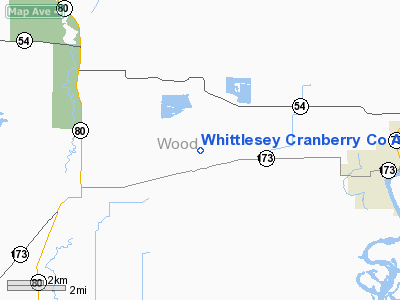
Whittlesey Cranberry Co Airport |
Location & QuickFacts
| FAA Information Effective: | 2008-09-25 |
| Airport Identifier: | 29WI |
| Airport Status: | Operational |
| Longitude/Latitude: | 090-01-38.4680W/44-19-31.8650N
-90.027352/44.325518 (Estimated) |
| Elevation: | 982 ft / 299.31 m (Surveyed) |
| Land: | 0 acres |
| From nearest city: | 3 nautical miles NE of Babcock, WI |
| Location: | Wood County, WI |
| Magnetic Variation: | 00E (1985) |
Owner & Manager
| Ownership: | Privately owned |
| Owner: | Whittlesey Cranberry Co, Inc. |
| Address: | 6134 Hwy 173w
Wisconsin Rapids, WI 54494 |
| Phone number: | 715-886-3365 |
| Manager: | N. D. Jasperson |
| Address: | 6134 Hwy 173w
Wisconsin Rapids, WI 54494 |
| Phone number: | 715-886-3365 |
Airport Operations and Facilities
| Airport Use: | Private |
| Segmented Circle: | No |
| Control Tower: | No |
| Landing fee charge: | No |
| Sectional chart: | Green Bay |
| Region: | AGL - Great Lakes |
| Boundary ARTCC: | ZMP - Minneapolis |
| Tie-in FSS: | GRB - Green Bay |
| FSS on Airport: | No |
| FSS Toll Free: | 1-800-WX-BRIEF |
Runway Information
Runway 01/19
| Dimension: | 2100 x 100 ft / 640.1 x 30.5 m |
| Surface: | TURF, |
| |
Runway 01 |
Runway 19 |
| Traffic Pattern: | Left | Left |
|
Radio Navigation Aids
| ID |
Type |
Name |
Ch |
Freq |
Var |
Dist |
| ISW | NDB | Wisconsin Rapids | | 215.00 | 01W | 8.4 nm |
| MFI | NDB | Marshfield | | 391.00 | 00E | 20.2 nm |
| VIQ | NDB | Neillsville | | 368.00 | 01W | 25.1 nm |
| CMY | NDB | Mccoy | | 412.00 | 00E | 35.3 nm |
| BCK | NDB | Black River Falls | | 362.00 | 00E | 35.6 nm |
| FZK | NDB | Wausau | | 243.00 | 01E | 40.1 nm |
| HBW | NDB | Kickapoo | | 251.00 | 03E | 42.4 nm |
| PCZ | NDB | Waupaca | | 382.00 | 01W | 43.5 nm |
| MDZ | NDB | Medford | | 335.00 | 00E | 48.4 nm |
| VOK | TACAN | Volk | 041X | | 00E | 25.1 nm |
| STE | VORTAC | Stevens Point | 043X | 110.60 | 01W | 25.0 nm |
| AUW | VORTAC | Wausau | 053X | 111.60 | 02E | 36.6 nm |
| DLL | VORTAC | Dells | 117X | 117.00 | 03E | 47.9 nm |
Remarks
Images and information placed above are from
http://www.airport-data.com/airport/29WI/
We thank them for the data!
| General Info
|
| Country |
United States
|
| State |
WISCONSIN
|
| FAA ID |
29WI
|
| Latitude |
44-19-31.865N
|
| Longitude |
090-01-38.468W
|
| Elevation |
982 feet
|
| Near City |
BABCOCK
|
We don't guarantee the information is fresh and accurate. The data may
be wrong or outdated.
For more up-to-date information please refer to other sources.
|
|


