|
|
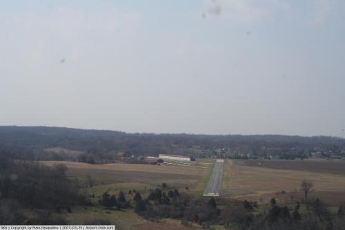 |
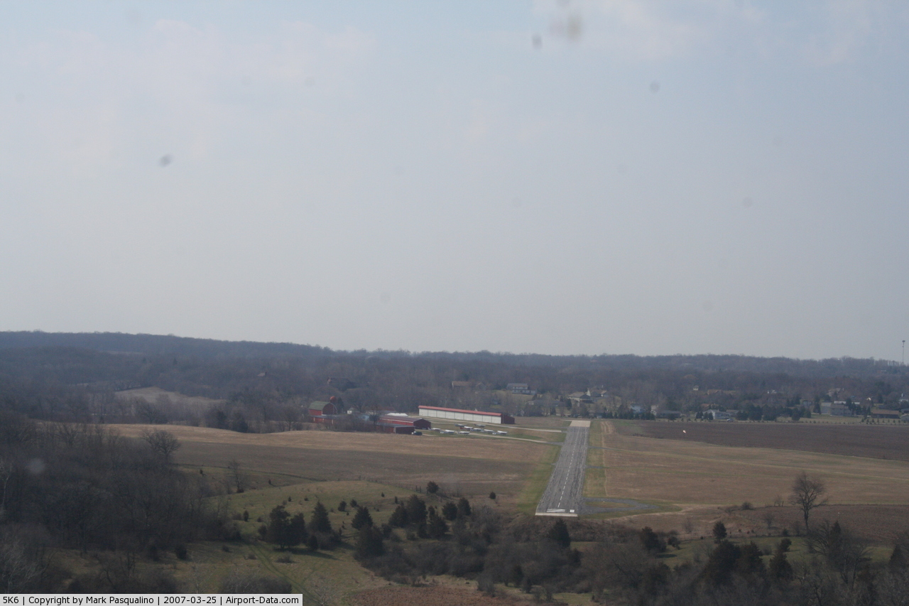
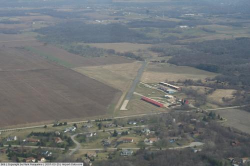
(Click on the photo to enlarge) |
 |
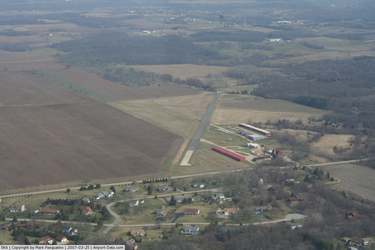
(Click on the photo to enlarge) |
Location & QuickFacts
| FAA Information Effective: | 2008-09-25 |
| Airport Identifier: | 5K6 |
| Airport Status: | Operational |
| Longitude/Latitude: | 088-12-18.6000W/42-30-50.9000N
-88.205167/42.514139 (Estimated) |
| Elevation: | 850 ft / 259.08 m (Estimated) |
| Land: | 62 acres |
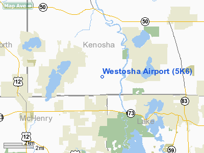
| From nearest city: | 1 nautical miles W of Wilmot, WI |
| Location: | Kenosha County, WI |
| Magnetic Variation: | 01W (1985) |
Owner & Manager
| Ownership: | Privately owned |
| Owner: | Thelen Sand & Gravel, Inc. |
| Address: | 28955 West Rte 173
Antioch, IL 60002 |
| Phone number: | 847-395-3313 |
| Manager: | Westosha Aviation Management |
| Address: | Box 246
Wilmot, WI 53192 |
| Phone number: | 847-603-8856 |
Airport Operations and Facilities
| Airport Use: | Open to public |
| Wind indicator: | Yes |
| Segmented Circle: | No |
| Control Tower: | No |
| Lighting Schedule: | RDO-CTL
ACTVT ROTG BCN - CTAF. |
| Beacon Color: | Clear-Green (lighted land airport) |
| Landing fee charge: | No |
| Sectional chart: | Chicago |
| Region: | AGL - Great Lakes |
| Traffic Pattern Alt: | 650 ft |
| Boundary ARTCC: | ZAU - Chicago |
| Tie-in FSS: | GRB - Green Bay |
| FSS on Airport: | No |
| FSS Toll Free: | 1-800-WX-BRIEF |
| NOTAMs Facility: | GRB (NOTAM-d service avaliable) |
Airport Communications
| CTAF: | 123.000 |
| Unicom: | 123.000 |
Airport Services
| Fuel available: | 100LL |
| Airframe Repair: | MAJOR |
| Power Plant Repair: | MAJOR |
| Bottled Oxygen: | NONE |
| Bulk Oxygen: | NONE |
Runway Information
Runway 03/21
| Dimension: | 2849 x 38 ft / 868.4 x 11.6 m |
| Surface: | ASPH-CONC, Fair Condition
SW 400 FT CONC & NE 27 FT CONC; REST OF RY ASPH. |
| Edge Lights: | Non-standard lighting system
NSTD LIRL; RY 03 THLD LGTS 3 EACH SIDE; RY 21 1 LIGHT EACH SIDE. |
| |
Runway 03 |
Runway 21 |
| Longitude: | 088-12-28.8628W | 088-12-10.7493W |
| Latitude: | 42-30-36.8662N | 42-31-01.6172N |
| Elevation: | 849.00 ft | 852.00 ft |
| Traffic Pattern: | Left | Left |
| Markings: | Basic, Fair Condition | Basic, Good Condition |
| Displaced threshold: | 36.00 ft | 9.00 ft |
| Runway End Identifier: | No | No |
| Centerline Lights: | No | No |
| Touchdown Lights: | No | No |
| Obstruction: | 11 ft road, 200.0 ft from runway, 18 ft right of centerline
APCH RATIO 21:1 TO DSPLCD THLD.
+14 FT ROAD 160 FT FM THLD 125 FT R. | , 50:1 slope to clear |
|
Runway 14/32
| Dimension: | 1517 x 45 ft / 462.4 x 13.7 m |
| Surface: | TURF, Fair Condition
SW 400 FT CONC & NE 27 FT CONC; REST OF RY ASPH. |
| |
Runway 14 |
Runway 32 |
| Longitude: | 088-12-23.1114W | 088-12-09.5253W |
| Latitude: | 42-30-59.6615N | 42-30-48.5475N |
| Elevation: | 852.00 ft | 850.00 ft |
| Traffic Pattern: | Left | Left |
| Runway End Identifier: | No | No |
| Centerline Lights: | No | No |
| Touchdown Lights: | No | No |
| Obstruction: | 4 ft fence, 32.0 ft from runway, 125 ft left of centerline, 8:1 slope to clear | 33 ft trees, 270.0 ft from runway, 60 ft right of centerline, 8:1 slope to clear |
|
Radio Navigation Aids
| ID |
Type |
Name |
Ch |
Freq |
Var |
Dist |
| RA | NDB | Paser | | 206.00 | 00E | 16.9 nm |
| LVV | NDB | Lake Lawn | | 404.00 | 00W | 20.4 nm |
| GM | NDB | Teels | | 242.00 | 02W | 24.8 nm |
| UES | NDB | Waukesha | | 359.00 | 01W | 31.9 nm |
| ME | NDB | Deana | | 350.00 | 00E | 33.8 nm |
| BL | NDB | Yanks | | 260.00 | 02W | 35.9 nm |
| JVL | NDB | Janesville | | 375.00 | 03E | 37.5 nm |
| DKB | NDB | Dekalb | | 209.00 | 02W | 41.4 nm |
| RYV | NDB | Rock River | | 371.00 | 01W | 45.8 nm |
| BUU | VOR/DME | Burbun | 092X | 114.50 | 01W | 11.4 nm |
| ENW | VOR/DME | Kenosha | 029X | 109.20 | 02W | 13.1 nm |
| OBK | VOR/DME | Northbrook | 077X | 113.00 | 02W | 20.9 nm |
| HRK | VOR/DME | Horlick | 124X | 117.70 | 02W | 22.8 nm |
| ORD | VOR/DME | Chicago O'hare | 086X | 113.90 | 02E | 34.3 nm |
| LJT | VOR/DME | Timmerman | 072X | 112.50 | 02W | 36.6 nm |
| DPA | VOR/DME | Dupage | 021X | 108.40 | 02E | 38.0 nm |
| JVL | VOR/DME | Janesville | 090X | 114.30 | 03E | 40.0 nm |
| RFD | VOR/DME | Rockford | 045X | 110.80 | 01E | 47.4 nm |
| BAE | VORTAC | Badger | 111X | 116.40 | 02E | 36.4 nm |
| MKE | VOT | Milwaukee | | 109.00 | | 29.4 nm |
| ORD | VOT | Chicago O'hare Intl | | 112.00 | | 34.6 nm |
| MDW | VOT | Chicago Midway | | 111.00 | | 48.2 nm |
Remarks
- ARPT HAS NOISE ABATEMENT PROCEDURES CTC AMGR ON 262-862-6111.
- RY 03/21 HAS A 60 FT DROP-OFF 10 FT FM NE END.
- RY 14/32 CLSD NOV 15 THRU MAR 31.
Images and information placed above are from
http://www.airport-data.com/airport/5K6/
We thank them for the data!
| General Info
|
| Country |
United States
|
| State |
WISCONSIN
|
| FAA ID |
5K6
|
| Latitude |
42-30-50.900N
|
| Longitude |
088-12-18.600W
|
| Elevation |
850 feet
|
| Near City |
WILMOT
|
We don't guarantee the information is fresh and accurate. The data may
be wrong or outdated.
For more up-to-date information please refer to other sources.
|
|