 |
|
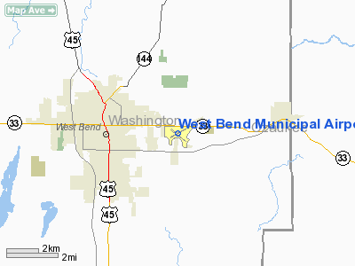
| West Bend Municipal Airport |
| IATA: ETB – ICAO: KETB |
| Summary |
| Airport type |
Public |
| Operator |
City of West Bend |
| Location |
West Bend, Wisconsin |
| Elevation AMSL |
887 ft / 270.4 m |
| Coordinates |
43°25′20″N 88°07′40″W / 43.42222°N 88.12778°W / 43.42222; -88.12778Coordinates: 43°25′20″N 88°07′40″W / 43.42222°N 88.12778°W / 43.42222; -88.12778 |
| Runways |
| Direction |
Length |
Surface |
| ft |
m |
| 13/31 |
4,494 |
1,370 |
Asphalt |
| 6/24 |
3,897 |
1,188 |
Asphalt |
| Helipads |
| Number |
Length |
Surface |
| ft |
m |
| H1 |
100 |
30 |
Asphalt |
West Bend Municipal Airport (IATA: ETB, ICAO: KETB) is a general aviation airport located three miles (4.8 km) east of the central business district (CBD) of the city of West Bend, in Washington County, Wisconsin, USA. It is owned and operated by the City of West Bend. Facilities
West Bend Municipal Airport covers 404 acres (163 ha) and has two runways and one helipad:
- Runway 13/31: 4,494 x 75 ft. (1,370 x 23 m), Surface: Asphalt. This runway has a left traffic pattern. It is equipped with a 4-box VASI on the left side of both runways. Both ends have Runway End Identification Lights, and have runway lights controllable via the CTAF. Runway 31 has a localizer with a frequency of 108.9.
- Runway 6/24: 3,897 x 75 ft. (1,188 x 23 m), Surface: Asphalt. This runway has a left traffic pattern. It does not have any visual slope indicators, nor does it have runway end identifier lights.
- Helipad H1: 100 x 100 ft. (30 x 30 m), Surface: Asphalt. This helipad has left traffic. There are blue perimeter lights.
West Bend Air operates the FBO (fixed base operator) and provides 100 octane low lead fuel as well as Jet-A fuel. Rental aircraft, a pilot's lounge, a weather office and a gift shop are also located on field and operated by West Bend Air.
Pilot information
Navigation
The West Bend Airport can be found on the Chicago sectional chart on the North side. The airport has a non-directional beacon (NDB), as well as a very high frequency omni directional radio (VOR), both on field. The Kettle Moraine NDB (LLE .-.. .-.. .) has a frequency of 329 KHz. The West Bend VOR (BJB -... .--- -...) has a frequency of 109.8 MHz.
Communication
West Bend Municipal Airport has a UNICOM frequency of 122.8 MHz, manned by West Bend Air Inc. This frequency is also the common traffic advisory frequency (CTAF). An AWOS is available on 120.0 MHz, which provides wind, visibility, sky conditions, and the altimeter. The weather for this airport can also be found in the form of a METAR on various online aviation weather sites. The controlling agency is Chicago center, but services are also available from Milwaukee approach or Milwaukee departure on 125.35 MHz. IFR flights can also contact clearance delivery on 124.75 MHz.
Airspace
Immediately overlying the airport is Class G Airspace. A ring approx. 14 miles in diameter, centered on the field, of Class E Airspace begins at 700 feet above ground level (AGL) and meets Class A Airspace at, but not including, 18,000 feet MSL. The outer ring of Milwaukee's Class C Airspace begins approx. 17 miles south-southeast of the field, with Waukesha County Airport and Lawrence J. Timmerman Airport's Class D Airspace beginning 18 miles south-southwest and 14 miles south (respectively) of the field.
The nearest special use airspace is Restricted Airspace R-6903, which is superimposed over the Minnow MOA (Military Operations Area), approx. 20 miles east and northeast of the field, over Lake Michigan.
The above content comes from Wikipedia and is published under free licenses – click here to read more.
Location & QuickFacts
| FAA Information Effective: | 2008-09-25 |
| Airport Identifier: | ETB |
| Airport Status: | Operational |
| Longitude/Latitude: | 088-07-40.5000W/43-25-19.8000N
-88.127917/43.422167 (Estimated) |
| Elevation: | 887 ft / 270.36 m (Surveyed) |
| Land: | 404 acres |
| From nearest city: | 3 nautical miles E of West Bend, WI |
| Location: | Washington County, WI |
| Magnetic Variation: | 01W (1985) |
Owner & Manager
| Ownership: | Publicly owned |
| Owner: | City Of West Bend |
| Address: | 1115 S Main Street
West Bend, WI 53095 |
| Phone number: | 262-335-5108 |
| Manager: | Jim Retzlaff |
| Address: | 1115 S Main Street
West Bend, WI 53095 |
| Phone number: | 262-483-5403 |
Airport Operations and Facilities
| Airport Use: | Open to public |
| Wind indicator: | Yes |
| Segmented Circle: | No |
| Control Tower: | No |
| Lighting Schedule: | DUSK-DAWN
MIRL RYS 06/24 & 13/31 PRESET ON LOW INTST; TO INCR INTST & ACTVT REIL RYS 13 & 31; VASI RYS 13 & 31 - CTAF. |
| Beacon Color: | Clear-Green (lighted land airport) |
| Landing fee charge: | No |
| Sectional chart: | Chicago |
| Region: | AGL - Great Lakes |
| Traffic Pattern Alt: | 1000 ft |
| Boundary ARTCC: | ZAU - Chicago |
| Tie-in FSS: | GRB - Green Bay |
| FSS on Airport: | No |
| FSS Toll Free: | 1-800-WX-BRIEF |
| NOTAMs Facility: | ETB (NOTAM-d service avaliable) |
| Federal Agreements: | NGY |
Airport Communications
| CTAF: | 122.800 |
| Unicom: | 122.800 |
Airport Services
| Fuel available: | 100LLA |
| Airframe Repair: | MAJOR |
| Power Plant Repair: | MAJOR |
Runway Information
Runway 06/24
| Dimension: | 3897 x 75 ft / 1187.8 x 22.9 m |
| Surface: | ASPH, Good Condition |
| Weight Limit: | Single wheel: 12000 lbs. |
| Edge Lights: | Medium
BLUE PERIMETER LIGHTS. |
| |
Runway 06 |
Runway 24 |
| Longitude: | 088-08-03.2941W | 088-07-18.0634W |
| Latitude: | 43-25-11.8547N | 43-25-31.7173N |
| Elevation: | 886.00 ft | 874.00 ft |
| Alignment: | 59 | 127 |
| Traffic Pattern: | Left | Left |
| Markings: | Non-precision instrument, Good Condition | Non-precision instrument, Good Condition |
| Runway End Identifier: | No | No |
| Centerline Lights: | No | No |
| Touchdown Lights: | No | No |
| Obstruction: | 40 ft tree, 800.0 ft from runway, 200 ft right of centerline, 15:1 slope to clear | 11 ft road, 200.0 ft from runway, 250 ft right of centerline |
|
Runway 13/31
| Dimension: | 4494 x 75 ft / 1369.8 x 22.9 m |
| Surface: | ASPH, Fair Condition |
| Weight Limit: | Single wheel: 15000 lbs. |
| Edge Lights: | Medium
BLUE PERIMETER LIGHTS. |
| |
Runway 13 |
Runway 31 |
| Longitude: | 088-08-04.9069W | 088-07-15.9108W |
| Latitude: | 43-25-31.3169N | 43-25-04.9629N |
| Elevation: | 882.00 ft | 868.00 ft |
| Alignment: | 127 | 127 |
| ILS Type: | | LOCALIZER
|
| Traffic Pattern: | Left | Left |
| Markings: | Non-precision instrument, Fair Condition | Non-precision instrument, Fair Condition |
| Crossing Height: | 38.00 ft | 30.00 ft |
| VASI: | 4-box on left side | 2-box on left side |
| Visual Glide Angle: | 3.00° | 3.00° |
| Runway End Identifier: | Yes | Yes |
| Centerline Lights: | No | No |
| Touchdown Lights: | No | No |
| Obstruction: | 12 ft road, 370.0 ft from runway, 270 ft left of centerline, 14:1 slope to clear | 36 ft trees, 1050.0 ft from runway, 300 ft left of centerline, 23:1 slope to clear |
|
Helipad H1
| Dimension: | 100 x 100 ft / 30.5 x 30.5 m |
| Surface: | ASPH, Good Condition |
| |
Runway H1 |
Runway |
| Traffic Pattern: | Left | Left |
| Markings: | Basic, Good Condition | , |
|
Radio Navigation Aids
| ID |
Type |
Name |
Ch |
Freq |
Var |
Dist |
| LLE | NDB | Kettle Moraine | | 329.00 | 01W | 0.2 nm |
| HXF | NDB | Hartford | | 200.00 | 00E | 12.5 nm |
| UES | NDB | Waukesha | | 359.00 | 01W | 23.2 nm |
| BL | NDB | Yanks | | 260.00 | 02W | 24.4 nm |
| UNU | NDB | Juneau | | 344.00 | 01W | 25.1 nm |
| RYV | NDB | Rock River | | 371.00 | 01W | 30.1 nm |
| GM | NDB | Teels | | 242.00 | 02W | 31.1 nm |
| RA | NDB | Paser | | 206.00 | 00E | 45.6 nm |
| LVV | NDB | Lake Lawn | | 404.00 | 00W | 48.0 nm |
| AQ | NDB | Kooky | | 407.00 | 02W | 49.1 nm |
| BJB | VOR | West Bend | | 109.80 | 01W | 0.1 nm |
| LJT | VOR/DME | Timmerman | 072X | 112.50 | 02W | 19.2 nm |
| FAH | VOR/DME | Falls | 37X | 110.00 | 02W | 24.1 nm |
| HRK | VOR/DME | Horlick | 124X | 117.70 | 02W | 42.0 nm |
| BUU | VOR/DME | Burbun | 092X | 114.50 | 01W | 44.7 nm |
| MTW | VOR/DME | Manitowoc | 047X | 111.00 | 02W | 46.7 nm |
| BAE | VORTAC | Badger | 111X | 116.40 | 02E | 19.6 nm |
| OSH | VORTAC | Oshkosh | 055X | 111.80 | 02E | 38.9 nm |
| MKE | VOT | Milwaukee | | 109.00 | | 30.2 nm |
Remarks
- WHEN USING MIL HELIPAD MIL HELS USE PATTERNS TO THE NORTH OR WEST OF ARPT.
- COPTER TRNG IN PROGRESS 0630-2200 BLO 5000 FT.
- FUEL - J8 (NC-100LL, A).
- ARNG - OPR 1230-2200Z++ MON-TUE; 1230-0400Z++ WED-FRI. LTD PRK. PPR TRAN SVC DSN 724-7550, C262-334-6712.
- CAUTION - COPTER TRNG IN PROGRESS 1230-0400Z++ BLW 5000'. MIL COPTER USE PAT TO N OR W OF ARPT. DEER HAZ.
- ARNG - OPR 1230-2200Z++ MON-TUE; 1230-0400Z++ WED-FRI. LTD PRK. PPR TRAN SVC DSN 724-3417, C262-334-9154.
- 100 FT CRANE 400 FT SW AER 13 1100-2300 MON-FRI.
Images and information placed above are from
http://www.airport-data.com/airport/ETB/
We thank them for the data!
| General Info
|
| Country |
United States
|
| State |
WISCONSIN
|
| FAA ID |
ETB
|
| Latitude |
43-25-19.800N
|
| Longitude |
088-07-40.500W
|
| Elevation |
887 feet
|
| Near City |
WEST BEND
|
We don't guarantee the information is fresh and accurate. The data may
be wrong or outdated.
For more up-to-date information please refer to other sources.
|
|


