 |
|
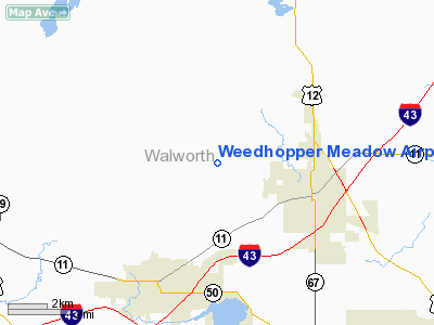
Weedhopper Meadow Airport |
Location & QuickFacts
| FAA Information Effective: | 2008-09-25 |
| Airport Identifier: | WI71 |
| Airport Status: | Operational |
| Longitude/Latitude: | 088-36-07.3660W/42-41-15.0500N
-88.602046/42.687514 (Estimated) |
| Elevation: | 1030 ft / 313.94 m (Estimated) |
| Land: | 0 acres |
| From nearest city: | 3 nautical miles NW of Elkhorn, WI |
| Location: | Walworth County, WI |
| Magnetic Variation: | 01W (1985) |
Owner & Manager
| Ownership: | Privately owned |
| Owner: | Larry E. Steenstry |
| Address: | Rr 2, Box 57
Elkhorn, WI 53121 |
| Phone number: | 414-723-3609 |
| Manager: | Larry E. Steenstry |
| Address: | Rr 2, Box 57
Elkhorn, WI 53121 |
| Phone number: | 414-723-3609 |
Airport Operations and Facilities
| Airport Use: | Private |
| Wind indicator: | Yes |
| Segmented Circle: | No |
| Control Tower: | No |
| Landing fee charge: | Yes |
| Sectional chart: | Chicago |
| Region: | AGL - Great Lakes |
| Boundary ARTCC: | ZAU - Chicago |
| Tie-in FSS: | GRB - Green Bay |
| FSS on Airport: | No |
| FSS Toll Free: | 1-800-WX-BRIEF |
Runway Information
Runway 17/35
| Dimension: | 1350 x 40 ft / 411.5 x 12.2 m |
| Surface: | TURF, |
| |
Runway 17 |
Runway 35 |
| Traffic Pattern: | Left | Right |
| Obstruction: | 4 ft fence, 50.0 ft from runway | , 500.0 ft from runway |
|
Radio Navigation Aids
| ID |
Type |
Name |
Ch |
Freq |
Var |
Dist |
| LVV | NDB | Lake Lawn | | 404.00 | 00W | 0.8 nm |
| JVL | NDB | Janesville | | 375.00 | 03E | 19.9 nm |
| UES | NDB | Waukesha | | 359.00 | 01W | 26.9 nm |
| GM | NDB | Teels | | 242.00 | 02W | 28.1 nm |
| RYV | NDB | Rock River | | 371.00 | 01W | 29.7 nm |
| RA | NDB | Paser | | 206.00 | 00E | 31.0 nm |
| BL | NDB | Yanks | | 260.00 | 02W | 39.0 nm |
| MS | NDB | Monah | | 400.00 | 00E | 39.8 nm |
| HXF | NDB | Hartford | | 200.00 | 00E | 40.7 nm |
| UNU | NDB | Juneau | | 344.00 | 01W | 44.8 nm |
| DKB | NDB | Dekalb | | 209.00 | 02W | 45.5 nm |
| LLE | NDB | Kettle Moraine | | 329.00 | 01W | 49.0 nm |
| BJB | VOR | West Bend | | 109.80 | 01W | 48.9 nm |
| BUU | VOR/DME | Burbun | 092X | 114.50 | 01W | 13.3 nm |
| JVL | VOR/DME | Janesville | 090X | 114.30 | 03E | 23.6 nm |
| ENW | VOR/DME | Kenosha | 029X | 109.20 | 02W | 30.1 nm |
| HRK | VOR/DME | Horlick | 124X | 117.70 | 02W | 35.1 nm |
| LJT | VOR/DME | Timmerman | 072X | 112.50 | 02W | 35.5 nm |
| RFD | VOR/DME | Rockford | 045X | 110.80 | 01E | 38.4 nm |
| OBK | VOR/DME | Northbrook | 077X | 113.00 | 02W | 40.2 nm |
| DPA | VOR/DME | Dupage | 021X | 108.40 | 02E | 49.2 nm |
| BAE | VORTAC | Badger | 111X | 116.40 | 02E | 29.4 nm |
| MSN | VORTAC | Madison | 023X | 108.60 | 03E | 42.5 nm |
| MKE | VOT | Milwaukee | | 109.00 | | 34.8 nm |
Remarks
- PROVIDED ALL TFC PAT OPNS E SIDE OF ARPT-IE- RGT TFC LNDG/TKOF TO N AND LEFT TFC LNDG TKOF TO S. E111 CONTD...THIS PROVISION BASED ON OVERLAP OF TFC PAT AIRSPACE WITH ADJ SWAN APT, IF STD TFC PAT WERE USED AT WEEDHOPPER MEADOW APT.
Images and information placed above are from
http://www.airport-data.com/airport/WI71/
We thank them for the data!
| General Info
|
| Country |
United States
|
| State |
WISCONSIN
|
| FAA ID |
WI71
|
| Latitude |
42-41-15.050N
|
| Longitude |
088-36-07.366W
|
| Elevation |
1030 feet
|
| Near City |
ELKHORN
|
We don't guarantee the information is fresh and accurate. The data may
be wrong or outdated.
For more up-to-date information please refer to other sources.
|
|


