 |
|
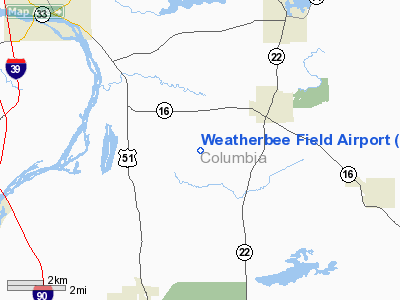
Location & QuickFacts
| FAA Information Effective: | 2008-09-25 |
| Airport Identifier: | 7WI6 |
| Airport Status: | Operational |
| Longitude/Latitude: | 089-21-32.4240W/43-28-13.9430N
-89.359007/43.470540 (Estimated) |
| Elevation: | 960 ft / 292.61 m (Estimated) |
| Land: | 15 acres |
| From nearest city: | 5 nautical miles NE of Wyocena, WI |
| Location: | Columbia County, WI |
| Magnetic Variation: | 01W (1995) |
Owner & Manager
| Ownership: | Privately owned |
| Address: |
|
| Manager: | Emil Weatherbee |
| Address: | 7204 Phillips Rd
Pardeeville, WI |
| Phone number: | 608-429-2372 |
Airport Operations and Facilities
| Airport Use: | Private |
| Wind indicator: | Yes |
| Segmented Circle: | No |
| Control Tower: | No |
| Sectional chart: | Green Bay |
| Region: | AGL - Great Lakes |
| Boundary ARTCC: | ZAU - Chicago |
| Tie-in FSS: | GRB - Green Bay |
| FSS Toll Free: | 1-800-WX-BRIEF |
Runway Information
Runway 06/24
| Dimension: | 1200 x 30 ft / 365.8 x 9.1 m |
| Surface: | TURF, |
| |
Runway 06 |
Runway 24 |
| Traffic Pattern: | Right | Left |
| Displaced threshold: | 200.00 ft
RY 06 & 24 DSPLCD THLDS ARE MKD WITH BLUE PLASTIC HALF BARRELS. | 75.00 ft |
| Obstruction: | 15 ft trees, 1500.0 ft from runway | 30 ft trees, 600.0 ft from runway |
|
Radio Navigation Aids
| ID |
Type |
Name |
Ch |
Freq |
Var |
Dist |
| MS | NDB | Monah | | 400.00 | 00E | 24.5 nm |
| UNU | NDB | Juneau | | 344.00 | 01W | 28.8 nm |
| RYV | NDB | Rock River | | 371.00 | 01W | 33.0 nm |
| HXF | NDB | Hartford | | 200.00 | 00E | 42.7 nm |
| HBW | NDB | Kickapoo | | 251.00 | 03E | 43.9 nm |
| VOK | TACAN | Volk | 041X | | 00E | 48.3 nm |
| LNR | VOR/DME | Lone Rock | 075X | 112.80 | 00E | 35.4 nm |
| DLL | VORTAC | Dells | 117X | 117.00 | 03E | 18.3 nm |
| MSN | VORTAC | Madison | 023X | 108.60 | 03E | 19.6 nm |
| OSH | VORTAC | Oshkosh | 055X | 111.80 | 02E | 46.8 nm |
Remarks
- PRVDD CLEAR 20:1 APCH, CLEAR OBSTACLE FREE ZONE & CLEAR RY SAFETY AREA.
Images and information placed above are from
http://www.airport-data.com/airport/7WI6/
We thank them for the data!
| General Info
|
| Country |
United States
|
| State |
WISCONSIN
|
| FAA ID |
7WI6
|
| Latitude |
43-28-13.943N
|
| Longitude |
089-21-32.424W
|
| Elevation |
960 feet
|
| Near City |
WYOCENA
|
We don't guarantee the information is fresh and accurate. The data may
be wrong or outdated.
For more up-to-date information please refer to other sources.
|
|


