|
|
 |
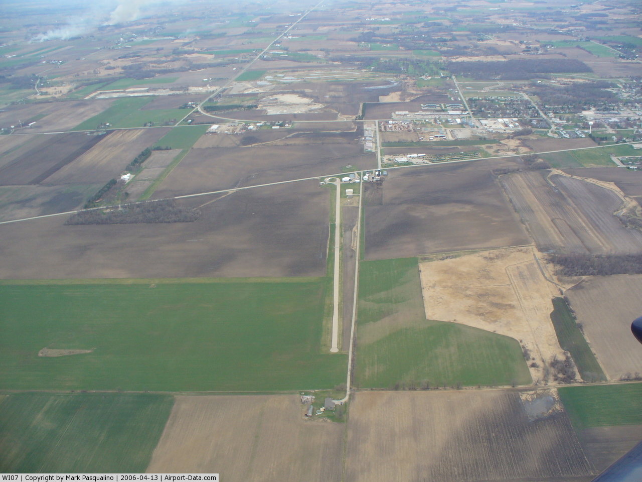
(Click on the photo to enlarge) |
Location & QuickFacts
| FAA Information Effective: | 2008-09-25 |
| Airport Identifier: | WI07 |
| Airport Status: | Operational |
| Longitude/Latitude: | 088-46-00.3880W/43-37-19.9580N
-88.766774/43.622211 (Estimated) |
| Elevation: | 940 ft / 286.51 m (Estimated) |
| Land: | 170 acres |
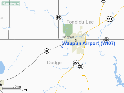
| From nearest city: | 2 nautical miles SW of Waupun, WI |
| Location: | Dodge County, WI |
| Magnetic Variation: | 01W (1985) |
Owner & Manager
| Ownership: | Privately owned |
| Owner: | Roy W. Reabe |
| Address: | Po Box 24
Waupun, WI 53963 |
| Phone number: | 414-324-3519 |
| Manager: | Roy W. Reabe |
| Address: | Reabe Flying Svc Inc Box 24
Waupun, WI 53963 |
| Phone number: | 414-324-3519 |
Airport Operations and Facilities
| Airport Use: | Private |
| Wind indicator: | Yes |
| Segmented Circle: | Yes |
| Control Tower: | No |
| Landing fee charge: | No |
| Sectional chart: | Chicago |
| Region: | AGL - Great Lakes |
| Boundary ARTCC: | ZAU - Chicago |
| Tie-in FSS: | GRB - Green Bay |
| FSS on Airport: | No |
| FSS Toll Free: | 1-800-WX-BRIEF |
Airport Services
| Fuel available: | 100LL |
| Airframe Repair: | MAJOR |
| Power Plant Repair: | MAJOR |
| Bottled Oxygen: | NONE |
| Bulk Oxygen: | NONE |
Runway Information
Runway 09/27
| Dimension: | 3075 x 150 ft / 937.3 x 45.7 m |
| Surface: | TURF, Fair Condition |
| |
Runway 09 |
Runway 27 |
| Traffic Pattern: | Right | Left |
| Obstruction: | 4 ft fence, 80 ft right of centerline | , 220.0 ft from runway, 22:1 slope to clear
ROAD RUNS PERPENDICULAR TO RWY. |
|
Runway 18/36
| Dimension: | 3400 x 35 ft / 1036.3 x 10.7 m |
| Surface: | ASPH, Fair Condition |
| |
Runway 18 |
Runway 36 |
| Traffic Pattern: | Left | Left |
| Markings: | None, | None, |
| Runway End Identifier: | No | No |
| Centerline Lights: | No | No |
| Touchdown Lights: | No | No |
| Obstruction: | 45 ft trees, 90 ft left of centerline
+25'BLDG AT THR 40L'. +30'TANKS AT THR 50'R. ROAD 30'FM THR L&R OF CL. | 8 ft trees, 0.0 ft from runway, 90 ft right of centerline
35' TREES 75' RIGHT OF CNTRLN. |
|
Radio Navigation Aids
| ID |
Type |
Name |
Ch |
Freq |
Var |
Dist |
| UNU | NDB | Juneau | | 344.00 | 01W | 12.0 nm |
| HXF | NDB | Hartford | | 200.00 | 00E | 23.1 nm |
| RYV | NDB | Rock River | | 371.00 | 01W | 27.0 nm |
| LLE | NDB | Kettle Moraine | | 329.00 | 01W | 30.3 nm |
| AQ | NDB | Kooky | | 407.00 | 02W | 39.1 nm |
| UES | NDB | Waukesha | | 359.00 | 01W | 41.8 nm |
| MS | NDB | Monah | | 400.00 | 00E | 42.1 nm |
| PCZ | NDB | Waupaca | | 382.00 | 01W | 44.0 nm |
| BJB | VOR | West Bend | | 109.80 | 01W | 30.4 nm |
| FAH | VOR/DME | Falls | 37X | 110.00 | 02W | 40.9 nm |
| LJT | VOR/DME | Timmerman | 072X | 112.50 | 02W | 44.3 nm |
| OSH | VORTAC | Oshkosh | 055X | 111.80 | 02E | 23.9 nm |
| BAE | VORTAC | Badger | 111X | 116.40 | 02E | 37.0 nm |
| MSN | VORTAC | Madison | 023X | 108.60 | 03E | 38.1 nm |
| DLL | VORTAC | Dells | 117X | 117.00 | 03E | 43.6 nm |
Remarks
- RWY 09/27 NOT PLOWED WINTER MONTHS.
- CAUTION: RWY 18/36 LAND; TKOF & TAXI ON HARD SURFACES ONLY.
- PROVIDED OBSTRUCTIONS IN RWY APCH SURFACES ARE REMOVED/LOWERED, OR THRESHOLDS DISPLACED, TO PROVIDED 20:1 CLEARANCE; PRIMARY SURFACE OF RWY 18/36 IS CLEARED OF OBSTRUCTIONS.
Images and information placed above are from
http://www.airport-data.com/airport/WI07/
We thank them for the data!
| General Info
|
| Country |
United States
|
| State |
WISCONSIN
|
| FAA ID |
WI07
|
| Latitude |
43-37-19.958N
|
| Longitude |
088-46-00.388W
|
| Elevation |
940 feet
|
| Near City |
WAUPUN
|
We don't guarantee the information is fresh and accurate. The data may
be wrong or outdated.
For more up-to-date information please refer to other sources.
|
|