 |
|
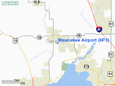
Location & QuickFacts
| FAA Information Effective: | 2008-09-25 |
| Airport Identifier: | 6P3 |
| Airport Status: | Operational |
| Longitude/Latitude: | 089-27-04.6000W/43-10-43.4000N
-89.451278/43.178722 (Estimated) |
| Elevation: | 954 ft / 290.78 m (Estimated) |
| Land: | 10 acres |
| From nearest city: | 1 nautical miles S of Waunakee, WI |
| Location: | Dane County, WI |
| Magnetic Variation: | 00E (1985) |
Owner & Manager
| Ownership: | Privately owned |
| Owner: | Waunakee Airpark Llc |
| Address: | 210 Winston Way
Waunakee, WI 53597 |
| Phone number: | 608-849-8985 |
| Manager: | Lynn Erickson & Joe Androfski |
| Address: | 210 Winston Way
Waunakee, WI 53597 |
| Phone number: | 608-849-8985 |
Airport Operations and Facilities
| Airport Use: | Open to public |
| Wind indicator: | Yes |
| Segmented Circle: | No |
| Control Tower: | No |
| Lighting Schedule: | DUSK-DAWN
ACTVT LIRL RY 09/27 - CTAF. |
| Landing fee charge: | No |
| Sectional chart: | Chicago |
| Region: | AGL - Great Lakes |
| Traffic Pattern Alt: | 1000 ft |
| Boundary ARTCC: | ZAU - Chicago |
| Tie-in FSS: | GRB - Green Bay |
| FSS on Airport: | No |
| FSS Toll Free: | 1-800-WX-BRIEF |
| NOTAMs Facility: | GRB (NOTAM-d service avaliable) |
Airport Communications
Airport Services
| Fuel available: | 100LL
FOR FUEL CALL 608-225-1109. |
| Airframe Repair: | NONE |
| Power Plant Repair: | NONE |
| Bottled Oxygen: | NONE |
| Bulk Oxygen: | NONE |
Runway Information
Runway 09/27
| Dimension: | 2223 x 30 ft / 677.6 x 9.1 m |
| Surface: | ASPH, Fair Condition |
| Edge Lights: | Non-standard lighting system
NSTD LIRL 165 FT FM E END; 155 FT FM W END; 1910 FT OF RY IS LGTD. RY LGTS APROXLY 60 FT FM PAVEMENT EDGE. |
| |
Runway 09 |
Runway 27 |
| Longitude: | 089-27-19.6196W | 089-26-49.6260W |
| Latitude: | 43-10-43.4105N | 43-10-43.4409N |
| Elevation: | 954.00 ft | 933.00 ft |
| Traffic Pattern: | Left | Left |
| Markings: | Basic, Fair Condition | Basic, Fair Condition |
| Displaced threshold: | 0.00 ft | 146.00 ft
NSTD DSPLCD THR MKGS. |
| Runway End Identifier: | No | No |
| Centerline Lights: | No | No |
| Touchdown Lights: | No | No |
| Obstruction: | , 50:1 slope to clear
+60 FT TREE 100 FT FRM THR 150 FT R OF CL. | 13 ft bldg, 750.0 ft from runway, 150 ft left of centerline, 42:1 slope to clear
RD DIST 197'; 0 LR; 13:1 BASED ON DSPLCD THR.
ROAD 50 FT FM THR L&R OF CL; +8 FT SIGN 80 FT FM THR 95 FT R OF CL. |
|
Radio Navigation Aids
| ID |
Type |
Name |
Ch |
Freq |
Var |
Dist |
| MS | NDB | Monah | | 400.00 | 00E | 8.4 nm |
| RYV | NDB | Rock River | | 371.00 | 01W | 31.8 nm |
| UNU | NDB | Juneau | | 344.00 | 01W | 36.1 nm |
| MRJ | NDB | Mineral Point | | 365.00 | 00W | 38.3 nm |
| JVL | NDB | Janesville | | 375.00 | 03E | 38.4 nm |
| HXF | NDB | Hartford | | 200.00 | 00E | 47.3 nm |
| LVV | NDB | Lake Lawn | | 404.00 | 00W | 47.5 nm |
| HBW | NDB | Kickapoo | | 251.00 | 03E | 48.0 nm |
| LNR | VOR/DME | Lone Rock | 075X | 112.80 | 00E | 30.7 nm |
| JVL | VOR/DME | Janesville | 090X | 114.30 | 03E | 40.3 nm |
| MSN | VORTAC | Madison | 023X | 108.60 | 03E | 5.3 nm |
| DLL | VORTAC | Dells | 117X | 117.00 | 03E | 26.2 nm |
Remarks
- E111 - NOT IN COMPLIANCE WITH FAR 157.
Images and information placed above are from
http://www.airport-data.com/airport/6P3/
We thank them for the data!
| General Info
|
| Country |
United States
|
| State |
WISCONSIN
|
| FAA ID |
6P3
|
| Latitude |
43-10-43.400N
|
| Longitude |
089-27-04.600W
|
| Elevation |
954 feet
|
| Near City |
WAUNAKEE
|
We don't guarantee the information is fresh and accurate. The data may
be wrong or outdated.
For more up-to-date information please refer to other sources.
|
|


