 |
|
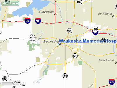
Waukesha Memorial Hospital Heliport |
Location & QuickFacts
| FAA Information Effective: | 2008-09-25 |
| Airport Identifier: | 6WI8 |
| Airport Status: | Operational |
| Longitude/Latitude: | 088-14-34.1340W/43-00-39.6420N
-88.242815/43.011012 (Estimated) |
| Elevation: | 900 ft / 274.32 m (Estimated) |
| Land: | 0 acres |
| From nearest city: | 2 nautical miles N of Waukesha, WI |
| Location: | Waukesha County, WI |
| Magnetic Variation: | 02W (1995) |
Owner & Manager
| Ownership: | Privately owned |
| Owner: | Waukesha Memorial Hospital |
| Address: | 725 American Avenue
Waukesha, WI 53188 |
| Phone number: | 262-928-2000 |
| Manager: | Michael W. Huebner |
| Address: | Waukesha Meml Hospital, 725 American Avenue
Waukesha, WI 53188 |
| Phone number: | 262-928-7858 |
Airport Operations and Facilities
| Airport Use: | Private
MEDICAL USE. |
| Wind indicator: | Yes |
| Segmented Circle: | No |
| Control Tower: | No |
| Lighting Schedule: | PHONE REQ
FOR PERIMETER LIGHTS CALL THE NURSING SUPERVISOR AT 262-896-1319. |
| Sectional chart: | Detroit |
| Region: | AGL - Great Lakes |
| Boundary ARTCC: | ZAU - Chicago |
| Tie-in FSS: | GRB - Green Bay |
| FSS on Airport: | No |
| FSS Toll Free: | 1-800-WX-BRIEF |
Runway Information
Helipad H1
| Dimension: | 40 x 40 ft / 12.2 x 12.2 m |
| Surface: | MATS, Good Condition |
| |
Runway H1 |
Runway |
| Traffic Pattern: | Left | Left |
|
Radio Navigation Aids
| ID |
Type |
Name |
Ch |
Freq |
Var |
Dist |
| UES | NDB | Waukesha | | 359.00 | 01W | 2.1 nm |
| GM | NDB | Teels | | 242.00 | 02W | 10.8 nm |
| BL | NDB | Yanks | | 260.00 | 02W | 16.4 nm |
| HXF | NDB | Hartford | | 200.00 | 00E | 21.3 nm |
| RYV | NDB | Rock River | | 371.00 | 01W | 23.3 nm |
| LVV | NDB | Lake Lawn | | 404.00 | 00W | 24.3 nm |
| RA | NDB | Paser | | 206.00 | 00E | 24.9 nm |
| LLE | NDB | Kettle Moraine | | 329.00 | 01W | 25.4 nm |
| UNU | NDB | Juneau | | 344.00 | 01W | 32.2 nm |
| JVL | NDB | Janesville | | 375.00 | 03E | 42.5 nm |
| MS | NDB | Monah | | 400.00 | 00E | 48.6 nm |
| BJB | VOR | West Bend | | 109.80 | 01W | 25.2 nm |
| LJT | VOR/DME | Timmerman | 072X | 112.50 | 02W | 10.8 nm |
| BUU | VOR/DME | Burbun | 092X | 114.50 | 01W | 19.5 nm |
| HRK | VOR/DME | Horlick | 124X | 117.70 | 02W | 24.1 nm |
| ENW | VOR/DME | Kenosha | 029X | 109.20 | 02W | 28.3 nm |
| JVL | VOR/DME | Janesville | 090X | 114.30 | 03E | 46.8 nm |
| FAH | VOR/DME | Falls | 37X | 110.00 | 02W | 48.7 nm |
| OBK | VOR/DME | Northbrook | 077X | 113.00 | 02W | 49.2 nm |
| BAE | VORTAC | Badger | 111X | 116.40 | 02E | 6.6 nm |
| MSN | VORTAC | Madison | 023X | 108.60 | 03E | 48.8 nm |
| MKE | VOT | Milwaukee | | 109.00 | | 15.7 nm |
Remarks
- PRVDD ALL APCH/DEP FROM 340 DEG TO 090 DEG AND 180 DEG TO 240 DEG; AREA IS MARKED; WIND INDICATOR IS MAINTAINED.
Images and information placed above are from
http://www.airport-data.com/airport/6WI8/
We thank them for the data!
| General Info
|
| Country |
United States
|
| State |
WISCONSIN
|
| FAA ID |
6WI8
|
| Latitude |
43-00-39.440N
|
| Longitude |
088-14-33.630W
|
| Elevation |
900 feet
|
| Near City |
WAUKESHA
|
We don't guarantee the information is fresh and accurate. The data may
be wrong or outdated.
For more up-to-date information please refer to other sources.
|
|


