 |
|
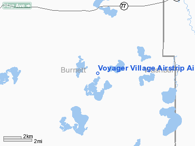
Voyager Village Airstrip Airport |
Location & QuickFacts
| FAA Information Effective: | 2008-09-25 |
| Airport Identifier: | 9WN2 |
| Airport Status: | Operational |
| Longitude/Latitude: | 092-08-45.6760W/45-57-59.7980N
-92.146021/45.966611 (Estimated) |
| Elevation: | 1020 ft / 310.90 m (Estimated) |
| Land: | 0 acres |
| From nearest city: | 11 nautical miles NE of Webster, WI |
| Location: | Burnett County, WI |
| Magnetic Variation: | 02E (1985) |
Owner & Manager
| Ownership: | Privately owned |
| Owner: | Voyager Village Prop Assn |
| Address: | 28851 Kilkare Road
Danbury, WI 54830 |
| Phone number: | 715-259-3910 |
| Manager: | Susan Braun |
| Address: | 28851 Kilkare Road
Danbury, WI 54830 |
| Phone number: | 715-259-3910 |
Airport Operations and Facilities
| Airport Use: | Private |
| Wind indicator: | Yes |
| Segmented Circle: | No |
| Control Tower: | No |
| Lighting Schedule: | DUSK-DAWN |
| Beacon Color: | Clear (unlighted land airport) |
| Landing fee charge: | No |
| Sectional chart: | Green Bay |
| Region: | AGL - Great Lakes |
| Boundary ARTCC: | ZMP - Minneapolis |
| Tie-in FSS: | GRB - Green Bay |
| FSS on Airport: | No |
| FSS Toll Free: | 1-800-WX-BRIEF |
Airport Services
| Airframe Repair: | NONE |
| Power Plant Repair: | NONE |
Runway Information
Runway 04/22
| Dimension: | 3500 x 50 ft / 1066.8 x 15.2 m |
| Surface: | ASPH, |
| Edge Lights: | Low |
| |
Runway 04 |
Runway 22 |
| Traffic Pattern: | Left | Left |
| Markings: | Basic, | Basic, |
| Displaced threshold: | 440.00 ft | 770.00 ft |
|
Radio Navigation Aids
| ID |
Type |
Name |
Ch |
Freq |
Var |
Dist |
| BXR | NDB | Big Doctor | | 203.00 | 02E | 12.7 nm |
| SSQ | NDB | Shell Lake | | 212.00 | 01E | 17.2 nm |
| OLG | NDB | Solon Springs | | 388.00 | 01E | 25.2 nm |
| UBE | NDB | Cumberland | | 375.00 | 01E | 28.4 nm |
| SLY | NDB | Seeley | | 344.00 | 01E | 33.0 nm |
| ROS | NDB | Rush City | | 282.00 | 02E | 37.6 nm |
| MZH | NDB | Moose Lake | | 362.00 | 02E | 38.5 nm |
| AHH | NDB | Ameron | | 278.00 | 01E | 42.3 nm |
| SUW | NDB | Bong | | 260.00 | 01E | 43.6 nm |
| OEO | NDB | Osceola | | 233.00 | 01E | 45.5 nm |
| COQ | NDB | Cloquet | | 335.00 | 03E | 46.3 nm |
| JMR | NDB | Mora | | 327.00 | 03E | 47.1 nm |
| RZN | VOR/DME | Siren | 031X | 109.40 | 02E | 13.0 nm |
| HYR | VOR/DME | Hayward | 081X | 113.40 | 03E | 29.4 nm |
| RPD | VOR/DME | Rice Lake | 037X | 110.00 | 01E | 36.6 nm |
Images and information placed above are from
http://www.airport-data.com/airport/9WN2/
We thank them for the data!
| General Info
|
| Country |
United States
|
| State |
WISCONSIN
|
| FAA ID |
9WN2
|
| Latitude |
45-57-59.798N
|
| Longitude |
092-08-45.676W
|
| Elevation |
1020 feet
|
| Near City |
WEBSTER
|
We don't guarantee the information is fresh and accurate. The data may
be wrong or outdated.
For more up-to-date information please refer to other sources.
|
|


