|
|
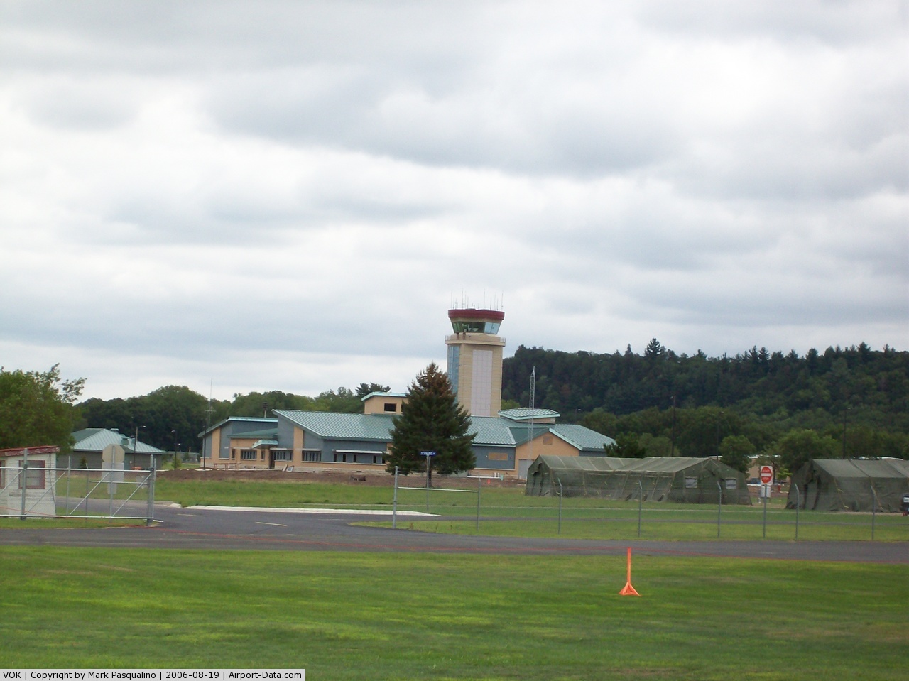
| Volk Field Air National Guard Base |
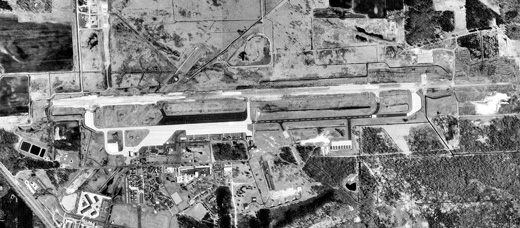 |
| 1998 USGS Photo |
| IATA: VOK – ICAO: KVOK – FAA LID: VOK |
| Summary |
| Airport type |
Military |
| Operator |
U.S. Air Force |
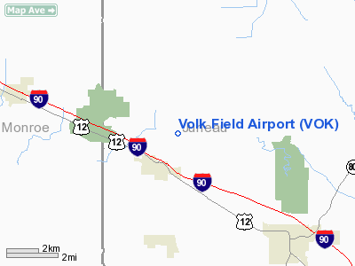
| Location |
Orange, near Camp Douglas, Wisconsin |
| Elevation AMSL |
912 ft / 278 m |
| Runways |
| Direction |
Length |
Surface |
| ft |
m |
| 9/27 |
9,000 |
2,743 |
Asphalt/Concrete |
| Source: Federal Aviation Administration |
Coordinates: 43°56′20″N 090°15′13″W / 43.93889°N 90.25361°W / 43.93889; -90.25361 Volk Field Air National Guard Base (IATA: VOK, ICAO: KVOK, FAA LID: VOK) is a military airport located just outside the village of Camp Douglas, in Juneau County, Wisconsin, United States. The base also houses Camp Williams, which is supported by the Wisconsin Army National Guard. History
The origin of Volk Field CRTC can be traced back to 1888 when the State Adjutant General, General Chandler Chapman, purchased a site for a rifle range and offered it to the state for a camp. In 1889 the State Legislature authorized the Governor to purchase land near the site for a permanent campground and rifle range for the Wisconsin National Guard.
By 1903 the camp had expanded to over 800 acres and was used for training by the then reorganized National Guard. From that date until the Federal Call of 1916 the camp was frequently visited by officials of other states who came to observe the model Wisconsin National Guard.
The site was named Camp Williams in 1927 in honor of Lt Col Charles R. Williams, the Chief Quartermaster of the post from 1917 until his death in 1926. Camp Williams grew slowly following the First World War, but with the increasing development of the airplane, it was all but inevitable that an airstrip would be built, and in 1935 and 1936, the first hard-surface runways were constructed.
In 1954 the federal government leased the field from the State of Wisconsin for use as a permanent field training site. That same year work began on the air-to-ground gunnery range near Finley, Wisconsin. In 1957, the Wisconsin Legislature officially designated the facility a Permanent Field Training Site and named it in memory of 1st Lt. Jerome A. Volk, the first Wisconsin National Guard pilot killed in combat in the Korean conflict.
In 1989 the site was re-designated a Combat Readiness Training Center (CRTC). The 128th Air Control Squadron, Air Combat Maneuvering Instrumentation system (ACMI), Air Base Operability and Ability to Survive and Operate (ATSO) training missions were added in 1991.
Facilities
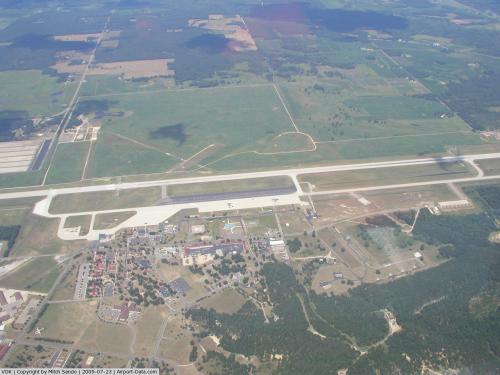
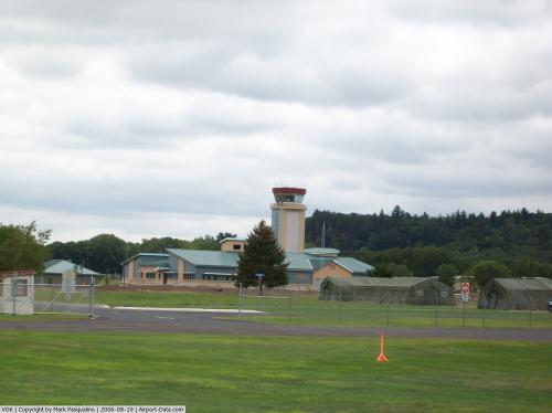
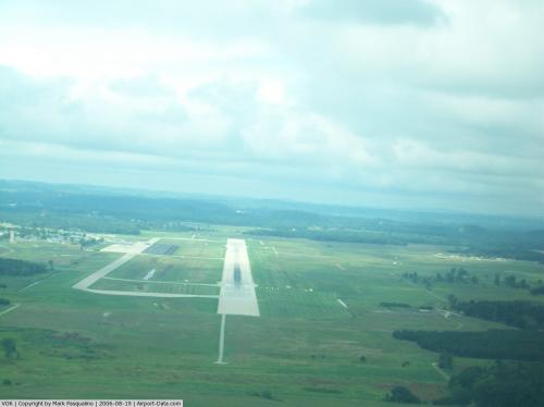
Volk Field has one asphalt and concrete paved runway (9/27) measuring 9,000 x 150 ft. (2,743 x 46 m).
Cuban Missile Crisis Incident
During the Cuban missile crisis a majority of B-47 bombers with capability to drop nuclear payloads were "dispersed" to Volk to make it harder for the Soviets to threaten USAF assets (utilizing many small, remote bases is like keeping your eggs in several baskets but did have a weakness as we will see).
At around midnight on October 25, a guard at the Duluth Sector Direction Center saw a figure climbing the security fence. He shot at it, and activated the "sabotage alarm." This automatically set off sabotage alarms at all bases in the area. At Volk Field, Wisconsin, the alarm was wrongly wired, and the Klaxon sounded which ordered nuclear armed F-106A interceptors to take off. The pilots knew there would be no practice alert drills while DEFCON 3 was in force, and they believed World War III had started.
Immediate communication with Duluth showed there was an error. By this time aircraft were starting down the runway and Volk was too small for a control tower (its aircraft were dispatched from Duluth 300 miles away). A truck raced from command center and successfully signaled the aircraft to stop.
The intruder was literally a black bear, not the Soviet saboteurs in advance of a nuclear attack the sentry was expecting.
The above content comes from Wikipedia and is published under free licenses – click here to read more.
 |
(Click on the photo to enlarge) |
 |
(Click on the photo to enlarge) |
 |
(Click on the photo to enlarge) |
 |
(Click on the photo to enlarge) |
Location & QuickFacts
| FAA Information Effective: | 2008-09-25 |
| Airport Identifier: | VOK |
| Airport Status: | Operational |
| Longitude/Latitude: | 090-15-12.6000W/43-56-20.4000N
-90.253500/43.939000 (Estimated) |
| Elevation: | 912 ft / 277.98 m (Estimated) |
| Land: | 0 acres |
| From nearest city: | 1 nautical miles N of Camp Douglas, WI |
| Location: | Juneau County, WI |
| Magnetic Variation: | 00E (1995) |
Owner & Manager
| Ownership: | Air Force owned |
| Owner: | Usaf |
| Address: | Hdqtrs Wi Ang Volk Fld Camp
Camp Douglas, WI 54618 |
| Phone number: | 608-427-1205 |
| Manager: | Base Operations |
| Address: | Hdqtrs Wi Ang Volk Fld Camp
Camp Douglas, WI 54618 |
| Phone number: | 608-427-1205 |
Airport Operations and Facilities
| Airport Use: | Private |
| Wind indicator: | Yes |
| Segmented Circle: | No |
| Control Tower: | Yes |
| Lighting Schedule: | SS-SR
ROTG BCN SCHED SS-SR WHEN TWR OPERATIONAL. |
| Beacon Color: | Clear-Green (lighted land airport) |
| Sectional chart: | Chicago |
| Region: | AGL - Great Lakes |
| Boundary ARTCC: | ZAU - Chicago |
| Tie-in FSS: | GRB - Green Bay |
| FSS on Airport: | No |
| FSS Toll Free: | 1-800-WX-BRIEF |
| NOTAMs Facility: | GRB (NOTAM-d service avaliable) |
Airport Communications
Airport Services
| Fuel available: | 115 B+ |
| Airframe Repair: | NONE |
| Power Plant Repair: | NONE |
| Bulk Oxygen: | HIGH/LOW |
Runway Information
Runway 09/27
| Dimension: | 9000 x 150 ft / 2743.2 x 45.7 m |
| Surface: | ASPH-CONC, |
| Surface Treatment: | Saw-cut or plastic Grooved |
| Pavement Class: | 97 /R/B/W/T |
| Weight Limit: | Single wheel: 81000 lbs.
Dual wheel: 190000 lbs.
Dual tandem wheel: 400000 lbs. |
| Edge Lights: | High |
| |
Runway 09 |
Runway 27 |
| Longitude: | 090-16-12.0000W | 090-14-09.0000W |
| Latitude: | 43-56-20.0000N | 43-56-22.0000N |
| Elevation: | 909.00 ft | 904.00 ft |
| Alignment: | 89 | 127 |
| ILS Type: | | ILS
|
| Traffic Pattern: | Left | Right |
| Arresting: | BAK12 | BAK12 |
| VASI: | 4-light PAPI on left side | 4-light PAPI on right side |
| Approach lights: | MALSR | ALSF1 |
| Runway End Identifier: | No | No |
|
Radio Navigation Aids
| ID |
Type |
Name |
Ch |
Freq |
Var |
Dist |
| CMY | NDB | Mccoy | | 412.00 | 00E | 16.8 nm |
| HBW | NDB | Kickapoo | | 251.00 | 03E | 17.4 nm |
| ISW | NDB | Wisconsin Rapids | | 215.00 | 01W | 31.2 nm |
| BCK | NDB | Black River Falls | | 362.00 | 00E | 32.0 nm |
| VIQ | NDB | Neillsville | | 368.00 | 01W | 38.8 nm |
| MFI | NDB | Marshfield | | 391.00 | 00E | 42.3 nm |
| VOK | TACAN | Volk | 041X | | 00E | 0.3 nm |
| LNR | VOR/DME | Lone Rock | 075X | 112.80 | 00E | 39.1 nm |
| LSE | VOR/DME | La Crosse | 021X | 108.40 | 02E | 43.6 nm |
| DLL | VORTAC | Dells | 117X | 117.00 | 03E | 31.6 nm |
| STE | VORTAC | Stevens Point | 043X | 110.60 | 01W | 47.8 nm |
Remarks
- JASU - (AM32A-60A) 6(A/M32A-86).
- FUEL - J8-AVBL LTD, EXP POSSIBLE GND DELAY FOR REQ EXCEEDING 10,000 GAL. .
- FLUID - LPOX LOX.
- TRAN ALERT - EXTREMELY LTD.
- MILITARY USE: OPR 1400-2200Z++ MON-FRI EXC HOL, OY IN SUPPORT OF NGB VALIDATED FLYING. SEE FLIP AP/1 SUPPLEMENTARY ARPT RMK.
- RSTD: PPR CTC VOLK FLD DSN 871-1205, C608-427-1205. ISSUED PPR VALID FOR ETA +/- 1 HR. EARLY/LATE ARR/DEP MUST BE COORD. AFTER HR RE-COORD OR CNL WILL BE PASSED TO BASE OPS SBY PERS C608-343-0104.
- CAUTION - WHEN WIND IS FR S/SW EXP POSSIBLE LOW LEVEL WIND SHEAR 1 TO 3 NM ON FINAL TO RWY 27. DUE TO TACTICAL ACFT RQR, BAK-12 CABLE MAY BE IN POSN FOR RWY 09-27 SIMULTANEOUSLY.
- CAUTION: TWY E, F AND G UNLGTD, UNLTD DAYTIME VFR USE, FOLLOW ME RQR FOR DAY IFR AND NGT IFR/VFR USE.
- TFC PAT: COPTER RECTANGULAR 1500'.
- MISC: FIRST 1600' RWY 09 AND FIRST 1600' RWY 27 GROOVED CONCRETE, MID 5800' GROOVED ASPHALT. STD USAF RSRS APPLIED.
- RSTD: RECOMMEND USE AS EMERG ARPT ONLY WHEN RQR TO LAND AS SOON AS POSSIBLE.
- BEARING STRENGTH RY 09/27: ST175, SBTT500,TDT820 & DDT710.
- LGT: RWY 27 PAPI NSTD LCTD RGT SIDE.
- A-GEAR - NML BAK-12B(B) CONFIGURATION: APCH END DOWN, DEP END UP; 20 MIN PN TO RECONNECT APCH END CABLE.
Images and information placed above are from
http://www.airport-data.com/airport/VOK/
We thank them for the data!
| General Info
|
| Country |
United States
|
| State |
WISCONSIN
|
| FAA ID |
VOK
|
| Latitude |
43-56-17.879N
|
| Longitude |
090-16-06.469W
|
| Elevation |
910 feet
|
| Near City |
CAMP DOUGLAS
|
We don't guarantee the information is fresh and accurate. The data may
be wrong or outdated.
For more up-to-date information please refer to other sources.
|
|