 |
|
Location & QuickFacts
| FAA Information Effective: | 2008-09-25 |
| Airport Identifier: | Y51 |
| Airport Status: | Operational |
| Longitude/Latitude: | 090-53-47.3070W/43-34-45.6970N
-90.896474/43.579360 (Estimated) |
| Elevation: | 1292 ft / 393.80 m (Surveyed) |
| Land: | 147 acres |
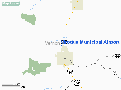
| From nearest city: | 2 nautical miles N of Viroqua, WI |
| Location: | Vernon County, WI |
| Magnetic Variation: | 00E (2000) |
Owner & Manager
| Ownership: | Publicly owned |
| Owner: | City Of Viroqua |
| Address: | City Hall
Viroqua, WI 54665 |
| Phone number: | 608-637-7154 |
| Manager: | Michael Skildum |
| Address: | S7453 Shannon Drive
Viroqua, WI 54665 |
| Phone number: | 608-675-3694
ADDNL PHONE 608-637-2346 |
Airport Operations and Facilities
| Airport Use: | Open to public |
| Wind indicator: | Yes |
| Segmented Circle: | Yes |
| Control Tower: | No |
| Lighting Schedule: | DUSK-DAWN
ACTVT LIRL RYS 11/29 & 02/20 - CTAF. |
| Beacon Color: | Clear-Green (lighted land airport) |
| Landing fee charge: | No |
| Sectional chart: | Chicago |
| Region: | AGL - Great Lakes |
| Boundary ARTCC: | ZMP - Minneapolis |
| Tie-in FSS: | GRB - Green Bay |
| FSS on Airport: | No |
| FSS Toll Free: | 1-800-WX-BRIEF |
| NOTAMs Facility: | GRB (NOTAM-d service avaliable) |
| Federal Agreements: | N |
Airport Communications
Airport Services
| Fuel available: | 100
24 HR FUEL AVAILABLE |
| Airframe Repair: | NONE |
| Power Plant Repair: | NONE |
| Bottled Oxygen: | NONE |
| Bulk Oxygen: | NONE |
Runway Information
Runway 02/20
| Dimension: | 2555 x 90 ft / 778.8 x 27.4 m
HAS SHARP 20' DROP-OFF EA END & SLOPES DOWNHILL TO THE NORTH APRXLY 1.5%. |
| Surface: | TURF, Good Condition |
| Edge Lights: | Low |
| |
Runway 02 |
Runway 20 |
| Longitude: | 090-53-35.2540W | 090-53-22.5200W |
| Latitude: | 43-34-30.3890N | 43-34-53.8640N |
| Elevation: | 1283.00 ft | 1257.00 ft |
| Alignment: | 22 | 127 |
| Traffic Pattern: | Left | Left |
| Obstruction: | , 50:1 slope to clear | 86 ft trees, 2000.0 ft from runway, 150 ft right of centerline, 23:1 slope to clear |
|
Runway 11/29
| Dimension: | 3346 x 60 ft / 1019.9 x 18.3 m
HAS SHARP 20' DROP-OFF EA END & SLOPES DOWNHILL TO THE NORTH APRXLY 1.5%. |
| Surface: | ASPH, Good Condition |
| Weight Limit: | Single wheel: 12000 lbs. |
| Edge Lights: | Low |
| |
Runway 11 |
Runway 29 |
| Longitude: | 090-54-22.0640W | 090-53-40.6840W |
| Latitude: | 43-34-55.2610N | 43-34-41.5870N |
| Elevation: | 1269.00 ft | 1292.00 ft |
| Alignment: | 114 | 127 |
| Traffic Pattern: | Left | Left |
| Markings: | Non-precision instrument, Good Condition | Non-precision instrument, Good Condition |
| Obstruction: | , 50:1 slope to clear | 39 ft trees, 1100.0 ft from runway, 30 ft right of centerline, 23:1 slope to clear |
|
Radio Navigation Aids
| ID |
Type |
Name |
Ch |
Freq |
Var |
Dist |
| CMY | NDB | Mccoy | | 412.00 | 00E | 24.2 nm |
| HBW | NDB | Kickapoo | | 251.00 | 03E | 24.9 nm |
| CHU | NDB | Caledonia | | 209.00 | 03E | 25.9 nm |
| BCK | NDB | Black River Falls | | 362.00 | 00E | 40.6 nm |
| DEH | NDB | Decorah | | 236.00 | 01E | 41.0 nm |
| VOK | TACAN | Volk | 041X | | 00E | 35.3 nm |
| LSE | VOR/DME | La Crosse | 021X | 108.40 | 02E | 23.7 nm |
| LNR | VOR/DME | Lone Rock | 075X | 112.80 | 00E | 37.5 nm |
| ONA | VOR/DME | Winona | 051X | 111.40 | 01E | 46.1 nm |
| ODI | VORTAC | Nodine | 126X | 117.90 | 01E | 31.9 nm |
| UKN | VORTAC | Waukon | 113X | 116.60 | 05E | 33.3 nm |
| DLL | VORTAC | Dells | 117X | 117.00 | 03E | 49.4 nm |
Images and information placed above are from
http://www.airport-data.com/airport/Y51/
We thank them for the data!
| General Info
|
| Country |
United States
|
| State |
WISCONSIN
|
| FAA ID |
Y51
|
| Latitude |
43-34-45.697N
|
| Longitude |
090-53-47.307W
|
| Elevation |
1292 feet
|
| Near City |
VIROQUA
|
We don't guarantee the information is fresh and accurate. The data may
be wrong or outdated.
For more up-to-date information please refer to other sources.
|
|


