|
|
 |
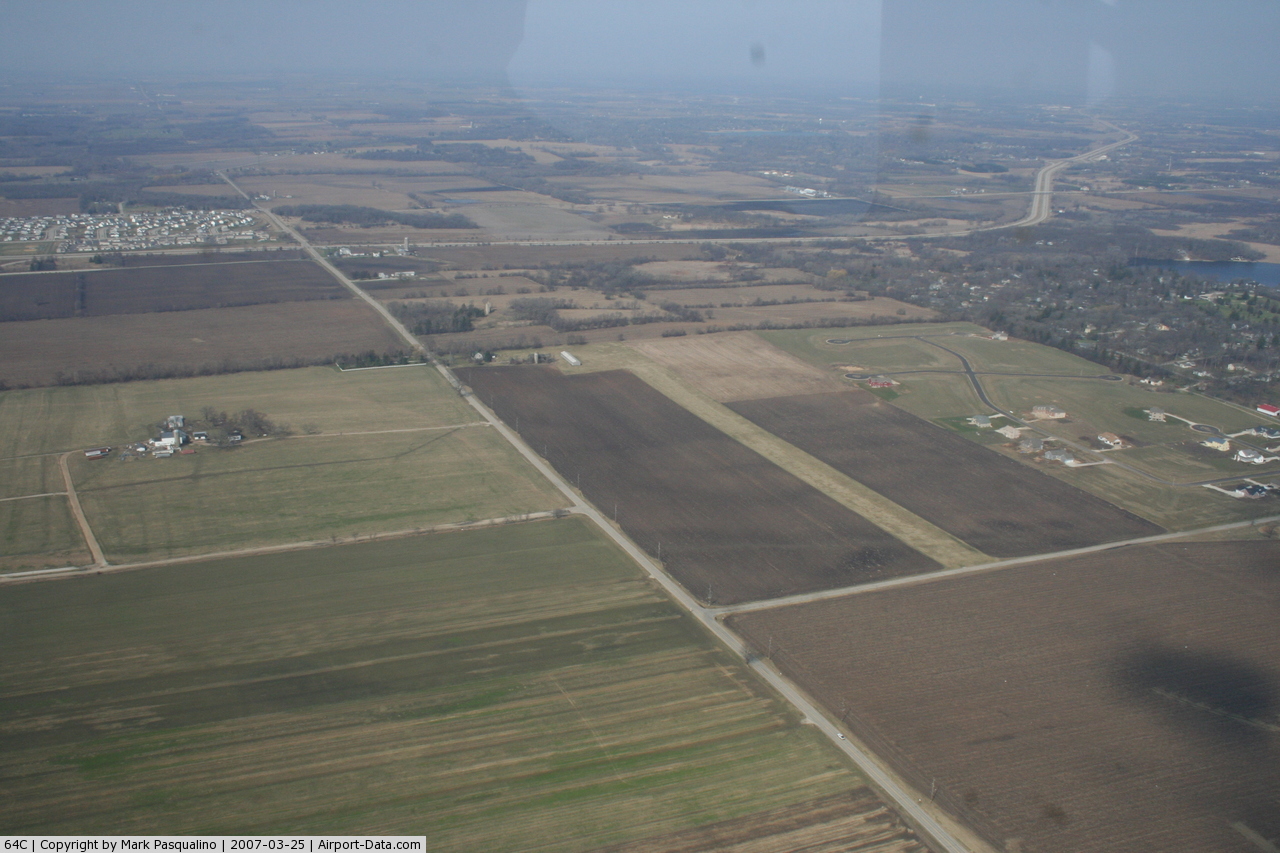
(Click on the photo to enlarge) |
Location & QuickFacts
| FAA Information Effective: | 2008-09-25 |
| Airport Identifier: | 64C |
| Airport Status: | Operational |
| Longitude/Latitude: | 088-18-01.3320W/42-31-06.0650N
-88.300370/42.518351 (Estimated) |
| Elevation: | 880 ft / 268.22 m (Estimated) |
| Land: | 12 acres |
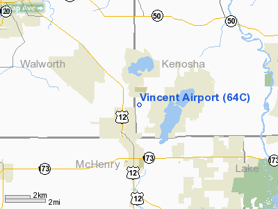
| From nearest city: | 3 nautical miles NE of Genoa City, WI |
| Location: | Kenosha County, WI |
| Magnetic Variation: | 01W (1985) |
Owner & Manager
| Ownership: | Privately owned |
| Owner: | Mrs Iris J. Vincent |
| Address: | P.o. Box 160
Genoa City, WI 53128 |
| Phone number: | 262-279-6060 |
| Manager: | Mrs Iris J. Vincent |
| Address: | P.o. Box 160
Genoa City, WI 53128 |
| Phone number: | 262-279-6060 |
Airport Operations and Facilities
| Airport Use: | Open to public |
| Wind indicator: | Yes |
| Segmented Circle: | No |
| Control Tower: | No |
| Landing fee charge: | No |
| Sectional chart: | Chicago |
| Region: | AGL - Great Lakes |
| Traffic Pattern Alt: | 800 ft |
| Boundary ARTCC: | ZAU - Chicago |
| Tie-in FSS: | GRB - Green Bay |
| FSS on Airport: | No |
| FSS Toll Free: | 1-800-WX-BRIEF |
| NOTAMs Facility: | GRB (NOTAM-d service avaliable) |
Airport Communications
| CTAF: | 122.800 |
| Unicom: | 122.800 |
Airport Services
| Airframe Repair: | NONE |
| Power Plant Repair: | NONE |
| Bottled Oxygen: | NONE |
| Bulk Oxygen: | NONE |
Runway Information
Runway 09/27
| Dimension: | 1775 x 130 ft / 541.0 x 39.6 m |
| Surface: | TURF, Fair Condition |
| |
Runway 09 |
Runway 27 |
| Longitude: | 088-18-09.1800W | 088-17-45.4800W |
| Latitude: | 42-31-06.0600N | 42-31-06.0600N |
| Elevation: | 870.00 ft | 860.00 ft |
| Traffic Pattern: | Left | Left |
| Runway End Identifier: | No | No |
| Centerline Lights: | No | No |
| Touchdown Lights: | No | No |
| Obstruction: | 86 ft trees, 950.0 ft from runway, 75 ft right of centerline, 11:1 slope to clear | 15 ft road, 315.0 ft from runway, 21:1 slope to clear |
|
Radio Navigation Aids
| ID |
Type |
Name |
Ch |
Freq |
Var |
Dist |
| LVV | NDB | Lake Lawn | | 404.00 | 00W | 16.9 nm |
| RA | NDB | Paser | | 206.00 | 00E | 20.3 nm |
| GM | NDB | Teels | | 242.00 | 02W | 26.1 nm |
| UES | NDB | Waukesha | | 359.00 | 01W | 31.8 nm |
| JVL | NDB | Janesville | | 375.00 | 03E | 33.3 nm |
| ME | NDB | Deana | | 350.00 | 00E | 35.3 nm |
| BL | NDB | Yanks | | 260.00 | 02W | 37.5 nm |
| DKB | NDB | Dekalb | | 209.00 | 02W | 39.5 nm |
| RYV | NDB | Rock River | | 371.00 | 01W | 43.6 nm |
| BUU | VOR/DME | Burbun | 092X | 114.50 | 01W | 10.3 nm |
| ENW | VOR/DME | Kenosha | 029X | 109.20 | 02W | 17.0 nm |
| OBK | VOR/DME | Northbrook | 077X | 113.00 | 02W | 23.6 nm |
| HRK | VOR/DME | Horlick | 124X | 117.70 | 02W | 26.0 nm |
| JVL | VOR/DME | Janesville | 090X | 114.30 | 03E | 35.7 nm |
| ORD | VOR/DME | Chicago O'hare | 086X | 113.90 | 02E | 36.4 nm |
| LJT | VOR/DME | Timmerman | 072X | 112.50 | 02W | 37.4 nm |
| DPA | VOR/DME | Dupage | 021X | 108.40 | 02E | 37.8 nm |
| RFD | VOR/DME | Rockford | 045X | 110.80 | 01E | 43.6 nm |
| BAE | VORTAC | Badger | 111X | 116.40 | 02E | 36.0 nm |
| MKE | VOT | Milwaukee | | 109.00 | | 31.4 nm |
| ORD | VOT | Chicago O'hare Intl | | 112.00 | | 36.7 nm |
Remarks
- RY 09/27 WEST END RISE +15 FT.
Images and information placed above are from
http://www.airport-data.com/airport/64C/
We thank them for the data!
| General Info
|
| Country |
United States
|
| State |
WISCONSIN
|
| FAA ID |
64C
|
| Latitude |
42-31-06.065N
|
| Longitude |
088-18-01.332W
|
| Elevation |
880 feet
|
| Near City |
GENOA CITY
|
We don't guarantee the information is fresh and accurate. The data may
be wrong or outdated.
For more up-to-date information please refer to other sources.
|
|