 |
|
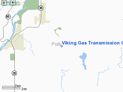
Viking Gas Transmission Co Heliport |
Location & QuickFacts
| FAA Information Effective: | 2008-09-25 |
| Airport Identifier: | 76WI |
| Airport Status: | Operational |
| Longitude/Latitude: | 092-35-20.7280W/45-18-44.8680N
-92.589091/45.312463 (Estimated) |
| Elevation: | 1115 ft / 339.85 m (Estimated) |
| Land: | 0 acres |
| From nearest city: | 0 nautical miles N of Dresser, WI |
| Location: | Polk County, WI |
| Magnetic Variation: | 02E (1985) |
Owner & Manager
| Ownership: | Privately owned |
| Owner: | Viking Gas Transmission Co |
| Address: | 230, 23823 W Amoco Rd
Channanon, IL 60410 |
| Phone number: | 815-467-2540 |
| Manager: | V.l. Smith |
| Address: | 320,23823 W Amoco Rd
Channahon, IL 60410 |
| Phone number: | 815-467-2540 |
Airport Operations and Facilities
| Airport Use: | Private |
| Wind indicator: | Yes |
| Segmented Circle: | No |
| Control Tower: | No |
| Landing fee charge: | No |
| Sectional chart: | Green Bay |
| Region: | AGL - Great Lakes |
| Boundary ARTCC: | ZMP - Minneapolis |
| Tie-in FSS: | GRB - Green Bay |
| FSS on Airport: | No |
| FSS Toll Free: | 1-800-WX-BRIEF |
Runway Information
Helipad H1
| Dimension: | 20 x 20 ft / 6.1 x 6.1 m |
| Surface: | CONC, |
| |
Runway H1 |
Runway |
| Traffic Pattern: | Left | Left |
|
Radio Navigation Aids
| ID |
Type |
Name |
Ch |
Freq |
Var |
Dist |
| OEO | NDB | Osceola | | 233.00 | 01E | 4.2 nm |
| AHH | NDB | Ameron | | 278.00 | 01E | 9.4 nm |
| RNH | NDB | New Richmond | | 257.00 | 02E | 10.2 nm |
| ROS | NDB | Rush City | | 282.00 | 02E | 27.8 nm |
| UBE | NDB | Cumberland | | 375.00 | 01E | 28.4 nm |
| PPI | NDB | Hopey | | 400.00 | 03E | 30.4 nm |
| CBG | NDB | Cambridge | | 350.00 | 03E | 32.0 nm |
| BXR | NDB | Big Doctor | | 203.00 | 02E | 32.0 nm |
| MS | NDB | Narco | | 266.00 | 02E | 36.2 nm |
| SSQ | NDB | Shell Lake | | 212.00 | 01E | 37.7 nm |
| JMR | NDB | Mora | | 327.00 | 03E | 45.0 nm |
| PNM | NDB | Princeton | | 368.00 | 03E | 45.6 nm |
| RZN | VOR/DME | Siren | 031X | 109.40 | 02E | 31.8 nm |
| RPD | VOR/DME | Rice Lake | 037X | 110.00 | 01E | 34.8 nm |
| MSP | VOR/DME | Minneapolis | 100X | 115.30 | 02E | 37.1 nm |
| FCM | VOR/DME | Flying Cloud | 055X | 111.80 | 06E | 47.0 nm |
| GEP | VORTAC | Gopher | 120X | 117.30 | 06E | 34.7 nm |
| FGT | VORTAC | Farmington | 104X | 115.70 | 06E | 48.1 nm |
| STP | VOT | St Paul | | 114.40 | | 29.9 nm |
| MSP | VOT | Minneapolis St Paul | | 111.00 | | 37.0 nm |
Remarks
- ALL APCH/DEPARTURE ROUTE HELICOPTER OPERATIONS ARE CONDUCTED IN AN AREA FROM 135 DEG CLOCKWISE TO 360 DEG USING THE TOUCHDOWN PAD AS THE CENTER OF A COMPASS ROSE. THE TAKEOFF/LANDING AREA IS APPROPRIATELY MARKED; A NON-OBSTRUCTING WIND INDICATOR IS MAINTAINED ADJACENT TO THE TAKEOFF/LANDING AREA.
Images and information placed above are from
http://www.airport-data.com/airport/76WI/
We thank them for the data!
| General Info
|
| Country |
United States
|
| State |
WISCONSIN
|
| FAA ID |
76WI
|
| Latitude |
45-18-44.868N
|
| Longitude |
092-35-20.728W
|
| Elevation |
1115 feet
|
| Near City |
DRESSER
|
We don't guarantee the information is fresh and accurate. The data may
be wrong or outdated.
For more up-to-date information please refer to other sources.
|
|


