 |
|
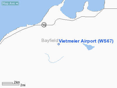
Location & QuickFacts
| FAA Information Effective: | 2008-09-25 |
| Airport Identifier: | WS67 |
| Airport Status: | Operational |
| Longitude/Latitude: | 091-12-30.6660W/46-47-59.7620N
-91.208518/46.799934 (Estimated) |
| Elevation: | 795 ft / 242.32 m (Estimated) |
| Land: | 5 acres |
| From nearest city: | 3 nautical miles SE of Herbster, WI |
| Location: | Bayfield County, WI |
| Magnetic Variation: | 01E (1990) |
Owner & Manager
| Ownership: | Privately owned |
| Owner: | Waldemar J. Vietmeier |
| Address: | 7333 Nicollet Ave So
Richfield, MN 55423 |
| Phone number: | 612-866-0237 |
| Manager: | Waldemar J. Vietmeier |
| Address: | 7333 Nicollet Ave So
Rickfield, MN 55423 |
| Phone number: | 612-866-0237 |
Airport Operations and Facilities
| Airport Use: | Private |
| Wind indicator: | Yes |
| Segmented Circle: | No |
| Control Tower: | No |
| Sectional chart: | Green Bay |
| Region: | AGL - Great Lakes |
| Boundary ARTCC: | ZMP - Minneapolis |
| Tie-in FSS: | GRB - Green Bay |
| FSS Toll Free: | 1-800-WX-BRIEF |
Runway Information
Runway 16/34
| Dimension: | 2000 x 80 ft / 609.6 x 24.4 m |
| Surface: | TURF, |
| |
Runway 16 |
Runway 34 |
| Traffic Pattern: | Left | Left |
| Displaced threshold: | 700.00 ft | 700.00 ft |
| Obstruction: | 40 ft trees, 100.0 ft from runway | 40 ft trees, 100.0 ft from runway |
|
Radio Navigation Aids
| ID |
Type |
Name |
Ch |
Freq |
Var |
Dist |
| ENY | NDB | Kennedy | | 254.00 | 02E | 19.2 nm |
| TWM | NDB | Two Harbors | | 243.00 | 01E | 26.7 nm |
| BFW | NDB | Silver Bay | | 350.00 | 00E | 28.4 nm |
| SUW | NDB | Bong | | 260.00 | 01E | 37.4 nm |
| OLG | NDB | Solon Springs | | 388.00 | 01E | 38.3 nm |
| SLY | NDB | Seeley | | 344.00 | 01E | 42.0 nm |
| DL | NDB | Pykla | | 379.00 | 02E | 47.2 nm |
| LKI | TACAN | Lakeside | 011X | | 05E | 40.3 nm |
| ASX | VOR/DME | Ashland | 039X | 110.20 | 02E | 19.3 nm |
| HYR | VOR/DME | Hayward | 081X | 113.40 | 03E | 48.0 nm |
| DLH | VORTAC | Duluth | 073X | 112.60 | 05E | 40.9 nm |
| IWD | VORTAC | Ironwood | 025X | 108.80 | 01E | 47.5 nm |
Remarks
- PRVDD RY 16 & 34 ARE LOCATED 200 FT FM ROADS ADJACENT TO RY ENDS; OBSTN IN RY APCH SLOPE BE LOWERED OR REMOVED OR RY THRS BE DSPLCD & MKD TO PRVD A MIN 20:1 APCH CLNC OVER ALL OBSTN & THE AREA 125 FT EITHER SIDE OF CNTRLN BE CLEAR OF OBSTNS.
Images and information placed above are from
http://www.airport-data.com/airport/WS67/
We thank them for the data!
| General Info
|
| Country |
United States
|
| State |
WISCONSIN
|
| FAA ID |
WS67
|
| Latitude |
46-47-59.762N
|
| Longitude |
091-12-30.666W
|
| Elevation |
795 feet
|
| Near City |
HERBSTER
|
We don't guarantee the information is fresh and accurate. The data may
be wrong or outdated.
For more up-to-date information please refer to other sources.
|
|


