 |
|
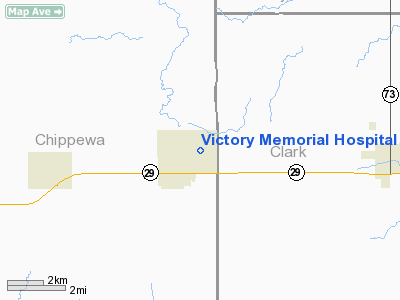
Victory Memorial Hospital Heliport |
Location & QuickFacts
| FAA Information Effective: | 2008-09-25 |
| Airport Identifier: | 11WI |
| Airport Status: | Operational |
| Longitude/Latitude: | 090-56-01.5030W/44-57-47.8760N
-90.933751/44.963299 (Estimated) |
| Elevation: | 1140 ft / 347.47 m (Estimated) |
| Land: | 0 acres |
| From nearest city: | 0 nautical miles N of Stanley, WI |
| Location: | Chippewa County, WI |
| Magnetic Variation: | 01E (1985) |
Owner & Manager
| Ownership: | Privately owned |
| Owner: | City Of Stanley Fire Dept |
| Address: | 116 E. 3rd Ave
Stanley, WI 54768 |
| Phone number: | 715-644-5758 |
| Manager: | Ron Zais |
| Address: | 945 N. Broadway
Stanley, WI 54768 |
| Phone number: | 715-644-3349 |
Airport Operations and Facilities
| Airport Use: | Private
MEDICAL USE. |
| Wind indicator: | Yes |
| Segmented Circle: | No |
| Control Tower: | No |
| Sectional chart: | Green Bay |
| Region: | AGL - Great Lakes |
| Boundary ARTCC: | ZMP - Minneapolis |
| Tie-in FSS: | GRB - Green Bay |
| FSS Toll Free: | 1-800-WX-BRIEF |
Runway Information
Helipad H1
| Dimension: | 100 x 100 ft / 30.5 x 30.5 m |
| Surface: | ASPH, |
| |
Runway H1 |
Runway |
| Traffic Pattern: | Left | Left |
|
Radio Navigation Aids
| ID |
Type |
Name |
Ch |
Freq |
Var |
Dist |
| MDZ | NDB | Medford | | 335.00 | 00E | 27.9 nm |
| VIQ | NDB | Neillsville | | 368.00 | 01W | 30.3 nm |
| RCX | NDB | Rusk County | | 356.00 | 00W | 32.5 nm |
| MFI | NDB | Marshfield | | 391.00 | 00E | 37.3 nm |
| BCK | NDB | Black River Falls | | 362.00 | 00E | 42.7 nm |
| PBH | NDB | Phillips | | 263.00 | 00E | 49.6 nm |
| RPD | VOR/DME | Rice Lake | 037X | 110.00 | 01E | 44.9 nm |
| EAU | VORTAC | Eau Claire | 076X | 112.90 | 04E | 23.5 nm |
Remarks
- PROVIDED INGRESS/EGRESS FM 270 TO 080; WIND INDICATOR IS MAINTAINED.
Images and information placed above are from
http://www.airport-data.com/airport/11WI/
We thank them for the data!
| General Info
|
| Country |
United States
|
| State |
WISCONSIN
|
| FAA ID |
11WI
|
| Latitude |
44-57-47.876N
|
| Longitude |
090-56-01.503W
|
| Elevation |
1140 feet
|
| Near City |
STANLEY
|
We don't guarantee the information is fresh and accurate. The data may
be wrong or outdated.
For more up-to-date information please refer to other sources.
|
|


