 |
|
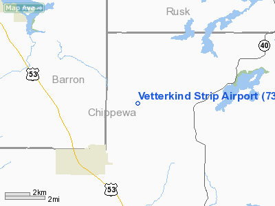
Location & QuickFacts
| FAA Information Effective: | 2008-09-25 |
| Airport Identifier: | 73WI |
| Airport Status: | Operational |
| Longitude/Latitude: | 091-30-31.5840W/45-14-25.8620N
-91.508773/45.240517 (Estimated) |
| Elevation: | 1080 ft / 329.18 m (Estimated) |
| Land: | 0 acres |
| From nearest city: | 3 nautical miles NE of New Auburn, WI |
| Location: | Chippewa County, WI |
| Magnetic Variation: | 01E (1985) |
Owner & Manager
| Ownership: | Privately owned |
| Owner: | Clifford W. Vetterkind |
| Address: | 8306 Airport Rd.
New Auburn, WI 54757 |
| Phone number: | 715-237-2289 |
| Address: |
|
Airport Operations and Facilities
| Airport Use: | Private |
| Wind indicator: | Yes |
| Segmented Circle: | No |
| Control Tower: | No |
| Landing fee charge: | No |
| Sectional chart: | Green Bay |
| Region: | AGL - Great Lakes |
| Boundary ARTCC: | ZMP - Minneapolis |
| Tie-in FSS: | GRB - Green Bay |
| FSS on Airport: | No |
| FSS Toll Free: | 1-800-WX-BRIEF |
Runway Information
Runway E/W
| Dimension: | 3200 x 100 ft / 975.4 x 30.5 m |
| Surface: | TURF, |
| |
Runway E |
Runway W |
| Traffic Pattern: | Left | Left |
|
Runway N/S
| Dimension: | 2700 x 100 ft / 823.0 x 30.5 m |
| Surface: | TURF, |
| |
Runway N |
Runway S |
| Traffic Pattern: | Left | Left |
|
Radio Navigation Aids
| ID |
Type |
Name |
Ch |
Freq |
Var |
Dist |
| UBE | NDB | Cumberland | | 375.00 | 01E | 25.5 nm |
| RCX | NDB | Rusk County | | 356.00 | 00W | 26.6 nm |
| SSQ | NDB | Shell Lake | | 212.00 | 01E | 34.0 nm |
| AHH | NDB | Ameron | | 278.00 | 01E | 36.6 nm |
| RNH | NDB | New Richmond | | 257.00 | 02E | 43.8 nm |
| RPD | VOR/DME | Rice Lake | 037X | 110.00 | 01E | 15.5 nm |
| HYR | VOR/DME | Hayward | 081X | 113.40 | 03E | 46.9 nm |
| EAU | VORTAC | Eau Claire | 076X | 112.90 | 04E | 20.6 nm |
Remarks
- AVAILABLE DATA INDICATES USABLE RWY LENGTH AND OBSTN CLEARANCES DO NOT OFFER AN ACCEPTABLE LEVEL OF SAFETY FOR ACFT OPERATIONS.
Images and information placed above are from
http://www.airport-data.com/airport/73WI/
We thank them for the data!
| General Info
|
| Country |
United States
|
| State |
WISCONSIN
|
| FAA ID |
73WI
|
| Latitude |
45-14-25.862N
|
| Longitude |
091-30-31.584W
|
| Elevation |
1080 feet
|
| Near City |
NEW AUBURN
|
We don't guarantee the information is fresh and accurate. The data may
be wrong or outdated.
For more up-to-date information please refer to other sources.
|
|


