 |
|
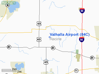
Location & QuickFacts
| FAA Information Effective: | 2008-09-25 |
| Airport Identifier: | 84C |
| Airport Status: | Operational |
| Longitude/Latitude: | 088-02-33.3040W/42-45-45.0640N
-88.042584/42.762518 (Estimated) |
| Elevation: | 805 ft / 245.36 m (Estimated) |
| Land: | 70 acres |
| From nearest city: | 2 nautical miles SE of North Cape, WI |
| Location: | Racine County, WI |
| Magnetic Variation: | 01W (1985) |
Owner & Manager
| Ownership: | Privately owned |
| Owner: | Francis J. Moran, P.e. |
| Address: | 4557 S 96 St
Franksville, WI 53126 |
| Phone number: | 262-878-8700 |
| Manager: | William R. Moran. |
| Address: | 4557 S 96 St
Franksville, WI 53126 |
| Phone number: | 262-878-8700 |
Airport Operations and Facilities
| Airport Use: | Open to public |
| Wind indicator: | Yes |
| Segmented Circle: | No |
| Control Tower: | No |
| Landing fee charge: | No |
| Sectional chart: | Chicago |
| Region: | AGL - Great Lakes |
| Boundary ARTCC: | ZAU - Chicago |
| Tie-in FSS: | GRB - Green Bay |
| FSS on Airport: | No |
| FSS Toll Free: | 1-800-WX-BRIEF |
| NOTAMs Facility: | GRB (NOTAM-d service avaliable) |
Airport Communications
| CTAF: | 122.800 |
| Unicom: | 122.800 |
Airport Services
| Airframe Repair: | MINOR |
| Power Plant Repair: | NONE |
| Bottled Oxygen: | NONE |
| Bulk Oxygen: | NONE |
Runway Information
Runway 09/27
| Dimension: | 2540 x 80 ft / 774.2 x 24.4 m
WIDTH VARIES FM 80 FT TO 108 FT. |
| Surface: | TURF, Poor Condition
CAUTION: RWY EXTRMLY ROUGH & ELEV VARIES 30'; ACFT WITH NOSE WHEELS AVOID EAST 1100' OF RWY. |
| |
Runway 09 |
Runway 27 |
| Longitude: | 088-02-50.1100W | 088-02-15.4900W |
| Latitude: | 42-45-42.0400N | 42-45-39.0800N |
| Elevation: | 800.00 ft | 770.00 ft |
| Traffic Pattern: | Left | Left |
| Markings: | None, | None, |
| Runway End Identifier: | No | No |
| Centerline Lights: | No | No |
| Touchdown Lights: | No | No |
| Obstruction: | 25 ft trees, 120.0 ft from runway, 100 ft left of centerline, 4:1 slope to clear | 15 ft road, 0.0 ft from runway
ROAD RUNS PERPENDICULAR TO RWY. |
|
Radio Navigation Aids
| ID |
Type |
Name |
Ch |
Freq |
Var |
Dist |
| RA | NDB | Paser | | 206.00 | 00E | 7.9 nm |
| GM | NDB | Teels | | 242.00 | 02W | 8.8 nm |
| UES | NDB | Waukesha | | 359.00 | 01W | 19.0 nm |
| BL | NDB | Yanks | | 260.00 | 02W | 19.3 nm |
| LVV | NDB | Lake Lawn | | 404.00 | 00W | 24.6 nm |
| HXF | NDB | Hartford | | 200.00 | 00E | 38.5 nm |
| RYV | NDB | Rock River | | 371.00 | 01W | 38.9 nm |
| LLE | NDB | Kettle Moraine | | 329.00 | 01W | 40.0 nm |
| JVL | NDB | Janesville | | 375.00 | 03E | 45.0 nm |
| ME | NDB | Deana | | 350.00 | 00E | 47.8 nm |
| UNU | NDB | Juneau | | 344.00 | 01W | 49.4 nm |
| BJB | VOR | West Bend | | 109.80 | 01W | 39.8 nm |
| HRK | VOR/DME | Horlick | 124X | 117.70 | 02W | 10.1 nm |
| ENW | VOR/DME | Kenosha | 029X | 109.20 | 02W | 11.0 nm |
| BUU | VOR/DME | Burbun | 092X | 114.50 | 01W | 12.3 nm |
| LJT | VOR/DME | Timmerman | 072X | 112.50 | 02W | 20.9 nm |
| OBK | VOR/DME | Northbrook | 077X | 113.00 | 02W | 32.8 nm |
| ORD | VOR/DME | Chicago O'hare | 086X | 113.90 | 02E | 47.0 nm |
| JVL | VOR/DME | Janesville | 090X | 114.30 | 03E | 48.6 nm |
| BAE | VORTAC | Badger | 111X | 116.40 | 02E | 23.8 nm |
| MKE | VOT | Milwaukee | | 109.00 | | 12.9 nm |
| ORD | VOT | Chicago O'hare Intl | | 112.00 | | 47.3 nm |
Remarks
- RWY NOT PLOWED.
- CALL AMGR ON 262-878-8700 PRIOR TO ARR TO CONFIRM CONDITION OF RY 09/27.
- E111: E-111 CONFLICT OF ASP FOR SIMUL TFC OPNS FOR BOTH VALHALLA & J & M FARMS ARPTS; RWY HAS EXCESSIVE LTRL & LONGL UNDULATIONS FOR SAFE ACFT OPNS; E111 CONT'D: USBL RWY LENGTH & OBSTN CLNC DO NOT OFFER AN ACPTBL LEVEL OF SAFETY FOR ACFT OPNS.
Images and information placed above are from
http://www.airport-data.com/airport/84C/
We thank them for the data!
| General Info
|
| Country |
United States
|
| State |
WISCONSIN
|
| FAA ID |
84C
|
| Latitude |
42-45-45.064N
|
| Longitude |
088-02-33.304W
|
| Elevation |
805 feet
|
| Near City |
NORTH CAPE
|
We don't guarantee the information is fresh and accurate. The data may
be wrong or outdated.
For more up-to-date information please refer to other sources.
|
|


