 |
|
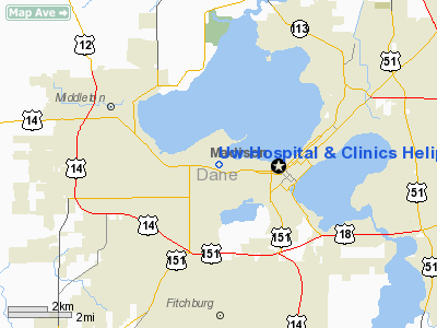
Uw Hospital & Clinics Heliport |
Location & QuickFacts
| FAA Information Effective: | 2008-09-25 |
| Airport Identifier: | WS27 |
| Airport Status: | Operational |
| Longitude/Latitude: | 089-25-58.4310W/43-04-32.9850N
-89.432897/43.075829 (Estimated) |
| Elevation: | 901 ft / 274.62 m (Estimated) |
| Land: | 0 acres |
| From nearest city: | 6 nautical miles N of Madison, WI |
| Location: | Dane County, WI |
| Magnetic Variation: | 00E (1985) |
Owner & Manager
| Ownership: | Privately owned |
| Owner: | Uw Hospital & Clinics |
| Address: | 600 Highland Ave
Madison, WI 53792 |
| Phone number: | 608-263-8010 |
| Manager: | Erica Christman |
| Address: | 600 Highland Ave F6/220
Madison, WI 53792 |
| Phone number: | 608-263-8010 |
Airport Operations and Facilities
| Airport Use: | Private
MEDICAL USE. |
| Wind indicator: | Yes |
| Segmented Circle: | No |
| Control Tower: | No |
| Lighting Schedule: | PHONE REQ
FOR PERIMETER & FLOOD LGTS CALL 608-263-3258 |
| Beacon Color: | Clear-Green-Yellow (heliport) |
| Sectional chart: | Chicago |
| Region: | AGL - Great Lakes |
| Boundary ARTCC: | ZAU - Chicago |
| Tie-in FSS: | GRB - Green Bay |
| FSS Toll Free: | 1-800-WX-BRIEF |
Airport Communications
Airport Services
Runway Information
Helipad H1
| Dimension: | 100 x 100 ft / 30.5 x 30.5 m |
| Surface: | CONC, |
| |
Runway H1 |
Runway |
| Traffic Pattern: | Left | Left |
|
Radio Navigation Aids
| ID |
Type |
Name |
Ch |
Freq |
Var |
Dist |
| MS | NDB | Monah | | 400.00 | 00E | 3.9 nm |
| RYV | NDB | Rock River | | 371.00 | 01W | 31.6 nm |
| JVL | NDB | Janesville | | 375.00 | 03E | 32.6 nm |
| MRJ | NDB | Mineral Point | | 365.00 | 00W | 36.7 nm |
| UNU | NDB | Juneau | | 344.00 | 01W | 38.4 nm |
| LVV | NDB | Lake Lawn | | 404.00 | 00W | 43.4 nm |
| HXF | NDB | Hartford | | 200.00 | 00E | 48.3 nm |
| PVB | NDB | Platteville | | 203.00 | 01E | 50.0 nm |
| LNR | VOR/DME | Lone Rock | 075X | 112.80 | 00E | 33.4 nm |
| JVL | VOR/DME | Janesville | 090X | 114.30 | 03E | 34.3 nm |
| MSN | VORTAC | Madison | 023X | 108.60 | 03E | 5.8 nm |
| DLL | VORTAC | Dells | 117X | 117.00 | 03E | 32.0 nm |
Remarks
- PRVDD ALL OPNS ARE CONDUCTED IN AREA FM 360-150 DEG; AREA IS MKD; WIND INDICATOR IS MNTD; TREES & SHRUBS ARE TRIMMED.
Images and information placed above are from
http://www.airport-data.com/airport/WS27/
We thank them for the data!
| General Info
|
| Country |
United States
|
| State |
WISCONSIN
|
| FAA ID |
WS27
|
| Latitude |
43-04-32.985N
|
| Longitude |
089-25-58.431W
|
| Elevation |
901 feet
|
| Near City |
MADISON
|
We don't guarantee the information is fresh and accurate. The data may
be wrong or outdated.
For more up-to-date information please refer to other sources.
|
|


