 |
|
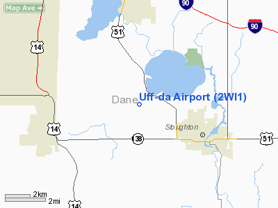
Location & QuickFacts
| FAA Information Effective: | 2008-09-25 |
| Airport Identifier: | 2WI1 |
| Airport Status: | Operational |
| Longitude/Latitude: | 089-17-11.9230W/42-56-37.0020N
-89.286645/42.943612 (Estimated) |
| Elevation: | 945 ft / 288.04 m (Estimated) |
| Land: | 10 acres |
| From nearest city: | 4 nautical miles NE of Stoughton, WI |
| Location: | Dane County, WI |
| Magnetic Variation: | 01W (1995) |
Owner & Manager
| Ownership: | Privately owned |
| Owner: | Donald H. Halverson |
| Address: | 3671 Halverson Road
Stoughton, WI 53589 |
| Phone number: | 608-873-6541 |
| Manager: | Donald H. Halverson |
| Address: | 3671 Halverson Road
Stoughton, WI 53589 |
| Phone number: | 608-873-6541 |
Airport Operations and Facilities
| Airport Use: | Private |
| Wind indicator: | Yes |
| Segmented Circle: | No |
| Control Tower: | No |
| Sectional chart: | Chicago |
| Region: | AGL - Great Lakes |
| Boundary ARTCC: | ZAU - Chicago |
| Tie-in FSS: | GRB - Green Bay |
| FSS on Airport: | No |
| FSS Toll Free: | 1-800-WX-BRIEF |
Runway Information
Runway 18/36
| Dimension: | 1800 x 75 ft / 548.6 x 22.9 m |
| Surface: | TURF, Good Condition |
| |
Runway 18 |
Runway 36 |
| Traffic Pattern: | Left | Left |
| Displaced threshold: | 700.00 ft
DSPLCD THLD IS UNMKD. | 0.00 ft |
| Obstruction: | 35 ft pline, 700.0 ft from runway | |
|
Radio Navigation Aids
| ID |
Type |
Name |
Ch |
Freq |
Var |
Dist |
| MS | NDB | Monah | | 400.00 | 00E | 7.6 nm |
| JVL | NDB | Janesville | | 375.00 | 03E | 22.5 nm |
| RYV | NDB | Rock River | | 371.00 | 01W | 28.3 nm |
| LVV | NDB | Lake Lawn | | 404.00 | 00W | 33.9 nm |
| UNU | NDB | Juneau | | 344.00 | 01W | 38.8 nm |
| MRJ | NDB | Mineral Point | | 365.00 | 00W | 41.5 nm |
| FEP | NDB | Freeport | | 335.00 | 00E | 44.0 nm |
| HXF | NDB | Hartford | | 200.00 | 00E | 46.0 nm |
| UES | NDB | Waukesha | | 359.00 | 01W | 46.6 nm |
| JVL | VOR/DME | Janesville | 090X | 114.30 | 03E | 24.5 nm |
| LNR | VOR/DME | Lone Rock | 075X | 112.80 | 00E | 42.7 nm |
| RFD | VOR/DME | Rockford | 045X | 110.80 | 01E | 43.3 nm |
| BUU | VOR/DME | Burbun | 092X | 114.50 | 01W | 46.0 nm |
| MSN | VORTAC | Madison | 023X | 108.60 | 03E | 12.3 nm |
| DLL | VORTAC | Dells | 117X | 117.00 | 03E | 42.1 nm |
| BAE | VORTAC | Badger | 111X | 116.40 | 02E | 45.3 nm |
Remarks
- PRVDD OBSTNS LOWERED OR THLDS DSPLCD TO PROVIDE A CLEAR 20:1 APCH; AREA 125 FT EITHER SIDE OF CNTRLN & 200 FT OFF RY ENDS IS CLEAR OF OBSTNS; AREA 60 FT EITHER SIDE OF CNTRLN & 240 FT OFF RY ENDS ARE CLEAR OF RUTS.
Images and information placed above are from
http://www.airport-data.com/airport/2WI1/
We thank them for the data!
| General Info
|
| Country |
United States
|
| State |
WISCONSIN
|
| FAA ID |
2WI1
|
| Latitude |
42-56-37.002N
|
| Longitude |
089-17-11.923W
|
| Elevation |
945 feet
|
| Near City |
STOUGHTON
|
We don't guarantee the information is fresh and accurate. The data may
be wrong or outdated.
For more up-to-date information please refer to other sources.
|
|


