 |
|
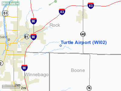
Location & QuickFacts
| FAA Information Effective: | 2008-09-25 |
| Airport Identifier: | WI02 |
| Airport Status: | Operational |
| Longitude/Latitude: | 088-54-53.3870W/42-30-25.0560N
-88.914830/42.506960 (Estimated) |
| Elevation: | 911 ft / 277.67 m (Estimated) |
| Land: | 7 acres |
| From nearest city: | 4 nautical miles E of Beloit, WI |
| Location: | Rock County, WI |
| Magnetic Variation: | 00W (1985) |
Owner & Manager
| Ownership: | Privately owned |
| Owner: | V. Howard Moore Jr. |
| Address: | 6424 East County Rd W.
Clinton, WI 53525 |
| Phone number: | 608-365-3292 |
| Manager: | V. Howard Moore Jr. |
| Address: | 6424 East County Rd W.
Clinton, WI 53525 |
| Phone number: | 608-365-3292 |
Airport Operations and Facilities
| Airport Use: | Private |
| Wind indicator: | Yes |
| Segmented Circle: | No |
| Control Tower: | No |
| Landing fee charge: | No |
| Sectional chart: | Chicago |
| Region: | AGL - Great Lakes |
| Boundary ARTCC: | ZAU - Chicago |
| Tie-in FSS: | GRB - Green Bay |
| FSS on Airport: | No |
| FSS Toll Free: | 1-800-WX-BRIEF |
Airport Services
| Airframe Repair: | NONE |
| Power Plant Repair: | NONE |
| Bottled Oxygen: | NONE |
| Bulk Oxygen: | NONE |
Runway Information
Runway 09/27
| Dimension: | 1800 x 90 ft / 548.6 x 27.4 m
420 FT STWY ON E END. |
| Surface: | TURF, Fair Condition |
| |
Runway 09 |
Runway 27 |
| Traffic Pattern: | Left | Right |
| Markings: | None,
09/27 THRS MKD WITH ORANGE/WHITE BARRELS. | None, |
| Runway End Identifier: | No | No |
| Centerline Lights: | No | No |
| Touchdown Lights: | No | No |
| Obstruction: | 61 ft tree, 1350.0 ft from runway, 90 ft left of centerline, 22:1 slope to clear | 41 ft tree, 690.0 ft from runway, 140 ft right of centerline, 16:1 slope to clear |
|
Radio Navigation Aids
| ID |
Type |
Name |
Ch |
Freq |
Var |
Dist |
| JVL | NDB | Janesville | | 375.00 | 03E | 8.6 nm |
| LVV | NDB | Lake Lawn | | 404.00 | 00W | 18.3 nm |
| FEP | NDB | Freeport | | 335.00 | 00E | 33.7 nm |
| DKB | NDB | Dekalb | | 209.00 | 02W | 35.7 nm |
| MS | NDB | Monah | | 400.00 | 00E | 38.4 nm |
| RYV | NDB | Rock River | | 371.00 | 01W | 40.9 nm |
| UES | NDB | Waukesha | | 359.00 | 01W | 44.1 nm |
| GM | NDB | Teels | | 242.00 | 02W | 45.5 nm |
| RA | NDB | Paser | | 206.00 | 00E | 46.2 nm |
| JVL | VOR/DME | Janesville | 090X | 114.30 | 03E | 9.0 nm |
| RFD | VOR/DME | Rockford | 045X | 110.80 | 01E | 21.1 nm |
| BUU | VOR/DME | Burbun | 092X | 114.50 | 01W | 29.3 nm |
| PLL | VOR/DME | Polo | 049X | 111.20 | 03E | 42.4 nm |
| ENW | VOR/DME | Kenosha | 029X | 109.20 | 02W | 43.9 nm |
| DPA | VOR/DME | Dupage | 021X | 108.40 | 02E | 44.8 nm |
| OBK | VOR/DME | Northbrook | 077X | 113.00 | 02W | 46.1 nm |
| MSN | VORTAC | Madison | 023X | 108.60 | 03E | 42.7 nm |
| BAE | VORTAC | Badger | 111X | 116.40 | 02E | 46.0 nm |
Remarks
- RWY NOT PLOWED IN WINTER.
- RWY 9/27 HAS SLIGHT MOUND MIDFIELD - RISES UPSLOPE FROM EACH THR END TO MIDFIELD.
Images and information placed above are from
http://www.airport-data.com/airport/WI02/
We thank them for the data!
| General Info
|
| Country |
United States
|
| State |
WISCONSIN
|
| FAA ID |
WI02
|
| Latitude |
42-30-25.056N
|
| Longitude |
088-54-53.387W
|
| Elevation |
911 feet
|
| Near City |
BELOIT
|
We don't guarantee the information is fresh and accurate. The data may
be wrong or outdated.
For more up-to-date information please refer to other sources.
|
|


