 |
|
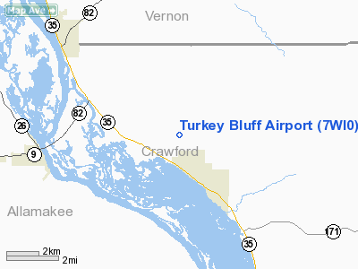
Location & QuickFacts
| FAA Information Effective: | 2008-09-25 |
| Airport Identifier: | 7WI0 |
| Airport Status: | Operational |
| Longitude/Latitude: | 091-06-35.4670W/43-22-22.9140N
-91.109852/43.373032 (Estimated) |
| Elevation: | 1110 ft / 338.33 m (Estimated) |
| Land: | 0 acres |
| From nearest city: | 3 nautical miles N of Ferryville, WI |
| Location: | Crawford County, WI |
| Magnetic Variation: | 02E (1985) |
Owner & Manager
| Ownership: | Privately owned |
| Owner: | Alexander F. Roussulek |
| Address: | Rt 1 Box 213c
Ferryville, WI 54628 |
| Phone number: | 708-377-6678 |
| Manager: | Alexander F. Roussulek |
| Address: | Rt 1 Box 213c
Ferryville, WI 54628 |
| Phone number: | 708-377-6678 |
Airport Operations and Facilities
| Airport Use: | Private |
| Wind indicator: | No |
| Segmented Circle: | No |
| Control Tower: | No |
| Landing fee charge: | No |
| Sectional chart: | Chicago |
| Region: | AGL - Great Lakes |
| Boundary ARTCC: | ZMP - Minneapolis |
| Tie-in FSS: | GRB - Green Bay |
| FSS on Airport: | No |
| FSS Toll Free: | 1-800-WX-BRIEF |
Runway Information
Runway NE/SW
| Dimension: | 2100 x 50 ft / 640.1 x 15.2 m |
| Surface: | TURF, |
| |
Runway NE |
Runway SW |
| Traffic Pattern: | Left | Left |
|
Radio Navigation Aids
| ID |
Type |
Name |
Ch |
Freq |
Var |
Dist |
| CHU | NDB | Caledonia | | 209.00 | 03E | 21.0 nm |
| DEH | NDB | Decorah | | 236.00 | 01E | 28.0 nm |
| HBW | NDB | Kickapoo | | 251.00 | 03E | 37.9 nm |
| XWY | NDB | West Union | | 278.00 | 02E | 39.2 nm |
| CMY | NDB | Mccoy | | 412.00 | 00E | 39.6 nm |
| CJJ | NDB | Cresco | | 293.00 | 02E | 44.6 nm |
| MRJ | NDB | Mineral Point | | 365.00 | 00W | 48.5 nm |
| LSE | VOR/DME | La Crosse | 021X | 108.40 | 02E | 30.9 nm |
| LNR | VOR/DME | Lone Rock | 075X | 112.80 | 00E | 43.0 nm |
| ONA | VOR/DME | Winona | 051X | 111.40 | 01E | 49.6 nm |
| UKN | VORTAC | Waukon | 113X | 116.60 | 05E | 19.5 nm |
| ODI | VORTAC | Nodine | 126X | 117.90 | 01E | 36.0 nm |
Images and information placed above are from
http://www.airport-data.com/airport/7WI0/
We thank them for the data!
| General Info
|
| Country |
United States
|
| State |
WISCONSIN
|
| FAA ID |
7WI0
|
| Latitude |
43-22-22.914N
|
| Longitude |
091-06-35.467W
|
| Elevation |
1110 feet
|
| Near City |
FERRYVILLE
|
We don't guarantee the information is fresh and accurate. The data may
be wrong or outdated.
For more up-to-date information please refer to other sources.
|
|


