 |
|
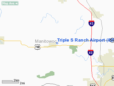
Location & QuickFacts
| FAA Information Effective: | 2008-09-25 |
| Airport Identifier: | 82WI |
| Airport Status: | Operational |
| Longitude/Latitude: | 087-48-51.8230W/44-08-56.9770N
-87.814395/44.149160 (Estimated) |
| Elevation: | 855 ft / 260.60 m (Estimated) |
| Land: | 60 acres |
| From nearest city: | 1 nautical miles NE of Whitelaw, WI |
| Location: | Manitowoc County, WI |
| Magnetic Variation: | 02W (1990) |
Owner & Manager
| Ownership: | Privately owned |
| Owner: | Steve Sauer |
| Address: | 11101 San Road
Whitelaw, WI 54247 |
| Phone number: | 920-860-0072 |
| Manager: | Steve Sauer |
| Address: | 11101 San Road
Whitelaw, WI 54247 |
| Phone number: | 920-860-0072 |
Airport Operations and Facilities
| Airport Use: | Private |
| Wind indicator: | Yes |
| Segmented Circle: | No |
| Control Tower: | No |
| Sectional chart: | Green Bay |
| Region: | AGL - Great Lakes |
| Boundary ARTCC: | ZAU - Chicago |
| Tie-in FSS: | GRB - Green Bay |
| FSS Toll Free: | 1-800-WX-BRIEF |
Runway Information
Runway 12/30
| Dimension: | 1650 x 110 ft / 502.9 x 33.5 m |
| Surface: | TURF, |
| |
Runway 12 |
Runway 30 |
| Traffic Pattern: | Left | Right |
| Obstruction: | 50 ft trees, 750.0 ft from runway | 50 ft trees, 1000.0 ft from runway |
|
Radio Navigation Aids
| ID |
Type |
Name |
Ch |
Freq |
Var |
Dist |
| SG | NDB | Depre | | 332.00 | 02W | 20.3 nm |
| AQ | NDB | Kooky | | 407.00 | 02W | 25.5 nm |
| OCQ | NDB | Oconto | | 388.00 | 03W | 43.9 nm |
| SUE | NDB | Sturgeon Bay | | 414.00 | 03W | 44.6 nm |
| LLE | NDB | Kettle Moraine | | 329.00 | 01W | 45.6 nm |
| CLI | NDB | Clintonville | | 209.00 | 02W | 48.5 nm |
| BJB | VOR | West Bend | | 109.80 | 01W | 45.7 nm |
| MTW | VOR/DME | Manitowoc | 047X | 111.00 | 02W | 5.9 nm |
| FAH | VOR/DME | Falls | 37X | 110.00 | 02W | 22.9 nm |
| GRB | VORTAC | Green Bay | 102X | 115.50 | 01E | 29.4 nm |
| OSH | VORTAC | Oshkosh | 055X | 111.80 | 02E | 33.4 nm |
Images and information placed above are from
http://www.airport-data.com/airport/82WI/
We thank them for the data!
| General Info
|
| Country |
United States
|
| State |
WISCONSIN
|
| FAA ID |
82WI
|
| Latitude |
44-08-56.977N
|
| Longitude |
087-48-51.823W
|
| Elevation |
855 feet
|
| Near City |
WHITELAW
|
We don't guarantee the information is fresh and accurate. The data may
be wrong or outdated.
For more up-to-date information please refer to other sources.
|
|


