 |
|
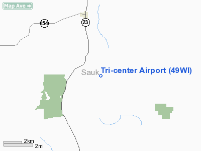
Location & QuickFacts
| FAA Information Effective: | 2008-09-25 |
| Airport Identifier: | 49WI |
| Airport Status: | Operational |
| Longitude/Latitude: | 090-00-55.4490W/43-22-44.9480N
-90.015403/43.379152 (Estimated) |
| Elevation: | 1225 ft / 373.38 m (Estimated) |
| Land: | 80 acres |
| From nearest city: | 4 nautical miles SE of Loganville, WI |
| Location: | Sauk County, WI |
| Magnetic Variation: | 01E (1985) |
Owner & Manager
| Ownership: | Privately owned |
| Owner: | Dennis C Schlieckau Jr |
| Address: | S 7330 Skyview Rd
Loganville, WI 53943 |
| Phone number: | 608-727-3385 |
| Manager: | Dennis C Schlieckau Jr |
| Address: | S 7330 Skyview Rd
Loganville, WI 53943 |
| Phone number: | 608-727-3385 |
Airport Operations and Facilities
| Airport Use: | Private |
| Wind indicator: | Yes |
| Segmented Circle: | No |
| Control Tower: | No |
| Landing fee charge: | No |
| Sectional chart: | Chicago |
| Region: | AGL - Great Lakes |
| Boundary ARTCC: | ZAU - Chicago |
| Tie-in FSS: | GRB - Green Bay |
| FSS on Airport: | No |
| FSS Toll Free: | 1-800-WX-BRIEF |
Airport Services
| Fuel available: | 100LLMOGAS
FUEL AVAILABLE EMERGENCY ONLY. |
Runway Information
Runway 15/33
| Dimension: | 2200 x 66 ft / 670.6 x 20.1 m |
| Surface: | TURF, |
| |
Runway 15 |
Runway 33 |
| Traffic Pattern: | Left | Left |
| Obstruction: | | 25 ft pline, 30.0 ft from runway |
|
Radio Navigation Aids
| ID |
Type |
Name |
Ch |
Freq |
Var |
Dist |
| HBW | NDB | Kickapoo | | 251.00 | 03E | 21.6 nm |
| MRJ | NDB | Mineral Point | | 365.00 | 00W | 30.9 nm |
| MS | NDB | Monah | | 400.00 | 00E | 35.0 nm |
| CMY | NDB | Mccoy | | 412.00 | 00E | 43.2 nm |
| PVB | NDB | Platteville | | 203.00 | 01E | 45.5 nm |
| VOK | TACAN | Volk | 041X | | 00E | 35.5 nm |
| LNR | VOR/DME | Lone Rock | 075X | 112.80 | 00E | 7.2 nm |
| DLL | VORTAC | Dells | 117X | 117.00 | 03E | 15.1 nm |
| MSN | VORTAC | Madison | 023X | 108.60 | 03E | 32.8 nm |
Remarks
- OWNER DESIRES ARPT BE CHARTED.
Images and information placed above are from
http://www.airport-data.com/airport/49WI/
We thank them for the data!
| General Info
|
| Country |
United States
|
| State |
WISCONSIN
|
| FAA ID |
49WI
|
| Latitude |
43-22-44.948N
|
| Longitude |
090-00-55.449W
|
| Elevation |
1225 feet
|
| Near City |
LOGANVILLE
|
We don't guarantee the information is fresh and accurate. The data may
be wrong or outdated.
For more up-to-date information please refer to other sources.
|
|


