 |
|
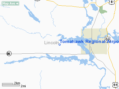
Location & QuickFacts
| FAA Information Effective: | 2008-09-25 |
| Airport Identifier: | TKV |
| Airport Status: | Operational |
| Longitude/Latitude: | 089-48-20.4065W/45-28-09.7378N
-89.805668/45.469372 (Estimated) |
| Elevation: | 1487 ft / 453.24 m (Surveyed) |
| Land: | 280 acres |
| From nearest city: | 3 nautical miles W of Tomahawk, WI |
| Location: | Lincoln County, WI |
| Magnetic Variation: | 00W (1985) |
Owner & Manager
| Ownership: | Publicly owned |
| Owner: | City Of Tomahawk |
| Address: | City Hall
Tomahawk, WI 54487 |
| Phone number: | 715-453-4040 |
| Manager: | Carl Hilgendorf |
| Address: | N1152 Forest Park Drive
Tomahawk, WI 54487 |
| Phone number: | 715-453-3505 |
Airport Operations and Facilities
| Airport Use: | Open to public |
| Wind indicator: | Yes |
| Segmented Circle: | Yes |
| Control Tower: | No |
| Lighting Schedule: | DUSK-DAWN
ACTVT MIRL RY 09/27, PAPI & REIL RYS 09 & 27 - CTAF. |
| Beacon Color: | Clear-Green (lighted land airport) |
| Landing fee charge: | No |
| Sectional chart: | Green Bay |
| Region: | AGL - Great Lakes |
| Boundary ARTCC: | ZMP - Minneapolis |
| Tie-in FSS: | GRB - Green Bay |
| FSS on Airport: | No |
| FSS Toll Free: | 1-800-WX-BRIEF |
| NOTAMs Facility: | TKV (NOTAM-d service avaliable) |
| Federal Agreements: | NGY |
Airport Communications
| CTAF: | 122.800 |
| Unicom: | 122.800 |
Airport Services
| Fuel available: | 100LLA |
| Airframe Repair: | MAJOR
AIRFRAME & POWER PLANT REPAIRS BY PRIOR ARRANGEMENT CALL 715-453-2264 OR 453-3482. |
| Power Plant Repair: | MAJOR |
| Bottled Oxygen: | NONE |
| Bulk Oxygen: | NONE |
Runway Information
Runway 09/27
| Dimension: | 3998 x 75 ft / 1218.6 x 22.9 m |
| Surface: | ASPH, Good Condition |
| Weight Limit: | Single wheel: 26000 lbs. |
| Edge Lights: | Medium |
| |
Runway 09 |
Runway 27 |
| Longitude: | 089-48-48.4719W | 089-47-52.3410W |
| Latitude: | 45-28-09.6535N | 45-28-09.8221N |
| Elevation: | 1468.00 ft | 1487.00 ft |
| Alignment: | 90 | 127 |
| Traffic Pattern: | Left | Left |
| Markings: | Non-precision instrument, Fair Condition | Non-precision instrument, Fair Condition |
| Crossing Height: | 25.00 ft | 21.00 ft |
| VASI: | 2-light PAPI on left side | 2-light PAPI on left side |
| Visual Glide Angle: | 3.00° | 3.00° |
| Runway End Identifier: | Yes | Yes |
| Obstruction: | 15 ft road, 500.0 ft from runway, 300 ft left of centerline, 26:1 slope to clear | , 50:1 slope to clear |
|
Radio Navigation Aids
| ID |
Type |
Name |
Ch |
Freq |
Var |
Dist |
| RRL | NDB | Merrill | | 257.00 | 01W | 16.8 nm |
| DO | NDB | Dougy | | 236.00 | 01W | 22.2 nm |
| ARV | NDB | Arbor Vitae | | 221.00 | 01W | 27.6 nm |
| PBH | NDB | Phillips | | 263.00 | 00E | 29.1 nm |
| MDZ | NDB | Medford | | 335.00 | 00E | 30.5 nm |
| FZK | NDB | Wausau | | 243.00 | 01E | 33.4 nm |
| AIG | NDB | Antigo | | 347.00 | 02W | 34.7 nm |
| EGV | NDB | Eagle River | | 341.00 | 02W | 36.0 nm |
| PKF | NDB | Park Falls | | 371.00 | 01W | 39.0 nm |
| MHA | NDB | Manitowish | | 364.00 | 01W | 39.4 nm |
| BDJ | NDB | Boulder Junction | | 206.00 | 02E | 40.4 nm |
| LNL | NDB | Land O Lakes | | 396.00 | 02W | 47.9 nm |
| RHI | VORTAC | Rhinelander | 029X | 109.20 | 02E | 17.7 nm |
| AUW | VORTAC | Wausau | 053X | 111.60 | 02E | 38.6 nm |
Remarks
Images and information placed above are from
http://www.airport-data.com/airport/TKV/
We thank them for the data!
| General Info
|
| Country |
United States
|
| State |
WISCONSIN
|
| FAA ID |
TKV
|
| Latitude |
45.469139
45° 28' 08.90" N
|
| Longitude |
-89.805694
089° 48' 20.50" W
|
| Elevation |
1486 feet
453 meters
|
| Magnetic Variation |
002° W (01/06)
|
| Beacon |
Yes
|
| Operating Agency |
U.S.CIVIL AIRPORT WHEREIN PERMIT COVERS USE BY TRANSIT MILITARY AIRCRAFT
|
| Daylight Saving Time |
Second Sunday in March at 0200 to first Sunday in November at 0200 local time (Exception Arizona and that portion of Indiana in the Eastern Time Zone)
|
We don't guarantee the information is fresh and accurate. The data may
be wrong or outdated.
For more up-to-date information please refer to other sources.
|
|


