 |
|
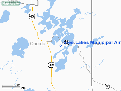
Location & QuickFacts
| FAA Information Effective: | 2008-09-25 |
| Airport Identifier: | 40D |
| Airport Status: | Operational |
| Longitude/Latitude: | 089-07-15.4510W/45-47-24.8460N
-89.120959/45.790235 (Estimated) |
| Elevation: | 1636 ft / 498.65 m (Surveyed) |
| Land: | 60 acres |
| From nearest city: | 3 nautical miles SE of Three Lakes, WI |
| Location: | Oneida County, WI |
| Magnetic Variation: | 01W (1985) |
Owner & Manager
| Ownership: | Publicly owned |
| Owner: | Town Of Three Lakes |
| Address: | Po Box 328
Three Lakes, WI 54562 |
| Phone number: | 715-546-3316 |
| Manager: | John Olkowski |
| Address: | 917 Olson Road
Three Lakes, WI 54562 |
| Phone number: | 715-546-3759 |
Airport Operations and Facilities
| Airport Use: | Open to public |
| Wind indicator: | Yes |
| Segmented Circle: | Yes |
| Control Tower: | No |
| Lighting Schedule: | DUSK-DAWN
ACTVT LIRL RY 3/21 & PAPI RY 21 - CTAF. |
| Beacon Color: | Clear-Green (lighted land airport) |
| Landing fee charge: | No |
| Sectional chart: | Green Bay |
| Region: | AGL - Great Lakes |
| Traffic Pattern Alt: | 800 ft |
| Boundary ARTCC: | ZMP - Minneapolis |
| Tie-in FSS: | GRB - Green Bay |
| FSS on Airport: | No |
| FSS Toll Free: | 1-800-WX-BRIEF |
| NOTAMs Facility: | GRB (NOTAM-d service avaliable) |
| Federal Agreements: | 1 |
Airport Communications
| CTAF: | 122.700 |
| Unicom: | 122.700 |
Airport Services
| Airframe Repair: | NONE |
| Power Plant Repair: | NONE |
| Bottled Oxygen: | NONE |
| Bulk Oxygen: | NONE |
Runway Information
Runway 03/21
| Dimension: | 3400 x 120 ft / 1036.3 x 36.6 m |
| Surface: | TURF, Good Condition |
| Edge Lights: | Low |
| |
Runway 03 |
Runway 21 |
| Longitude: | 089-07-27.5200W | 089-07-04.3800W |
| Latitude: | 45-47-08.7500N | 45-47-41.9400N |
| Elevation: | 1636.00 ft | 1638.00 ft |
| Traffic Pattern: | Left | Left |
| Crossing Height: | 0.00 ft | 24.00 ft |
| VASI: | | 2-light PAPI on left side |
| Visual Glide Angle: | 0.00° | 3.00° |
| Obstruction: | 65 ft trees, 1300.0 ft from runway, 200 ft right of centerline, 20:1 slope to clear | 19 ft tree, 600.0 ft from runway, 170 ft left of centerline, 31:1 slope to clear |
|
Radio Navigation Aids
| ID |
Type |
Name |
Ch |
Freq |
Var |
Dist |
| EGV | NDB | Eagle River | | 341.00 | 02W | 10.4 nm |
| LNL | NDB | Land O Lakes | | 396.00 | 02W | 21.9 nm |
| DO | NDB | Dougy | | 236.00 | 01W | 25.7 nm |
| ARV | NDB | Arbor Vitae | | 221.00 | 01W | 26.7 nm |
| BDJ | NDB | Boulder Junction | | 206.00 | 02E | 30.4 nm |
| RXW | NDB | Watersmeet | | 407.00 | 01E | 30.7 nm |
| MHA | NDB | Manitowish | | 364.00 | 01W | 37.6 nm |
| AIG | NDB | Antigo | | 347.00 | 02W | 38.0 nm |
| RRL | NDB | Merrill | | 257.00 | 01W | 43.2 nm |
| IMT | VOR/DME | Iron Mountain | 049X | 111.20 | 02W | 42.3 nm |
| RHI | VORTAC | Rhinelander | 029X | 109.20 | 02E | 17.0 nm |
Remarks
- 1683 FT AGL/3327 FT MSL TWR 8.5 NM SW.
- ARPT CLSD DEC 1 THRU 30 APR.
Images and information placed above are from
http://www.airport-data.com/airport/40D/
We thank them for the data!
| General Info
|
| Country |
United States
|
| State |
WISCONSIN
|
| FAA ID |
40D
|
| Latitude |
45-47-24.846N
|
| Longitude |
089-07-15.451W
|
| Elevation |
1636 feet
|
| Near City |
THREE LAKES
|
We don't guarantee the information is fresh and accurate. The data may
be wrong or outdated.
For more up-to-date information please refer to other sources.
|
|


