 |
|
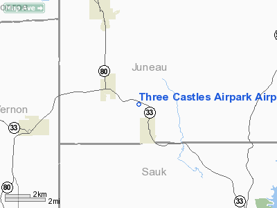
Three Castles Airpark Airport |
Location & QuickFacts
| FAA Information Effective: | 2008-09-25 |
| Airport Identifier: | 4D1 |
| Airport Status: | Operational |
| Longitude/Latitude: | 090-13-57.4600W/43-40-11.9060N
-90.232628/43.669974 (Estimated) |
| Elevation: | 921 ft / 280.72 m (Surveyed) |
| Land: | 160 acres |
| From nearest city: | 1 nautical miles NW of Wonewoc, WI |
| Location: | Juneau County, WI |
| Magnetic Variation: | 01E (1985) |
Owner & Manager
| Ownership: | Privately owned |
| Owner: | Rick Braun |
| Address: | 14744 River Oak Road
Lincolnshire, IL 60069 |
| Phone number: | 847-955-1140 |
| Manager: | Rick Braun |
| Address: | W 9383 Hwy 33
Wonewoc, WI 53968 |
| Phone number: | 608-464-7103 |
Airport Operations and Facilities
| Airport Use: | Open to public |
| Wind indicator: | Yes |
| Segmented Circle: | No |
| Control Tower: | No |
| Landing fee charge: | No |
| Sectional chart: | Chicago |
| Region: | AGL - Great Lakes |
| Traffic Pattern Alt: | 1000 ft |
| Boundary ARTCC: | ZAU - Chicago |
| Tie-in FSS: | GRB - Green Bay |
| FSS on Airport: | No |
| FSS Toll Free: | 1-800-WX-BRIEF |
| NOTAMs Facility: | GRB (NOTAM-d service avaliable) |
Airport Communications
Airport Services
| Airframe Repair: | NONE |
| Power Plant Repair: | NONE |
| Bottled Oxygen: | NONE |
| Bulk Oxygen: | NONE |
Runway Information
Runway 10/28
| Dimension: | 2740 x 90 ft / 835.2 x 27.4 m |
| Surface: | TURF, Fair Condition |
| |
Runway 10 |
Runway 28 |
| Longitude: | 090-14-15.2800W | 090-13-39.6400W |
| Latitude: | 43-40-15.8700N | 43-40-07.9400N |
| Elevation: | 920.00 ft | 921.00 ft |
| Traffic Pattern: | Left | Left |
| Runway End Identifier: | No | No |
| Centerline Lights: | No | No |
| Touchdown Lights: | No | No |
| Obstruction: | 15 ft trees | 20 ft trees, 75.0 ft from runway, 100 ft left of centerline, 3:1 slope to clear |
|
Radio Navigation Aids
| ID |
Type |
Name |
Ch |
Freq |
Var |
Dist |
| HBW | NDB | Kickapoo | | 251.00 | 03E | 4.5 nm |
| CMY | NDB | Mccoy | | 412.00 | 00E | 24.0 nm |
| BCK | NDB | Black River Falls | | 362.00 | 00E | 44.1 nm |
| ISW | NDB | Wisconsin Rapids | | 215.00 | 01W | 45.0 nm |
| MRJ | NDB | Mineral Point | | 365.00 | 00W | 47.0 nm |
| VOK | TACAN | Volk | 041X | | 00E | 16.4 nm |
| LNR | VOR/DME | Lone Rock | 075X | 112.80 | 00E | 23.0 nm |
| LSE | VOR/DME | La Crosse | 021X | 108.40 | 02E | 46.1 nm |
| DLL | VORTAC | Dells | 117X | 117.00 | 03E | 21.6 nm |
Remarks
Images and information placed above are from
http://www.airport-data.com/airport/4D1/
We thank them for the data!
| General Info
|
| Country |
United States
|
| State |
WISCONSIN
|
| FAA ID |
4D1
|
| Latitude |
43-40-11.906N
|
| Longitude |
090-13-57.460W
|
| Elevation |
921 feet
|
| Near City |
WONEWOC
|
We don't guarantee the information is fresh and accurate. The data may
be wrong or outdated.
For more up-to-date information please refer to other sources.
|
|


