 |
|
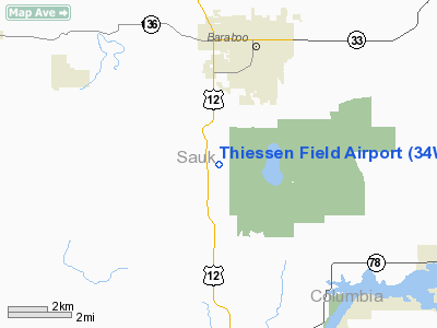
Location & QuickFacts
| FAA Information Effective: | 2008-09-25 |
| Airport Identifier: | 34WI |
| Airport Status: | Operational |
| Longitude/Latitude: | 089-45-55.4460W/43-25-03.9450N
-89.765402/43.417763 (Estimated) |
| Elevation: | 1200 ft / 365.76 m (Estimated) |
| Land: | 40 acres |
| From nearest city: | 5 nautical miles S of Baraboo, WI |
| Location: | Sauk County, WI |
| Magnetic Variation: | 01E (1990) |
Owner & Manager
| Ownership: | Privately owned |
| Owner: | Jerome L. Thiessen |
| Address: | E11219a Ski-hi Rd
Baraboo, WI 53913 |
| Phone number: | 608-356-2469 |
| Manager: | Jerome L. Thiessen |
| Address: | E11219a Ski-hi Rd
Baraboo, WI 53913 |
| Phone number: | 608-356-2469 |
Airport Operations and Facilities
| Airport Use: | Private
PERSONAL USE. |
| Segmented Circle: | No |
| Control Tower: | No |
| Sectional chart: | Chicago |
| Region: | AGL - Great Lakes |
| Boundary ARTCC: | ZAU - Chicago |
| Tie-in FSS: | GRB - Green Bay |
| FSS on Airport: | No |
| FSS Toll Free: | 1-800-WX-BRIEF |
Runway Information
Runway 08/26
| Dimension: | 1200 x 60 ft / 365.8 x 18.3 m |
| Surface: | TURF, Good Condition |
| |
Runway 08 |
Runway 26 |
| Traffic Pattern: | Left | Left |
|
Radio Navigation Aids
| ID |
Type |
Name |
Ch |
Freq |
Var |
Dist |
| MS | NDB | Monah | | 400.00 | 00E | 28.2 nm |
| HBW | NDB | Kickapoo | | 251.00 | 03E | 28.6 nm |
| MRJ | NDB | Mineral Point | | 365.00 | 00W | 37.7 nm |
| UNU | NDB | Juneau | | 344.00 | 01W | 46.4 nm |
| RYV | NDB | Rock River | | 371.00 | 01W | 47.8 nm |
| CMY | NDB | Mccoy | | 412.00 | 00E | 49.3 nm |
| VOK | TACAN | Volk | 041X | | 00E | 38.2 nm |
| LNR | VOR/DME | Lone Rock | 075X | 112.80 | 00E | 17.7 nm |
| DLL | VORTAC | Dells | 117X | 117.00 | 03E | 8.0 nm |
| MSN | VORTAC | Madison | 023X | 108.60 | 03E | 24.8 nm |
Remarks
- PRVDD OBSTRUCTIONS IN RY APCH SLOPE BE LOWERED/REMOVED OR THRS DSPLCD TO PRVD 20:1 APCH CLNC OVER OBSTRUCTIONS, AREA 125' EITHERSIDE OF RY CNTRLN BE CLEAR; PERSONAL USE ONLY.
Images and information placed above are from
http://www.airport-data.com/airport/34WI/
We thank them for the data!
| General Info
|
| Country |
United States
|
| State |
WISCONSIN
|
| FAA ID |
34WI
|
| Latitude |
43-25-03.945N
|
| Longitude |
089-45-55.446W
|
| Elevation |
1200 feet
|
| Near City |
BARABOO
|
We don't guarantee the information is fresh and accurate. The data may
be wrong or outdated.
For more up-to-date information please refer to other sources.
|
|


