 |
|
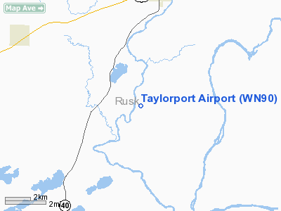
Location & QuickFacts
| FAA Information Effective: | 2008-09-25 |
| Airport Identifier: | WN90 |
| Airport Status: | Operational |
| Longitude/Latitude: | 091-17-30.5500W/45-22-29.8700N
-91.291819/45.374964 (Estimated) |
| Elevation: | 1250 ft / 381.00 m (Estimated) |
| Land: | 0 acres |
| From nearest city: | 8 nautical miles S of Bruce, WI |
| Location: | Rusk County, WI |
| Magnetic Variation: | 01E (1990) |
Owner & Manager
| Ownership: | Privately owned |
| Owner: | Paul L Taylor |
| Address: | W12084 River Road
Bruce, WI 54819 |
| Phone number: | 612-445-3923 |
| Manager: | Paul L Taylor |
| Address: | 14385 Mystic La.
Prior Lake, MN 55372 |
| Phone number: | 612-445-3923 |
Airport Operations and Facilities
| Airport Use: | Private |
| Segmented Circle: | No |
| Control Tower: | No |
| Sectional chart: | Green Bay |
| Region: | AGL - Great Lakes |
| Boundary ARTCC: | ZMP - Minneapolis |
| Tie-in FSS: | GRB - Green Bay |
| FSS Toll Free: | 1-800-WX-BRIEF |
Runway Information
Runway 06/24
| Dimension: | 1800 x 250 ft / 548.6 x 76.2 m |
| Surface: | TURF, |
| |
Runway 06 |
Runway 24 |
| Traffic Pattern: | Left | Left |
|
Runway 06W/24W
| Dimension: | 4500 x 150 ft / 1371.6 x 45.7 m |
| Surface: | WATER, |
| |
Runway 06W |
Runway 24W |
| Traffic Pattern: | Left | Left |
|
Radio Navigation Aids
| ID |
Type |
Name |
Ch |
Freq |
Var |
Dist |
| RCX | NDB | Rusk County | | 356.00 | 00W | 14.4 nm |
| UBE | NDB | Cumberland | | 375.00 | 01E | 30.0 nm |
| SSQ | NDB | Shell Lake | | 212.00 | 01E | 33.9 nm |
| PBH | NDB | Phillips | | 263.00 | 00E | 41.9 nm |
| SLY | NDB | Seeley | | 344.00 | 01E | 44.5 nm |
| MDZ | NDB | Medford | | 335.00 | 00E | 44.7 nm |
| AHH | NDB | Ameron | | 278.00 | 01E | 46.0 nm |
| RPD | VOR/DME | Rice Lake | 037X | 110.00 | 01E | 20.7 nm |
| HYR | VOR/DME | Hayward | 081X | 113.40 | 03E | 39.3 nm |
| EAU | VORTAC | Eau Claire | 076X | 112.90 | 04E | 29.8 nm |
Remarks
- (E111-1) OTHERWISE THE RY THRS SHOULD BE DSPLCD & MKD TO PRVD A 20:1 APCH SLOPE. (FOR THE SEAPLANE BASE) A 20:1 APCH SLOPE OVER OBSTN BE PRVDD & YOU REF FAR 91.115; RIGHT-OF-WAY RULES; WATER OPS.
- (FOR THE AIRPORT) THE AREA 125 FT EITHER SIDE OF THE RY CNTRLN & 200 FT FM EITHER END OF THE RY END BE CLEAR OF ANY OBSTN & ANY OBSTNS IN THE RY APCH SLOPE SURFACE BE LOWERED OR REMOVED.
Images and information placed above are from
http://www.airport-data.com/airport/WN90/
We thank them for the data!
| General Info
|
| Country |
United States
|
| State |
WISCONSIN
|
| FAA ID |
WN90
|
| Latitude |
45-22-29.870N
|
| Longitude |
091-17-30.550W
|
| Elevation |
1250 feet
|
| Near City |
BRUCE
|
We don't guarantee the information is fresh and accurate. The data may
be wrong or outdated.
For more up-to-date information please refer to other sources.
|
|


