 |
|
| Taylor County Airport |
| IATA: MDF – ICAO: KMDZ – FAA LID: MDZ |
| Summary |
| Airport type |
Public |
| Owner |
Taylor County |
| Location |
Medford, Wisconsin |
| Elevation AMSL |
1,478 ft / 450 m |
| Coordinates |
45°06′05″N 090°18′03″W / 45.10139°N 90.30083°W / 45.10139; -90.30083 |
| Website |
co.taylor.wi.us/... |
| Runways |
| Direction |
Length |
Surface |
| ft |
m |
| 9/27 |
6,902 |
2,104 |
Asphalt |
| 16/34 |
4,435 |
1,352 |
Asphalt |
| Statistics (2007) |
| Aircraft operations |
7,520 |
| Source: Federal Aviation Administration |
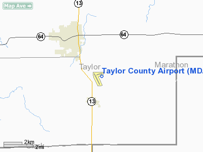
Taylor County Airport (IATA: MDF, ICAO: KMDZ, FAA LID: MDZ) is a county-owned public-use airport located three nautical miles (6 km) southeast of the central business district of Medford, a city in Taylor County, Wisconsin, United States.
No commercial airlines service the airport, however it is subject to much general aviation traffic, including business and leisure fliers. Hangars are available for lease, and fuel is also available.
Although most U.S. airports use the same three-letter location identifier for the FAA and IATA, this airport is assigned MDZ by the FAA and MDF by the IATA (which assigned MDZ to El Plumerillo Airport in Mendoza, Argentina).
Facilities and aircraft
Taylor County Airport covers an area of 380 acres (154 ha) at an elevation of 1,478 feet (450 m) above mean sea level. It has two asphalt paved runways: 9/27 is 6,902 by 75 feet (2,104 x 23 m) and 16/34 is 4,435 by 75 feet (1,352 x 23 m). For the 12-month period ending September 13, 2007, the airport had 7,520 aircraft operations, an average of 20 per day: 86% general aviation, 13% air taxi and <1% military.
The above content comes from Wikipedia and is published under free licenses – click here to read more.
Location & QuickFacts
| FAA Information Effective: | 2008-09-25 |
| Airport Identifier: | MDZ |
| Airport Status: | Operational |
| Longitude/Latitude: | 090-18-03.0000W/45-06-05.3000N
-90.300833/45.101472 (Estimated) |
| Elevation: | 1478 ft / 450.49 m (Surveyed) |
| Land: | 380 acres |
| From nearest city: | 3 nautical miles SE of Medford, WI |
| Location: | Taylor County, WI |
| Magnetic Variation: | 00E (1995) |
Owner & Manager
| Ownership: | Publicly owned |
| Owner: | Taylor County |
| Address: | Taylor County Courthouse
Medford, WI 54451 |
| Phone number: | 715-748-1460 |
| Manager: | James Wood |
| Address: | W5125 Apple Ave
Medford, WI 54451 |
| Phone number: | 715-678-2152 |
Airport Operations and Facilities
| Airport Use: | Open to public |
| Wind indicator: | Yes |
| Segmented Circle: | Yes |
| Control Tower: | No |
| Lighting Schedule: | DUSK-DAWN
MIRL RY 09/27 PRESET LOW INTST; TO INCR INTST & ACTVT MIRL RY 16/34 & PAPI RYS 16 & 34; REIL RYS 27 & 34 - CTAF. |
| Beacon Color: | Clear-Green (lighted land airport) |
| Landing fee charge: | No |
| Sectional chart: | Green Bay |
| Region: | AGL - Great Lakes |
| Traffic Pattern Alt: | 1000 ft |
| Boundary ARTCC: | ZMP - Minneapolis |
| Tie-in FSS: | GRB - Green Bay |
| FSS on Airport: | No |
| FSS Toll Free: | 1-800-WX-BRIEF |
| NOTAMs Facility: | MDZ (NOTAM-d service avaliable) |
| Federal Agreements: | NGY |
Airport Communications
| CTAF: | 122.800 |
| Unicom: | 122.800 |
Airport Services
| Fuel available: | 100LLA
24 HR SELF SERVICE |
Runway Information
Runway 09/27
| Dimension: | 6902 x 75 ft / 2103.7 x 22.9 m |
| Surface: | ASPH, Good Condition |
| Edge Lights: | Medium |
| |
Runway 09 |
Runway 27 |
| Longitude: | 090-18-36.6009W | 090-17-00.3824W |
| Latitude: | 45-06-11.2871N | 45-06-12.0737N |
| Elevation: | 1455.00 ft | 1478.00 ft |
| Alignment: | 89 | 127 |
| Traffic Pattern: | Left | Left |
| Markings: | Non-precision instrument, Good Condition | Non-precision instrument, Good Condition |
| Crossing Height: | 31.00 ft | 26.00 ft |
| VASI: | 2-light PAPI on left side | 2-light PAPI on left side |
| Visual Glide Angle: | 3.00° | 3.00° |
| Runway End Identifier: | | Yes |
| Obstruction: | 42 ft tree, 1050.0 ft from runway, 330 ft right of centerline, 20:1 slope to clear | , 50:1 slope to clear |
|
Runway 16/34
| Dimension: | 4435 x 75 ft / 1351.8 x 22.9 m |
| Surface: | ASPH, Good Condition |
| Weight Limit: | Single wheel: 12500 lbs. |
| Edge Lights: | Medium |
| |
Runway 16 |
Runway 34 |
| Longitude: | 090-18-38.2488W | 090-18-12.8719W |
| Latitude: | 45-06-15.2628N | 45-05-35.3296N |
| Elevation: | 1459.00 ft | 1451.00 ft |
| Alignment: | 127 | 127 |
| Traffic Pattern: | Left | Left |
| Markings: | Non-precision instrument, Good Condition | Non-precision instrument, Good Condition |
| VASI: | 2-light PAPI on left side | 2-light PAPI on left side |
| Runway End Identifier: | No | Yes |
| Centerline Lights: | No | No |
| Touchdown Lights: | No | No |
| Obstruction: | 24 ft tree, 950.0 ft from runway, 250 ft left of centerline, 31:1 slope to clear | , 50:1 slope to clear |
|
Radio Navigation Aids
| ID |
Type |
Name |
Ch |
Freq |
Var |
Dist |
| MDZ | NDB | Medford | | 335.00 | 00E | 0.4 nm |
| RRL | NDB | Merrill | | 257.00 | 01W | 26.0 nm |
| MFI | NDB | Marshfield | | 391.00 | 00E | 28.1 nm |
| FZK | NDB | Wausau | | 243.00 | 01E | 30.5 nm |
| VIQ | NDB | Neillsville | | 368.00 | 01W | 34.0 nm |
| PBH | NDB | Phillips | | 263.00 | 00E | 36.5 nm |
| RCX | NDB | Rusk County | | 356.00 | 00W | 38.2 nm |
| ISW | NDB | Wisconsin Rapids | | 215.00 | 01W | 48.5 nm |
| AUW | VORTAC | Wausau | 053X | 111.60 | 02E | 34.0 nm |
| STE | VORTAC | Stevens Point | 043X | 110.60 | 01W | 46.9 nm |
| RHI | VORTAC | Rhinelander | 029X | 109.20 | 02E | 47.9 nm |
Remarks
- FOR TAKE OFF ON RY 34 LEFT TURN AFTER 1000 FT 'AGL.
- GCO AVBL ON FREQ 121.725 THRU FLT SVCS.
- DEER ON & INVOF ARPT.
Images and information placed above are from
http://www.airport-data.com/airport/MDZ/
We thank them for the data!
| General Info
|
| Country |
United States
|
| State |
WISCONSIN
|
| FAA ID |
MDZ
|
| Latitude |
45-06-03.559N
|
| Longitude |
090-18-12.023W
|
| Elevation |
1470 feet
|
| Near City |
MEDFORD
|
We don't guarantee the information is fresh and accurate. The data may
be wrong or outdated.
For more up-to-date information please refer to other sources.
|
|


