 |
|
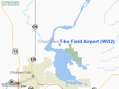
Location & QuickFacts
| FAA Information Effective: | 2008-09-25 |
| Airport Identifier: | WI32 |
| Airport Status: | Operational |
| Longitude/Latitude: | 091-19-49.3500W/44-59-14.3600N
-91.330375/44.987322 (Estimated) |
| Elevation: | 940 ft / 286.51 m (Estimated) |
| Land: | 100 acres |
| From nearest city: | 3 nautical miles NE of Chippewa Falls, WI |
| Location: | Chippewa County, WI |
| Magnetic Variation: | 00E () |
Owner & Manager
| Ownership: | Privately owned |
| Owner: | Terry & Carolyn Bowe |
| Address: | 13541 85th Ave
Chippewa Falls, WI 54729 |
| Phone number: | 715-723-7664 |
| Manager: | Terry & Carolyn Bowe |
| Address: | 13541 85th Ave
Chippewa Falls, WI 54729 |
| Phone number: | 715-382-4864 |
Airport Operations and Facilities
| Airport Use: | Private |
| Wind indicator: | Yes |
| Segmented Circle: | No |
| Control Tower: | No |
| Sectional chart: | Chicago |
| Region: | AGL - Great Lakes |
| Boundary ARTCC: | ZMP - Minneapolis |
| Tie-in FSS: | GRB - Green Bay |
| FSS Toll Free: | 1-800-WX-BRIEF |
Runway Information
Runway 01/19
| Dimension: | 2000 x 100 ft / 609.6 x 30.5 m |
| Surface: | TURF, |
| |
Runway 01 |
Runway 19 |
| Traffic Pattern: | Left | Left |
| Obstruction: | 20 ft trees, 500.0 ft from runway | 70 ft pline, 1600.0 ft from runway |
|
Radio Navigation Aids
| ID |
Type |
Name |
Ch |
Freq |
Var |
Dist |
| RCX | NDB | Rusk County | | 356.00 | 00W | 33.9 nm |
| UBE | NDB | Cumberland | | 375.00 | 01E | 41.6 nm |
| VIQ | NDB | Neillsville | | 368.00 | 01W | 43.3 nm |
| MDZ | NDB | Medford | | 335.00 | 00E | 44.0 nm |
| AHH | NDB | Ameron | | 278.00 | 01E | 47.5 nm |
| BCK | NDB | Black River Falls | | 362.00 | 00E | 48.6 nm |
| RPD | VOR/DME | Rice Lake | 037X | 110.00 | 01E | 32.0 nm |
| EAU | VORTAC | Eau Claire | 076X | 112.90 | 04E | 8.3 nm |
Remarks
- PRVDD CLEAR 20:1 APCHS, CLEAR OBSTACLE FREE ZONE, CLEAR RY SAFETY AREA.
Images and information placed above are from
http://www.airport-data.com/airport/WI32/
We thank them for the data!
| General Info
|
| Country |
United States
|
| State |
WISCONSIN
|
| FAA ID |
WI32
|
| Latitude |
44-59-14.360N
|
| Longitude |
091-19-49.350W
|
| Elevation |
940 feet
|
| Near City |
CHIPPEWA FALLS
|
We don't guarantee the information is fresh and accurate. The data may
be wrong or outdated.
For more up-to-date information please refer to other sources.
|
|


