 |
|
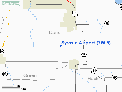
Location & QuickFacts
| FAA Information Effective: | 2008-09-25 |
| Airport Identifier: | 7WI5 |
| Airport Status: | Operational |
| Longitude/Latitude: | 089-24-02.4280W/42-52-57.0060N
-89.400674/42.882502 (Estimated) |
| Elevation: | 1000 ft / 304.80 m (Estimated) |
| Land: | 0 acres |
| From nearest city: | 3 nautical miles NW of Brooklyn, WI |
| Location: | Dane County, WI |
| Magnetic Variation: | 00E (1985) |
Owner & Manager
| Ownership: | Privately owned |
| Owner: | Keith Syvrud |
| Address: | 457 Union Road
Brooklyn, WI 53521 |
| Phone number: | 608-455-4061 |
| Manager: | Keith Syvrud |
| Address: | 9055 East Ellasar Ave
Mesa, AZ 85208 |
| Phone number: | 480-357-5412 |
Airport Operations and Facilities
| Airport Use: | Private |
| Wind indicator: | Yes |
| Segmented Circle: | No |
| Control Tower: | No |
| Lighting Schedule: | RDO-CTL
ACTVT LIRL RY 13/31 - CTAF. |
| Landing fee charge: | No |
| Sectional chart: | Chicago |
| Region: | AGL - Great Lakes |
| Boundary ARTCC: | ZAU - Chicago |
| Tie-in FSS: | GRB - Green Bay |
| FSS on Airport: | No |
| FSS Toll Free: | 1-800-WX-BRIEF |
Runway Information
Runway 13/31
| Dimension: | 2500 x 90 ft / 762.0 x 27.4 m |
| Surface: | TURF, |
| Edge Lights: | Low |
| |
Runway 13 |
Runway 31 |
| Traffic Pattern: | Left | Left |
| VASI: | pulsating/steady burning on left side | |
| Obstruction: | 50 ft trees, 1200.0 ft from runway | |
|
Radio Navigation Aids
| ID |
Type |
Name |
Ch |
Freq |
Var |
Dist |
| MS | NDB | Monah | | 400.00 | 00E | 11.1 nm |
| JVL | NDB | Janesville | | 375.00 | 03E | 22.6 nm |
| RYV | NDB | Rock River | | 371.00 | 01W | 34.5 nm |
| MRJ | NDB | Mineral Point | | 365.00 | 00W | 36.4 nm |
| LVV | NDB | Lake Lawn | | 404.00 | 00W | 37.3 nm |
| FEP | NDB | Freeport | | 335.00 | 00E | 39.2 nm |
| UNU | NDB | Juneau | | 344.00 | 01W | 44.9 nm |
| PVB | NDB | Platteville | | 203.00 | 01E | 47.2 nm |
| JVL | VOR/DME | Janesville | 090X | 114.30 | 03E | 23.5 nm |
| RFD | VOR/DME | Rockford | 045X | 110.80 | 01E | 40.5 nm |
| LNR | VOR/DME | Lone Rock | 075X | 112.80 | 00E | 40.6 nm |
| BUU | VOR/DME | Burbun | 092X | 114.50 | 01W | 49.8 nm |
| MSN | VORTAC | Madison | 023X | 108.60 | 03E | 16.0 nm |
| DLL | VORTAC | Dells | 117X | 117.00 | 03E | 43.2 nm |
Images and information placed above are from
http://www.airport-data.com/airport/7WI5/
We thank them for the data!
| General Info
|
| Country |
United States
|
| State |
WISCONSIN
|
| FAA ID |
7WI5
|
| Latitude |
42-52-57.006N
|
| Longitude |
089-24-02.428W
|
| Elevation |
1000 feet
|
| Near City |
BROOKLYN
|
We don't guarantee the information is fresh and accurate. The data may
be wrong or outdated.
For more up-to-date information please refer to other sources.
|
|


