 |
|
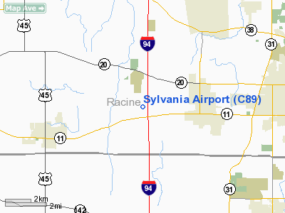
Location & QuickFacts
| FAA Information Effective: | 2008-09-25 |
| Airport Identifier: | C89 |
| Airport Status: | Operational |
| Longitude/Latitude: | 087-57-32.3000W/42-42-11.7000N
-87.958972/42.703250 (Estimated) |
| Elevation: | 785 ft / 239.27 m (Estimated) |
| Land: | 34 acres |
| From nearest city: | 3 nautical miles W of Sturtevant, WI |
| Location: | Racine County, WI |
| Magnetic Variation: | 01W (1985) |
Owner & Manager
| Ownership: | Privately owned |
| Owner: | Don Sutton |
| Address: | 2624 South Sylvania Ave
Sturtevant, WI 53177 |
| Phone number: | 262-886-0445 |
| Manager: | Don Sutton |
| Address: | 2624 South Sylvania Ave
Sturtevant, WI 53177 |
| Phone number: | 262-886-0445 |
Airport Operations and Facilities
| Airport Use: | Open to public |
| Wind indicator: | Yes |
| Segmented Circle: | No |
| Control Tower: | No |
| Lighting Schedule: | DUSK-DAWN
ACTCT MIRL RY 08R/26L & PAPI RY 26L - CTAF. |
| Beacon Color: | Clear-Green (lighted land airport) |
| Landing fee charge: | No |
| Sectional chart: | Chicago |
| Region: | AGL - Great Lakes |
| Traffic Pattern Alt: | 800 ft |
| Boundary ARTCC: | ZAU - Chicago |
| Tie-in FSS: | GRB - Green Bay |
| FSS on Airport: | No |
| FSS Toll Free: | 1-800-WX-BRIEF |
| NOTAMs Facility: | GRB (NOTAM-d service avaliable) |
Airport Communications
| CTAF: | 122.800 |
| Unicom: | 122.800 |
Airport Services
| Fuel available: | 100LL |
| Airframe Repair: | MAJOR |
| Power Plant Repair: | MAJOR |
Runway Information
Runway 08L/26R
| Dimension: | 2343 x 120 ft / 714.1 x 36.6 m |
| Surface: | TURF, Good Condition |
| Edge Lights: | Medium
RY 08R/26L NSTD MIRL. |
| |
Runway 08L |
Runway 26R |
| Longitude: | 087-57-47.8459W | 087-57-16.9661W |
| Latitude: | 42-42-10.0703N | 42-42-14.1652N |
| Elevation: | 787.00 ft | 770.00 ft |
| Traffic Pattern: | Left | Left |
| Markings: | None, | None, |
| Runway End Identifier: | No | No |
| Centerline Lights: | No | No |
| Touchdown Lights: | No | No |
| Obstruction: | 18 ft road, 110.0 ft from runway, 150 ft left of centerline, 6:1 slope to clear | 18 ft road, 175.0 ft from runway, 9:1 slope to clear |
|
Runway 08R/26L
| Dimension: | 2272 x 38 ft / 692.5 x 11.6 m |
| Surface: | ASPH, |
| Edge Lights: | Medium
RY 08R/26L NSTD MIRL. |
| |
Runway 08R |
Runway 26L |
| Longitude: | 087-57-47.1991W | 087-57-17.2600W |
| Latitude: | 42-42-09.2327N | 42-42-13.2366N |
| Elevation: | 788.00 ft | 771.00 ft |
| Traffic Pattern: | Left | Left |
| Markings: | Basic, Good Condition | Basic, Good Condition |
| Displaced threshold: | 0.00 ft | 140.00 ft |
| VASI: | | 2-light PAPI on left side |
| Runway End Identifier: | No | No |
| Centerline Lights: | No | No |
| Touchdown Lights: | No | No |
| Obstruction: | 18 ft road, 320.0 ft from runway, 140 ft left of centerline, 6:1 slope to clear
25 FT TREES 25 FT FM THR 50-125 FT R. | 18 ft road, 200.0 ft from runway
RY 26L APCH RATIO 20:1 TO DSPLCD THLD.
ROAD 33' LEFT OF CNTRLN. |
|
Radio Navigation Aids
| ID |
Type |
Name |
Ch |
Freq |
Var |
Dist |
| RA | NDB | Paser | | 206.00 | 00E | 2.9 nm |
| GM | NDB | Teels | | 242.00 | 02W | 12.9 nm |
| BL | NDB | Yanks | | 260.00 | 02W | 21.7 nm |
| UES | NDB | Waukesha | | 359.00 | 01W | 23.9 nm |
| LVV | NDB | Lake Lawn | | 404.00 | 00W | 28.0 nm |
| HXF | NDB | Hartford | | 200.00 | 00E | 43.3 nm |
| RYV | NDB | Rock River | | 371.00 | 01W | 44.0 nm |
| LLE | NDB | Kettle Moraine | | 329.00 | 01W | 44.0 nm |
| ME | NDB | Deana | | 350.00 | 00E | 44.3 nm |
| JVL | NDB | Janesville | | 375.00 | 03E | 48.1 nm |
| BJB | VOR | West Bend | | 109.80 | 01W | 43.8 nm |
| ENW | VOR/DME | Kenosha | 029X | 109.20 | 02W | 6.4 nm |
| HRK | VOR/DME | Horlick | 124X | 117.70 | 02W | 7.3 nm |
| BUU | VOR/DME | Burbun | 092X | 114.50 | 01W | 15.2 nm |
| LJT | VOR/DME | Timmerman | 072X | 112.50 | 02W | 24.7 nm |
| OBK | VOR/DME | Northbrook | 077X | 113.00 | 02W | 29.0 nm |
| ORD | VOR/DME | Chicago O'hare | 086X | 113.90 | 02E | 43.1 nm |
| BAE | VORTAC | Badger | 111X | 116.40 | 02E | 28.7 nm |
| MKE | VOT | Milwaukee | | 109.00 | | 15.0 nm |
| ORD | VOT | Chicago O'hare Intl | | 112.00 | | 43.4 nm |
Remarks
- ULTRALIGHTS ON & IN VCNTY OF ARPT.
- PARA ATVT ON & IN VCNTY OF ARPT.
- PRIOR TO 1959.
Images and information placed above are from
http://www.airport-data.com/airport/C89/
We thank them for the data!
| General Info
|
| Country |
United States
|
| State |
WISCONSIN
|
| FAA ID |
C89
|
| Latitude |
42-42-11.700N
|
| Longitude |
087-57-32.300W
|
| Elevation |
785 feet
|
| Near City |
STURTEVANT
|
We don't guarantee the information is fresh and accurate. The data may
be wrong or outdated.
For more up-to-date information please refer to other sources.
|
|


